1 Lindores Street, Addington
37 reports on record since March 2019 · 32 with photographs. The most-reported address on Lindores Street. Indicative rating valuation and school zones, hazards, bin day and what stood here before.
What gets reported here
Photographed here 32 on record

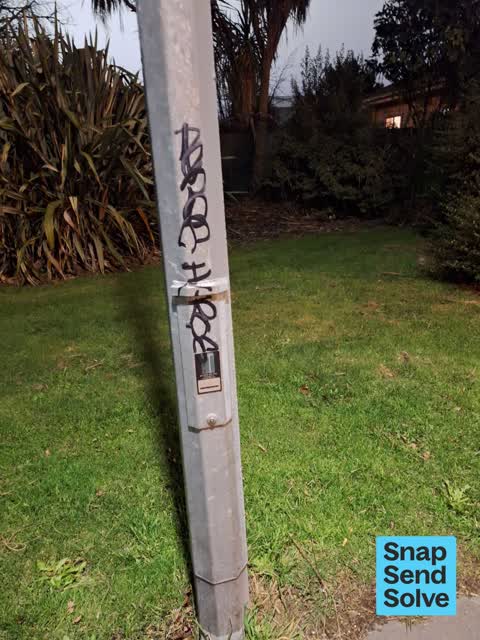


Reported here
 Graffiti on a traffic light pole or cabinet, or wa —
  Graffiti on a traffic light pole or cabinet, or wa —
  Graffiti on a fence, building or structure —
  Overgrown Vegetation —
 invasive weeds - old mans beard and some ivy spreading very badly from an empty block of native bush next to and underneath the motorway/Lin
 Graffiti on a fence, building or structure —
 graffiti
 Graffiti on a bus stop or public toilet —
  Graffiti on a fence, building or structure —
  Graffiti on a fence, building or structure —
  Graffiti on a fence, building or structure —
  Graffiti on a fence, building or structure —
 Yes ccc lamp post to clean up
 Dumped Rubbish —
 Bumper bar
 Graffiti on a fence, building or structure —
  Graffiti on a fence, building or structure —
  Graffiti somewhere else —
 Waka kotahi x 39
 Accessibility —
 Tent amongst bushes Lindore Lincoln rd cnr
 Graffiti on a fence, building or structure —
 On overhead bridge Lincoln and lindores
 Overgrown Vegetation —
 Reporting again Making pushing pram past here difficult
 Overgrown Vegetation —
 On Lincoln Rd
 Overgrown Vegetation —
 Bushes need trimming back from the footpath at the corner of Lindores Street and Lincoln Road.
 Graffiti —
 KAEPE black paint tag on metal plate on concrete lamp pole at the corner of Lindores Street and Lincoln Road.
 Damaged Street Sign —
 Not actually damaged but I don’t think this kind of advertising sign is acceptable here? Give Way sign at the corner of Lindores Street and
 Pavement - General —
 - Roads - General —
- Graffiti —
- Dumped Rubbish —
- Overgrown Vegetation —
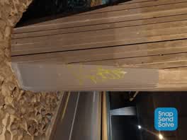 Graffiti —
 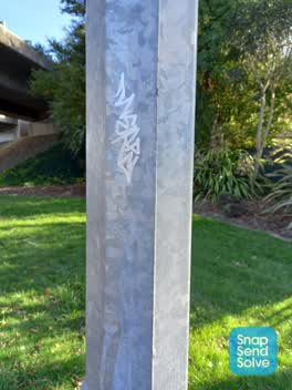 Graffiti —
 Lincoln Rd, just on town side of over bridge - Graffiti on light post
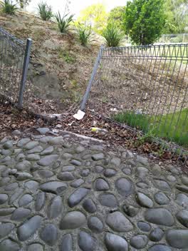 Graffiti —
 Not graffiti just vandalism
Graffiti —
Graffiti —
Graffiti —
Graffiti —
- Graffiti —
on fence
Water Supply —
Graffiti —
Roading/Streets —
These bike lights work wonderfully late morning and early afternoon but after 5 pm they are too slow. About 3/4 of cyclists ignore them. P
Also reported on Lindores Street
- 2 Lindores Street — 10 reports
- 7 Lindores Street — 5 reports
- 20 Lindores Street — 3 reports
- 5 Lindores Street — 2 reports
- 13 Lindores Street — 2 reports
- 9 Lindores Street — 1 report
- 8 Lindores Street — 1 report
- 4 Lindores Street — 1 report
The green nearby
- Leith Reserve — 159 m to the edge
- Parade Court Reserve — 286 m to the edge
- Cardigan Bay Reserve — 293 m to the edge
- Lincoln Park — 365 m to the edge
- Addington Park — 443 m to the edge · Sports ground · 3 ha
Parks within half a kilometre, measured to the boundary — the council’s open data.
On the doorstep
- Plunket — 118 m away · Doctors & clinics
- Addington Court Motel — 170 m away · Motels
- Canterbury Court Motel — 216 m away · Motels
- Addington Events Centre — 271 m away · Venues & events
Businesses within four hundred metres, measured at the pin — OpenStreetMap and the council directories.
The bus nearby
The closest Metro stops, within four hundred and fifty metres.
The tracks through here
- Walk and bike track through Addington — 9 m to the line · walk · bike
- Walk and bike track through Addington — 414 m to the line · walk · bike
- Walk and bike track through Addington — 414 m to the line · walk · bike
- Walk and bike track through Addington — 418 m to the line · walk · bike
- Walk and bike track through Addington — 431 m to the line · walk · bike
Tracks whose line passes within half a kilometre, measured to the line itself — the council’s open data.
The named ground
Named water within 500 m of this address, measured to the line or the edge; Named places within 1.5 km of this address; the council’s own structure register — bridges, boardwalks and steps standing nearby — the open map’s record.
Renting nearby
new bonds in Addington ran about $502 a week — $48 below the city median of $550 — the suburb page keeps the rent record →.
The civic layer
This ground votes in Spreydon ward — the Spreydon-Cashmere-Heathcote community board. Ward lines don’t always follow suburb lines; this one is measured at the pin, not the suburb’s centre.
What stood on this ground → · On the map → · From the air — the Crown’s aerials back to 1936; search the address on RetroLens →
Questions, answered briefly
37 council reports on record since March 2019 — most often graffiti (11), graffiti on a fence, building or structure (9), overgrown vegetation (5).
Addington, Christchurch — on Lindores Street.
Nothing on the heritage register at this exact spot — the record around this ground →
Leith Reserve — 159 m to its edge.