105 Antigua Street, Addington
13 reports on record since September 2020 · 8 with photographs. The street’s heaviest record is 47 Antigua Street — 81 reports on file. Indicative rating valuation and school zones, hazards, bin day and what stood here before.
What gets reported here
Photographed here 8 on record




Reported here
 Dumped Rubbish —
 dumped rubbish
 Dumped Rubbish —
 dumped rubbish
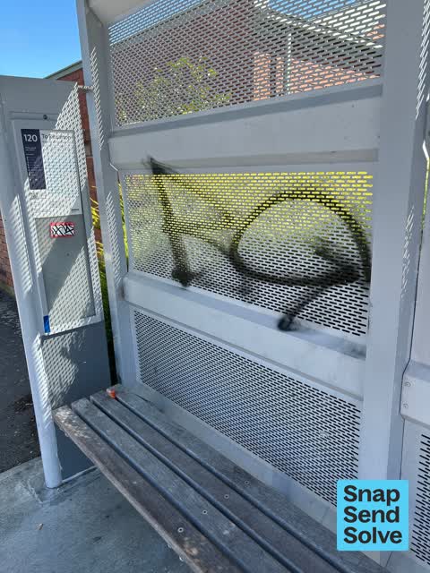
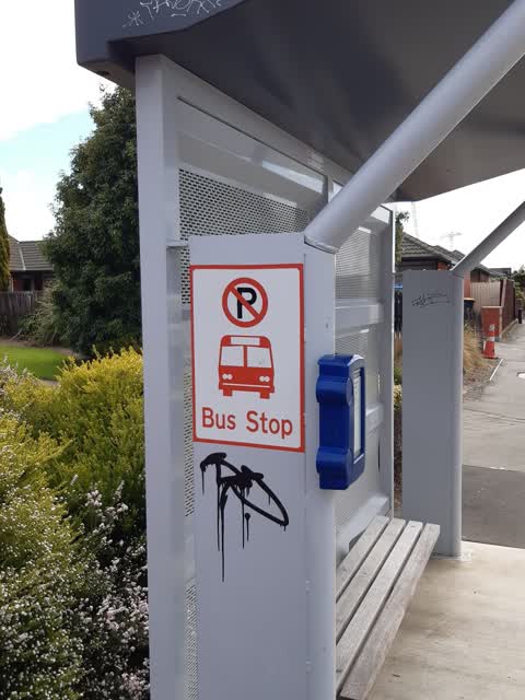
 Graffiti on a bus stop or public toilet —
  Graffiti on a bus stop or public toilet —
  Graffiti —
 Black paint and sticky tags inside bus stop shelter opposite 122 Antigua Street.
 Graffiti —
 Its on the every angle and side of the bus stop.
- Graffiti —
- Graffiti —
- Graffiti —
- Graffiti —
 Dumped Rubbish —
 Dumped small cupboard door behind bus stop shelter 29468, opposite 122 Antigua Street. Bus shelter is also badly paint tagged.
- Dumped Rubbish —
Dumped chair in small park opposite 122 Antigua Street behind a bus stop.
 Graffiti —
 Graffiti on bus stop
Also reported on Antigua Street
- 47 Antigua Street — 81 reports
- 87 Antigua Street — 43 reports
- 29 Antigua Street — 39 reports
- 49 Antigua Street — 28 reports
- 78 Antigua Street — 21 reports
- 52 Antigua Street — 18 reports
- 160 Antigua Street — 15 reports
- 125 Antigua Street — 15 reports
The street’s crash record
NZTA’s record names Antigua Street in 58 crashes that hurt somebody since 2006 — 13 seriously hurt, nobody killed.
The green nearby
- Braddon Reserve — you are in it
- Addington Cemetery — 219 m to the edge · Botanic · 2 ha
- Baxters Drain — 246 m to the edge
- Ruskin Reserve — 329 m to the edge
- Disraeli Reserve — 368 m to the edge
Parks within half a kilometre, measured to the boundary — the council’s open data.
On the doorstep
- Trent Builders — 128 m away · Builders
- City Art Depot — 142 m away · Galleries
- Richfields — 166 m away · Delis
- gilt edge — 173 m away · Car parts
Businesses within four hundred metres, measured at the pin — OpenStreetMap and the council directories.
The bus nearby
- Antigua St near Disraeli St — 15 m away · route 120
- Antigua St near Fairfield Ave — 159 m away · route 120
The closest Metro stops, within four hundred and fifty metres.
The tracks through here
- Walk and bike track through Addington — 18 m to the line · walk · bike
- Walk and bike track through Addington — 342 m to the line · walk · bike
- Walk and bike track through Addington — 342 m to the line · walk · bike
- Walk and bike track through Addington — 499 m to the line · walk · bike
Tracks whose line passes within half a kilometre, measured to the line itself — the council’s open data.
The named ground
Named water within 500 m of this address, measured to the line or the edge; Named places within 1.5 km of this address; the council’s own structure register — bridges, boardwalks and steps standing nearby — the open map’s record.
Renting nearby
new bonds in Addington ran about $502 a week — $48 below the city median of $550 — the suburb page keeps the rent record →.
The civic layer
This ground votes in Spreydon ward — the Spreydon-Cashmere-Heathcote community board. Ward lines don’t always follow suburb lines; this one is measured at the pin, not the suburb’s centre.
What stood on this ground → · On the map → · From the air — the Crown’s aerials back to 1936; search the address on RetroLens →
Questions, answered briefly
13 council reports on record since September 2020 — most often graffiti (7), dumped rubbish (4), graffiti on a bus stop or public toilet (2).
Addington, Christchurch — on Antigua Street.
Nothing on the heritage register at this exact spot — the record around this ground →
Braddon Reserve — the address is inside it.