12 Macaulay Street, Addington
12 reports on record since October 2019 · 9 with photographs. The street’s heaviest record is 33 Macaulay Street — 16 reports on file. Indicative rating valuation and school zones, hazards, bin day and what stood here before.
What gets reported here
Photographed here 9 on record




Reported here
 Pavement - General —
 Cones and signs left from previous works on the pavement
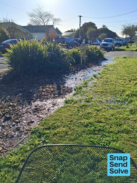
 Water Leak —
 Water leaking from next to power pole
 Pavement - General —
 Hi water leak
 Water Leak —
 Can't quite see where the water is coming, but it looks like a service or lateral pipe. There is a vehicle parked on drive that might have
 Dumped Rubbish —
  Graffiti on a cabinet, pole or railway asset —
 Broken white plastic conduit cover on FD489 concrete pole by 12 Macaulay Street.
 Damaged Street Light —
 Broken white plastic conduit cover on concrete pole by 12 MacAulay Street: Orion or Chorus?
- Graffiti —
- Dumped Rubbish —
- Dumped Rubbish —
 Roading/Streets —
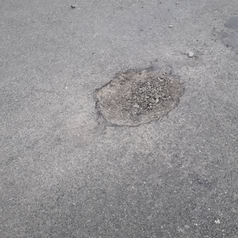
 Pot hole outside number 12 Macaulay Street, Addington.
Roading/Streets —
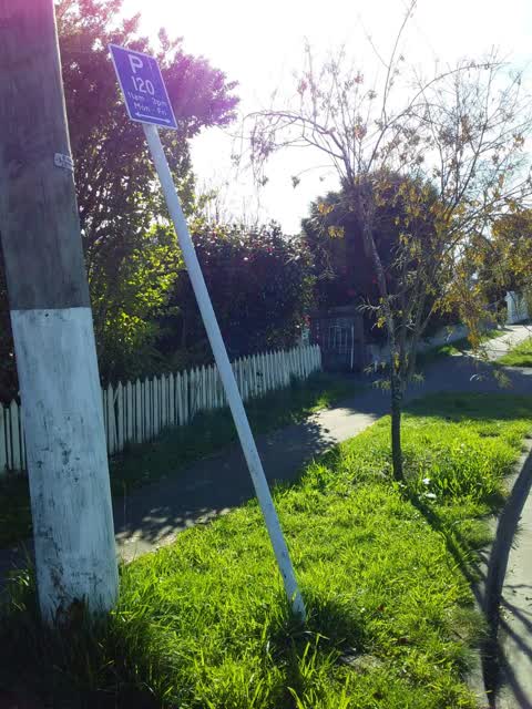
parking sign tipped over
Also reported on Macaulay Street
- 33 Macaulay Street — 16 reports
- 6 Macaulay Street — 8 reports
- 36E Macaulay Street — 8 reports
- 30 Macaulay Street — 6 reports
- 13 Macaulay Street — 6 reports
- 10 Macaulay Street — 6 reports
- 42 Macaulay Street — 5 reports
- 36 Macaulay Street — 5 reports
The street’s crash record
NZTA’s record names Macaulay Street in 1 crash that hurt somebody since 2006 — 0 seriously hurt, nobody killed.
The green nearby
- Addington Park — 150 m to the edge · Sports ground · 3 ha
- Jerrold Reserve — 162 m to the edge
- Mountfort Park — 295 m to the edge · Botanic
- Simeon Park — 296 m to the edge · 1 ha
Parks within half a kilometre, measured to the boundary — the council’s open data.
On the doorstep
- Augustine Outlet — 327 m away · Clothing
- Card Merchant — 327 m away · Games
- Jailhouse Accommodation — 327 m away · Hostels
- Addington Mall — 336 m away · Malls
Businesses within four hundred metres, measured at the pin — OpenStreetMap and the council directories.
The bus nearby
- Howard St near Simeon St — 367 m away · route 120
- Lincoln Rd near Clarence St S — 391 m away · route 7, route 120
The closest Metro stops, within four hundred and fifty metres.
The tracks through here
- Walk and bike track through Addington — 164 m to the line · walk · bike
- Walk and bike track through Addington — 225 m to the line · walk · bike
- Walk and bike track through Addington — 302 m to the line · walk · bike
- Walk and bike track through Addington — 352 m to the line · walk · bike
- Walk and bike track through Addington — 360 m to the line · walk · bike
Tracks whose line passes within half a kilometre, measured to the line itself — the council’s open data.
The named ground
Named water within 500 m of this address, measured to the line or the edge; Named places within 1.5 km of this address; the council’s own structure register — bridges, boardwalks and steps standing nearby — the open map’s record.
Renting nearby
new bonds in Addington ran about $502 a week — $48 below the city median of $550 — the suburb page keeps the rent record →.
The civic layer
This ground votes in Spreydon ward — the Spreydon-Cashmere-Heathcote community board. Ward lines don’t always follow suburb lines; this one is measured at the pin, not the suburb’s centre.
What stood on this ground → · On the map → · From the air — the Crown’s aerials back to 1936; search the address on RetroLens →
Questions, answered briefly
12 council reports on record since October 2019 — most often dumped rubbish (3), water leak (2), roading/streets (2).
Addington, Christchurch — on Macaulay Street.
Nothing on the heritage register at this exact spot — the record around this ground →
Addington Park — 150 m to its edge, 3 ha.