183 Strickland Street, Addington
24 reports on record since April 2022 · 21 with photographs. The most-reported address on Strickland Street. Indicative rating valuation and school zones, hazards, bin day and what stood here before.
What gets reported here
Photographed here 21 on record




Reported here
 Dumped Rubbish,
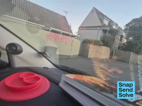
  Graffiti on a fence, building or structure,
 tagging, Norman Kirk Courts
 Graffiti on a fence, building or structure,
 multiple tags on James Baxter pl housing, on Baxter pl as well as Strickland st.
 Poles and Signage - General,
 Left over signage closing crossing on Strickland Street and Brougham
 Graffiti on a fence, building or structure,
 Graffiti on fence
 Graffiti on a fence, building or structure,
 Graffitti on wall
 Graffiti on a cabinet, pole or railway asset,
 Multiple utility cabinets
 Dumped Rubbish,
  Dumped Rubbish,
  Dumped Rubbish,
 Dumped outside of Norman Kirk Complex down James K Baxter Place Thanks you
 Dumped Rubbish,
  Graffiti on a fence, building or structure,
  Accessibility,
 Pedestrian path between Bletsoe Ave and James K Baxter Pl has steel hoops at both ends which restrict access to path users, namely wheelchai
 Graffiti on a fence, building or structure,
 Outside Norman Kirk courts, all over the fences. There is heaps.
 Street Light Outage,
 White street lights above the traffic lights, either side of the Antigua/Strickland street intersection are not working again. They have bee
 Street Light Outage,
 White street lights about traffic lights either side of Antigua street not working again
 Dumped Rubbish,
  Dumped Rubbish,
  Dumped Rubbish,
 - Dumped Rubbish,
- Graffiti,
- Dumped Rubbish,
 Dumped Rubbish,
 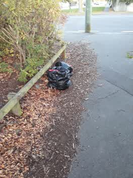 Rubbish/Recycling,
 Fly tipping
Also reported on Strickland Street
- 183B Strickland Street, 3 reports
- 210A Strickland Street, 1 report
- 183A Strickland Street, 1 report
- 179 Strickland Street, 1 report
The street’s crash record
NZTA’s record names Strickland Street in 12 crashes that hurt somebody since 2006, 2 seriously hurt, nobody killed.
The green nearby
- Antigua Reserve, 116 m to the edge
- Ruskin Reserve, 317 m to the edge
- Baxters Drain, 381 m to the edge
- Selwyn Reserve, 445 m to the edge
- Sydenham Park, 466 m to the edge · Sports ground · 5 ha
Parks within half a kilometre, measured to the boundary, the council’s open data.
On the doorstep
- Underground Coffee South, 360 m away · Cafés
- Selwyn Street Medical Centre, 392 m away · Doctors & clinics
Businesses within four hundred metres, measured at the pin: OpenStreetMap and the council directories.
The bus nearby
- Brougham St near James K Baxter Pl, 48 m away · route 120
- Brougham St near Barrie St, 113 m away · route 120
The closest Metro stops, within four hundred and fifty metres.
The tracks through here
- Walk and bike track through Addington, 61 m to the line · walk · bike
- Walk and bike track through Addington, 107 m to the line · walk · bike
- Walk and bike track through Addington, 462 m to the line · walk · bike
- Walk and bike track through Addington, 463 m to the line · walk · bike
Tracks whose line passes within half a kilometre, measured to the line itself, the council’s open data.
The named ground
Named water within 500 m of this address, measured to the line or the edge, the open map’s record.
Renting nearby
new bonds in Addington ran about $502 a week, $48 below the city median of $550, the suburb page keeps the rent record →.
The civic layer
This ground votes in Heathcote ward, the Spreydon-Cashmere-Heathcote community board. Ward lines don’t always follow suburb lines; this one is measured at the pin, not the suburb’s centre.
What stood on this ground → · On the map → · From the air, the Crown’s aerials back to 1936; search the address on RetroLens →
Questions, answered briefly
24 council reports on record since April 2022, most often dumped rubbish (11), graffiti on a fence, building or structure (6), street light outage (2).
Addington, Christchurch, on Strickland Street.
Nothing on the heritage register at this exact spot, the record around this ground →
Antigua Reserve, 116 m to its edge.