2 Brougham Street, Addington
12 reports on record since April 2022 · 8 with photographs. The most-reported address on Brougham Street. Indicative rating valuation and school zones, hazards, bin day and what stood here before.
What gets reported here
- Traffic Signals — 2
- Street Cleaning — 2
- Overgrown Vegetation — 2
- Roads - General — 1
- Pavement - Damaged — 1
- Graffiti — 1
Photographed here 8 on record


Reported here
- Traffic Signals —
I don't know if we can solve this, but the lights at this crossing change too quickly, especially when coming from the north. As a pedestria
 Pavement - Damaged —
 Cracked pavement at kerb letdown on cyclist and pedestrian crossing at Brougham Street. This letdown was repaired previously and the repair
 Traffic Signals —
 Light on the button not working
 Overgrown Vegetation —
 It is very hard to see cyclists coming along the path due to the overgrown plants and branches near the base of the tree
 Dumped Rubbish —
 Outdoor table, pallet and bed
 Street Cleaning —
 Pieces of glass are ending up on the island of the cycle crossing
- General Request —
The timing of the bike/pedestrian crossing has been changed, with it now taking so long to change that cyclists and pedestrians take risks c
 Overgrown Vegetation —
 Overgrown vegetation on cycle path
 Street Cleaning —
 Broken glass in and around pedestrian/cyclist path at Brougham x Collins
- Roads - General —
Collins/Brougham pedestrian crossing : Heading north toward Hagley park the cyclist crossing button is not working
- Damaged Street Light —
 Graffiti —
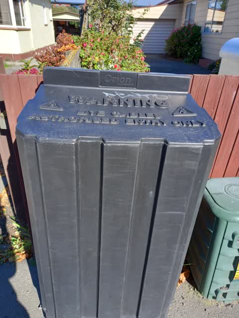
 2 Brougham St - Graffiti on top of Orion box
Also reported on Brougham Street
- 109 Brougham Street — 8 reports
- 14 Brougham Street — 7 reports
- 40 Brougham Street — 5 reports
- 104 Brougham Street — 5 reports
- 91 Brougham Street — 4 reports
- 61 Brougham Street — 4 reports
- 23A Brougham Street — 4 reports
- 131 Brougham Street — 4 reports
The street’s crash record
NZTA’s record names Brougham Street in 33 crashes that hurt somebody since 2006 — 3 seriously hurt, nobody killed.
The green nearby
- Jerrold Reserve — 49 m to the edge
- Simeon Park — 128 m to the edge · 1 ha
- Addington Park — 313 m to the edge · Sports ground · 3 ha
- Selwyn Reserve — 316 m to the edge
- Mountfort Park — 439 m to the edge · Botanic
Parks within half a kilometre, measured to the boundary — the council’s open data.
The bus nearby
The closest Metro stops, within four hundred and fifty metres.
The tracks through here
- Walk and bike track through Addington — 38 m to the line · walk · bike
- Walk and bike track through Addington — 64 m to the line · walk · bike
- Walk and bike track through Addington — 308 m to the line · walk · bike
- Walk and bike track through Addington — 403 m to the line · walk · bike
- Walk and bike track through Addington — 428 m to the line · walk · bike
Tracks whose line passes within half a kilometre, measured to the line itself — the council’s open data.
The named ground
Named water within 500 m of this address, measured to the line or the edge; Named places within 1.5 km of this address — the open map’s record.
Renting nearby
new bonds in Addington ran about $502 a week — $48 below the city median of $550 — the suburb page keeps the rent record →.
The civic layer
This ground votes in Spreydon ward — the Spreydon-Cashmere-Heathcote community board. Ward lines don’t always follow suburb lines; this one is measured at the pin, not the suburb’s centre.
What stood on this ground → · On the map → · From the air — the Crown’s aerials back to 1936; search the address on RetroLens →
Questions, answered briefly
12 council reports on record since April 2022 — most often traffic signals (2), street cleaning (2), overgrown vegetation (2).
Addington, Christchurch — on Brougham Street.
Nothing on the heritage register at this exact spot — the record around this ground →
Jerrold Reserve — 49 m to its edge.