66 Harman Street, Addington
17 reports on record since April 2021 · 14 with photographs. The street’s heaviest record is 34 Harman Street — 18 reports on file. Indicative rating valuation and school zones, hazards, bin day and what stood here before.
What gets reported here
- Dumped Rubbish — 7
- Parks — 4
- Water Leak — 1
- Playground Equipment — 1
- Hazard — vehicle — 1
- Graffiti somewhere else — 1
Photographed here 14 on record




Reported here
 Graffiti on a playground or in a park —
 Graffiti of Penis on park sign
 Dumped Rubbish —
 Dumped rubbish outside reserve
 Hazard — vehicle —
 car left on road with no plates
 Dumped Rubbish —
 Pallets and other rubbish
 Graffiti on a fence, building or structure —
 Graffiti on a wall
 Dumped Rubbish —
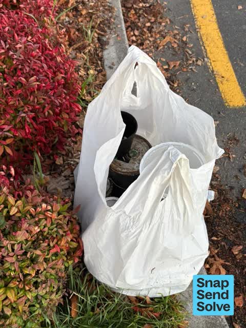
 Bag of old paint tins, outside the reserve by Manuka Cottage
 Playground Equipment —
 Bolts + other parts falling out of basketball hoop
 Graffiti somewhere else —
 Graffiti on fence line
 Dumped Rubbish —
 There are a pile of bike wheels and bike tyres in the bushes on the western side of Cornelius O'Connor Reserve. They need to go, but it's st
 Dumped Rubbish —
 Tyre stack
- Dumped Rubbish —
- Dumped Rubbish —
- Water Leak —
 Parks —
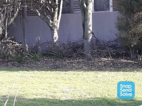
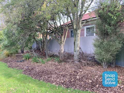
 Left hand of park at the front heaps of old tree branches, illegal dumping
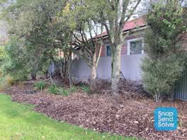 Parks —
 Pruned branches left in garden
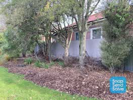 Parks —
 Pruned branches left in garden
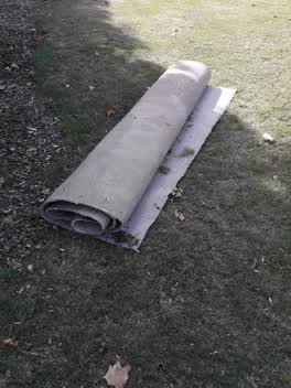 Parks —
 illegal dumping
Also reported on Harman Street
- 34 Harman Street — 18 reports
- 112 Harman Street — 16 reports
- 70 Harman Street — 15 reports
- 60 Harman Street — 14 reports
- 40 Harman Street — 11 reports
- 97 Harman Street — 10 reports
- 66-70 Harman Street — 10 reports
- 77 Harman Street — 9 reports
The street’s crash record
NZTA’s record names Harman Street in 23 crashes that hurt somebody since 2006 — 3 seriously hurt, nobody killed.
The green nearby
- Cornelius O'connor Reserve — you are in it
- Disraeli Reserve — 243 m to the edge
- Addington Cemetery — 250 m to the edge · Botanic · 2 ha
- Mountfort Park — 303 m to the edge · Botanic
- Hagley Park South — 315 m to the edge · Sports ground · 71 ha
Parks within half a kilometre, measured to the boundary — the council’s open data.
On the doorstep
- Harcourts Christchurch — 191 m away · Real estate
- Back Alley Bikes — 198 m away · Bike shops
- Tunnel Wash — 216 m away · Car washes
- Paul Kelly Motor Company — 220 m away · Car dealers
Businesses within four hundred metres, measured at the pin — OpenStreetMap and the council directories.
The bus nearby
The closest Metro stops, within four hundred and fifty metres.
The tracks through here
- Walk and bike track through Addington — 85 m to the line · walk · bike
- Walk and bike track through Addington — 112 m to the line · walk · bike
- Walk and bike track through Addington — 164 m to the line · walk · bike
- Walk and bike track through Addington — 206 m to the line · walk · bike
- Walk and bike track through Addington — 276 m to the line · walk · bike
Tracks whose line passes within half a kilometre, measured to the line itself — the council’s open data.
The named ground
Named water within 500 m of this address, measured to the line or the edge; Named places within 1.5 km of this address; the council’s own structure register — bridges, boardwalks and steps standing nearby — the open map’s record.
Renting nearby
new bonds in Addington ran about $502 a week — $48 below the city median of $550 — the suburb page keeps the rent record →.
What was here — Church of St Mary the Virgin Lychgate and Setting
193 m away · located to ±3 m · the place’s own record →
On the register. Nothing researched here yet.
What was here — Church Square and Setting
219 m away · 21A Church Square · located to ±45 m · the place’s own record →
On the register. Nothing researched here yet.
What was here — Church of St Mary the Virgin and Setting
228 m away · 21A Church Square · located to ±16 m · the place’s own record →
On the register. Nothing researched here yet.
What was here — Church of St Mary the Virgin Belltower and Setting
239 m away · located to ±3 m · the place’s own record →
On the register. Nothing researched here yet.
What was here — Dwelling and Setting
242 m away · 391 Selwyn Street · located to ±8 m · the place’s own record →
On the register. Nothing researched here yet.
The civic layer
This ground votes in Spreydon ward — the Spreydon-Cashmere-Heathcote community board. Ward lines don’t always follow suburb lines; this one is measured at the pin, not the suburb’s centre.
What stood on this ground → · On the map → · From the air — the Crown’s aerials back to 1936; search the address on RetroLens →
Questions, answered briefly
17 council reports on record since April 2021 — most often dumped rubbish (7), parks (4), water leak (1).
Addington, Christchurch — on Harman Street.
The heritage register names 5 places at or beside it — Church of St Mary the Virgin Lychgate and Setting, Church Square and Setting.
Cornelius O'connor Reserve — the address is inside it.