85 Jerrold Street North, Addington
16 reports on record since October 2020 · 15 with photographs. The street’s heaviest record is 85E Jerrold Street North — 62 reports on file. Indicative rating valuation and school zones, hazards, bin day and what stood here before.
What gets reported here
Photographed here 15 on record




Reported here
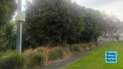
 Overgrown Vegetation —
 Large nightshade weeds and elderberry on the banks of Jackson's Creek in Addington Park, particularly behind the pole in 1st photo. They're
 Graffiti on a playground or in a park —
 East side of Paddington park. On changing sheds east wall
 Graffiti somewhere else —
 Graffiti on a pole behind Sacred Heart School closet to the toilets in Addington Park.
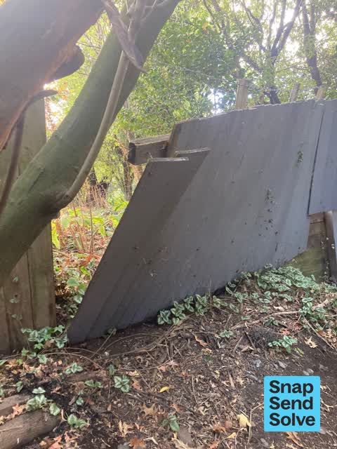
 Park - General Request —
 Fence between park and school is broken
 Park - General Request —
 Drain cover has been broken off lock and the drain is open.
 Graffiti on a fence, building or structure —
  Dumped Rubbish —
  Graffiti on a playground or in a park —
 Addington park east end above entrance to Jackson creek tunnel
 Dumped Rubbish —
 Huge amount of dumped rubbish and a trolley in the river area
 Dumped Rubbish —
 Large amount of rubbish illegaly dumped in river way behind toilets
 Dumped Rubbish —
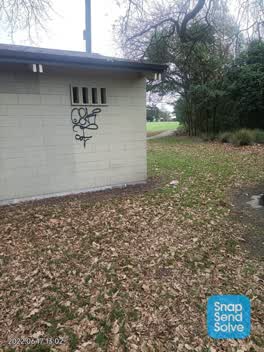
  Graffiti —
 The Addington park toilets have been covered in graffiti
- Street Gutters / Storm Water —
 Graffiti —
 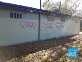 Graffiti —
 Addington Park toilet block
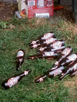 Litter —
 used beer bottles at chafing rooms Addington park park
Also reported on Jerrold Street North
- 85E Jerrold Street North — 62 reports
- 87 Jerrold Street North — 11 reports
- 89 Jerrold Street North — 3 reports
- 85F Jerrold Street North — 3 reports
- 93 Jerrold Street North — 2 reports
- 125 Jerrold Street North — 2 reports
- 115B Jerrold Street North — 2 reports
- 91 Jerrold Street North — 1 report
The street’s crash record
NZTA’s record names Jerrold Street North in 10 crashes that hurt somebody since 2006 — 1 person killed, 0 seriously hurt.
The green nearby
- Addington Park — you are in it · Sports ground · 3 ha
- Jerrold Reserve — 233 m to the edge
- Simeon Park — 369 m to the edge · 1 ha
- Mountfort Park — 386 m to the edge · Botanic
- Parade Court Reserve — 414 m to the edge
Parks within half a kilometre, measured to the boundary — the council’s open data.
On the doorstep
- Pepper Bridge Indian Restaurant — 312 m away · Restaurants
- Addington Mall — 315 m away · Malls
- Augustine Outlet — 316 m away · Clothing
- Bensons — 322 m away · Beauty
Businesses within four hundred metres, measured at the pin — OpenStreetMap and the council directories.
The bus nearby
- Lincoln Rd near Clarence St S — 343 m away · route 7, route 120
- Addington Village — 373 m away · route 7, route 120
The closest Metro stops, within four hundred and fifty metres.
The tracks through here
- Walk and bike track through Addington — 198 m to the line · walk · bike
- Walk and bike track through Addington — 217 m to the line · walk · bike
- Walk and bike track through Addington — 317 m to the line · walk · bike
- Walk and bike track through Addington — 330 m to the line · walk · bike
- Walk and bike track through Addington — 342 m to the line · walk · bike
Tracks whose line passes within half a kilometre, measured to the line itself — the council’s open data.
The named ground
Named water within 500 m of this address, measured to the line or the edge; Named places within 1.5 km of this address; the council’s own structure register — bridges, boardwalks and steps standing nearby — the open map’s record.
Renting nearby
new bonds in Addington ran about $502 a week — $48 below the city median of $550 — the suburb page keeps the rent record →.
The civic layer
This ground votes in Spreydon ward — the Spreydon-Cashmere-Heathcote community board. Ward lines don’t always follow suburb lines; this one is measured at the pin, not the suburb’s centre.
What stood on this ground → · On the map → · From the air — the Crown’s aerials back to 1936; search the address on RetroLens →
Questions, answered briefly
16 council reports on record since October 2020 — most often dumped rubbish (4), graffiti (3), park - general request (2).
Addington, Christchurch — on Jerrold Street North.
Nothing on the heritage register at this exact spot — the record around this ground →
Addington Park — the address is inside it, 3 ha.