2543 Christchurch Akaroa Road
2 council reports since October 2020, 1 carrying a photograph. The street’s heaviest record is 2652 Christchurch Akaroa Road, 4 reports on file.
The green nearby
- Ataahua Domain, you are in it · Sports ground · 2 ha
- Kaituna Reserve, 15 m to the edge · playground, 1 pieces
Parks within half a kilometre, measured to the boundary, the council’s open data. The whole roll is at /parks.
The named ground
Named water within 500 m of this address, measured to the line or the edge, the open map’s record.
Renting nearby
new bonds in Ataahua ran about $500 a week, $50 below the city median of $550, the suburb page keeps the rent record →.
What gets reported here
- Water Leak, 1
- Public Toilet, 1
Photographed here 1 on record
What’s on record
- Water Leak, 16 Feb 2024
Leaking toilet sistern in the male public toilet.
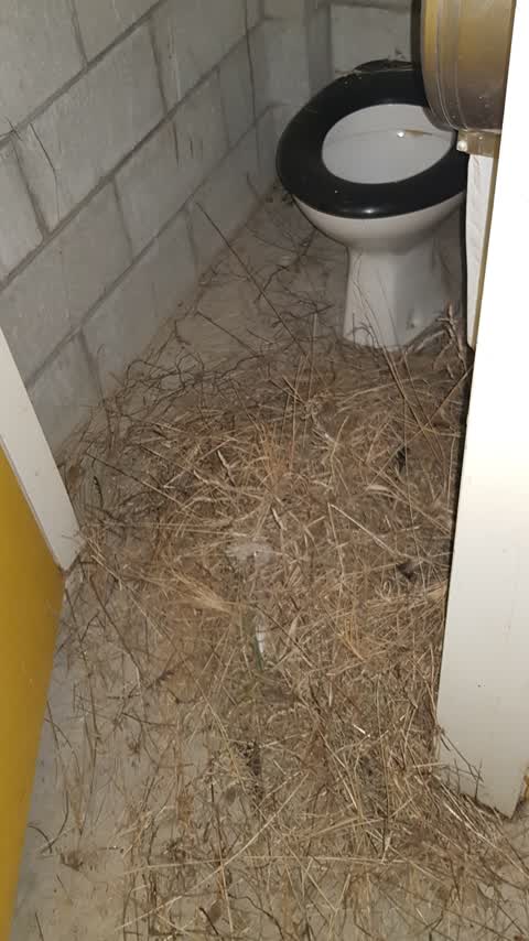
 Public Toilet, 15 Oct 2020
 Toilet cubicles covered in straw, presumably brought in by birds but with a cricket game scheduled in the park Saturday it needs to be clear
Elsewhere on Christchurch Akaroa Road
- 2652 Christchurch Akaroa Road, 4 reports
- 2531 Christchurch Akaroa Road, 4 reports
- 2471 Christchurch Akaroa Road, 1 report
- 2290 Christchurch Akaroa Road, 1 report
- 2287 Christchurch Akaroa Road, 1 report
The civic layer
This ground votes in Banks Peninsula ward, the Banks Peninsula community board is its local layer. Ward lines don’t always follow suburb lines; this one is measured at the pin, not the suburb’s centre. The whole roll is at /wards.
Christchurch Akaroa Road, the whole record → · Everything about Ataahua → · What stood on this ground → · On the map → · From the air, RetroLens holds the Crown’s aerials back to 1936; search the address there →
Questions, answered briefly
2 council reports on record since October 2020, most often water leak (1), public toilet (1).
Ataahua, Christchurch, on Christchurch Akaroa Road.
Nothing on the heritage register at this exact spot, the record around this ground →
Ataahua Domain, the address is inside it, 2 ha.