204 Avonside Drive, Avonside
12 reports on record since April 2020 · 11 with photographs. The street’s heaviest record is 244/240 Avonside Drive — 56 reports on file. Indicative rating valuation and school zones, hazards, bin day and what stood here before.
What gets reported here
- Rubbish/Recycling — 4
- Graffiti — 2
- Trees - General — 1
- Roading/Streets — 1
- Road Signage — 1
- Overgrown Vegetation — 1
Photographed here 11 on record


Reported here
 Trees - General —
 Tree branches hanging. On river side of Avonside Drive
 Graffiti on a road, footpath or bridge —
 3 lamp posts
 Overgrown Vegetation —
 Bush growing into the path. We bike here and it’s too hard to get past, making my young son ride on the road instead.
 Road Signage —
 The plants are nearly fully obscuring the light reflectors. This is right on the corner of Cowlishaw Street & Avonside Drive. Thanks Juanita
 Damaged Street Sign —
 Cowlishaw street sign is hanging loose
- Graffiti —
 Roading/Streets —
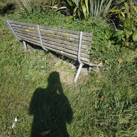
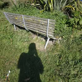
 Support pole bent on Riverside seating probably be pushed over by a car
 Rubbish/Recycling —
 Rubbish/Recycling —
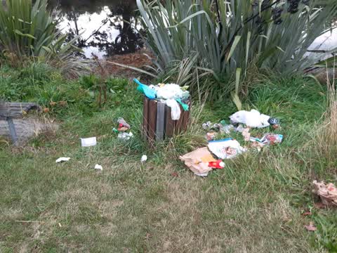
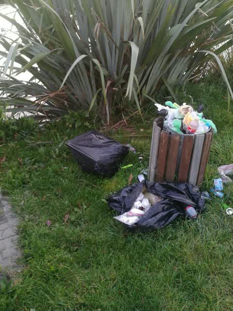
river bank rubbish bin.Not been emptied for some time.Now over ground as well.
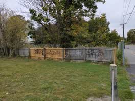 Graffiti —
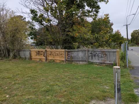
 please remove graffiti from this block. some on other corner of fence too not on picture.
Rubbish/Recycling —
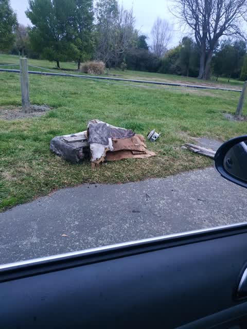
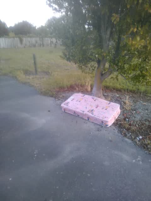
A small mattress has been dumped on the berm outside this address.
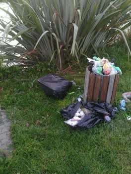 Rubbish/Recycling —
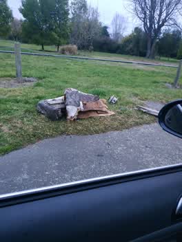
 over flowing bin and fly dumped rubbish
Also reported on Avonside Drive
- 244/240 Avonside Drive — 56 reports
- 800 Avonside Drive — 43 reports
- 746 Avonside Drive — 34 reports
- 774 Avonside Drive — 31 reports
- 658 Avonside Drive — 27 reports
- 740 Avonside Drive — 23 reports
- 836 Avonside Drive — 21 reports
- 240 Avonside Drive — 20 reports
The street’s crash record
NZTA’s record names Avonside Drive in 17 crashes that hurt somebody since 2006 — 1 seriously hurt, nobody killed.
The green nearby
- Avon Riverbank True Right — 85 m to the edge · 11 ha
- Avebury Park — 240 m to the edge · Botanic
- Richmond Playground — 401 m to the edge
- Beverley Park — 423 m to the edge · 3 ha
- Alexandra Park — 434 m to the edge
Parks within half a kilometre, measured to the boundary — the council’s open data.
On the doorstep
- Riverlution Cafe — 182 m away · Cafés
- Woodham Road Medical Centre — 249 m away · Business
- Woodham Road Pharmacy — 258 m away · Pharmacies
- Woodham Road Healthcare — 265 m away · Doctors & clinics
Businesses within four hundred metres, measured at the pin — OpenStreetMap and the council directories.
The bus nearby
- Woodham Rd near Avonside Dr — 270 m away · the Orbiter (clockwise)
- Woodham Rd near Linwood Ave — 275 m away · the Orbiter (anticlockwise)
The closest Metro stops, within four hundred and fifty metres.
The tracks through here
- Walk and bike track through Avonside — 76 m to the line · walk · bike
- Walk and bike track through Avonside — 76 m to the line · walk · bike
- Walk and bike track through Avonside — 100 m to the line · walk · bike
- Walk and bike track through Avonside — 229 m to the line · walk · bike
- Walk and bike track through Avonside — 265 m to the line · walk · bike
Tracks whose line passes within half a kilometre, measured to the line itself — the council’s open data.
The named ground
Named water within 500 m of this address, measured to the line or the edge; the council’s own structure register — bridges, boardwalks and steps standing nearby — the open map’s record.
Renting nearby
new bonds in Avonside ran about $293 a week — $257 below the city median of $550 — the suburb page keeps the rent record →.
What was here — MED Substation and Setting
157 m away · 11 Retreat Road · located to ±5 m · the place’s own record →
On the register. Nothing researched here yet.
The civic layer
This ground votes in Burwood ward — the Coastal-Burwood-Linwood community board. Ward lines don’t always follow suburb lines; this one is measured at the pin, not the suburb’s centre.
What stood on this ground → · On the map → · From the air — the Crown’s aerials back to 1936; search the address on RetroLens →
Questions, answered briefly
12 council reports on record since April 2020 — most often rubbish/recycling (4), graffiti (2), trees - general (1).
Avonside, Christchurch — on Avonside Drive.
The heritage register names a place at or beside it — MED Substation and Setting.
Avon Riverbank True Right — 85 m to its edge, 11 ha.