20 Norwood Street, Beckenham
56 reports on record since October 2017 · 45 with photographs. The most-reported address on Norwood Street. Indicative rating valuation and school zones, hazards, bin day and what stood here before.
What gets reported here
- Park - General Request — 10
- Parks — 9
- Water Leak — 7
- Water Fountain — 4
- Graffiti — 4
- Facility - General Request — 4
Photographed here 45 on record





Reported here
 Pest / Vermin —
 Australian magpie seen in Beckenham park. They have not been here before. Is there any pest control to remove them before they start becomin
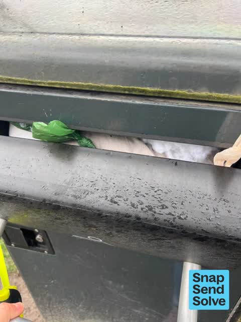
 Facility - General Request —
 The bin has been blocked up with ? Bedding and is unable to be opened properly.
 Water General —
 Ponds in Beckenham Park near Eastern Tce need arrention. Snap Send Solve sent a month ago and nothing has improved.
 Water Fountain —
 thanks for the new fountain but its not working. a Dribble of water was coming out, no pressure, couldn't drink from it
 Water Fountain —
 when is the drink fountain getting replaced?
 Park - General Request —
 The ponds in Beckenham Park are a mess...the edges are closing in, water levels are rising, drainage area is covered in watercress and weeds
 Park - General Request —
 Beckenham Park ponds on Eastern Tce are a neglected mess. The edges are filling in and the water level is rising. There are dead branches in
 Fallen Tree —
 fallen tree
 Fallen Tree —
 Fallen tree next to tennis court clubrooms in Beckenham Park
 Sewer - Leak / Blockage —
 Possibly a sewage leak in Beckenham Park. Smells like raw sewage and dogs are very attracted to it (& are eating it). Lots of kids playing n
- Water Fountain —
What happening with the water fountain in beckenham park? Its been gone for ages now
 Park - General Request —
 leaking Sprinkler
 Fallen Tree —
 broken tree branch, hanging over pathway near kids playground
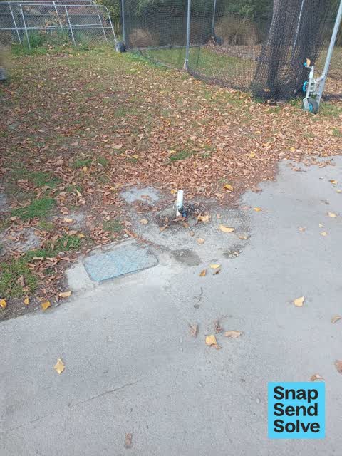
 Water Leak —
 hole and broken pipe
 Water Leak —
 leaking pop up sprinkler
 Facility - General Request —
 This tree or low historic, is pastits used by date and has significant numbers of dead branches that have broken and may fall on people. In
 Park - General Request —
 At the base of the steps to the door on the south side of the building there is a hollow in the ground, which after rain becomes a puddle an
 Overgrown Vegetation —
 Please remove privet bush from south side of Beckenham Tennis Club building.
 Graffiti on a fence, building or structure —
 Graffiti on ccc building
 Graffiti on a fence, building or structure —
 Graffiti on ccc roller
 Graffiti on a fence, building or structure —
 Graffiti on ccc seat
 Water Leak —
 Water leak
 Water Fountain —
 Leaking drinking fountain next to clubrooms
 Pavement - General —
 Ponding. They've done a good job regravelling the footpath, but the water now ponds here. Could they cut a swale drain into the grass toward
- Public Toilet —
Someone missed the toilet and there's poo outside the toilet
 Facility - General Request —
 Chair has broken middle wooden plank.
 Trees - General —
 Dead tree please remove
 Playground Equipment —
 Nail sticking out at head height (admittedly in a place where you wouldn’t normally put your head!).
 Water Leak —
 Leak is making the field very boggy. The pitch is not depressed making water accumulate. Seems like it’s coming up from underneath.
 Park - General Request —
 Irrigation leak western side on park near tennis club in front of exercise equipment
 Graffiti —
 Someone has drawn a cock and balls on the field in what looks like weed killer. They have also done two other big patches. Will it need gras
 Dumped Rubbish —
 Dumped tyres
 Graffiti —
 Graffiti in Beckenham Park on the toddler swing, pond side
- Park - General Request —
- Water Leak —
- Park - General Request —
- Facility - General Request —
- Park - General Request —
- Pavement - General —
- Park - General Request —
- Park - General Request —
- Water Leak —
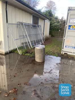 Parks —
 Constantly going drinking fountain next to club rooms, flooding the path
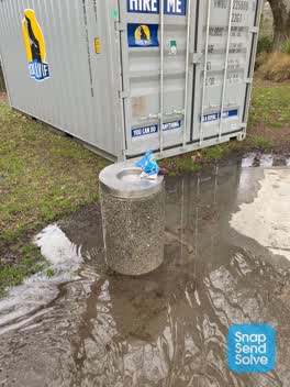 Water Leak —
 Water fountain not turning off. A snack packet over outlet to direct some water to drain
 Flooding —
 Water fountain flooding and running continuously. Someone has covered the with a chip packet to stop it spraying everywhere.
 Parks —
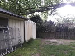
 Tree branch has fallen onto the roof of the cricket Pavilion
 Parks —
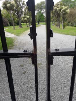
 No lock
 Flooding —
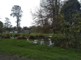
 Beckenham ponds are flooding. Outlets and channel needs to be cleared.
 Parks —
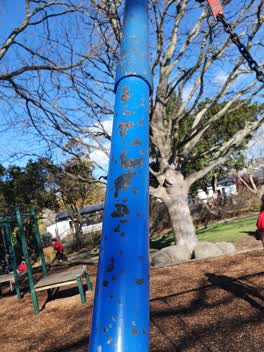
 A child climbing the frame had paint chip off and get stuck under finger nail causing it to bleed. On close inspection the paint is strong.
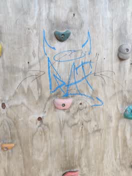 Graffiti —
 Graffiti on Beckenham Park playground
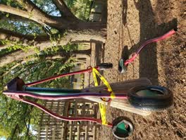 Parks —
 pole snapped off this playground equipment today while my 9yo son was on it. Luckily he wasn't seriously hurt, but he could have been.
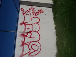 Graffiti —
 in park by tennis courts
Parks —
Parks —
broken sprinkle
Parks —
Broken padlock park currently insecure Mable Howard
Parks —
Tree fallen across access road in Beckenham Park
Also reported on Norwood Street
- 15 Norwood Street — 11 reports
- 14 Norwood Street — 10 reports
- 33 Norwood Street — 8 reports
- 27 Norwood Street — 8 reports
- 38A Norwood Street — 7 reports
- 29 Norwood Street — 7 reports
- 28 Norwood Street — 7 reports
- 48 Norwood Street — 6 reports
The street’s crash record
NZTA’s record names Norwood Street in 1 crash that hurt somebody since 2006 — 1 seriously hurt, nobody killed.
The green nearby
- Beckenham Park — you are in it · Sports ground · 5 ha
- Heathcote Riverbank True Left — 141 m to the edge · 4 ha
- Palatine Native Reserve — 256 m to the edge
- Waimea Reserve — 318 m to the edge
- Palatine Reserve — 357 m to the edge
Parks within half a kilometre, measured to the boundary — the council’s open data.
On the doorstep
- Southern Districts Cricket Club — 48 m away · Clubs
- Beckenham Bowling Club — 391 m away · Sports centres
Businesses within four hundred metres, measured at the pin — OpenStreetMap and the council directories.
The bus nearby
- Centaurus Rd near St Martins Rd — 331 m away · the Orbiter (anticlockwise)
- Centaurus Rd near St Martins Rd — 345 m away · the Orbiter (clockwise)
The closest Metro stops, within four hundred and fifty metres.
The tracks through here
- Walk and bike track through Beckenham — 139 m to the line · walk · bike
- Walk and bike track through Beckenham — 166 m to the line · walk · bike
- Walk and bike track through Beckenham — 207 m to the line · walk · bike
- Walk and bike track through Beckenham — 313 m to the line · walk · bike
- Walk and bike track through Beckenham — 344 m to the line · walk · bike
Tracks whose line passes within half a kilometre, measured to the line itself — the council’s open data.
The named ground
Named water within 500 m of this address, measured to the line or the edge; the council’s own structure register — bridges, boardwalks and steps standing nearby — the open map’s record.
The remembered names nearby
- This Tree Was Planted in Loving Memory of Lynn Taylor 1950 — 88 m away ·
This tree was planted in loving memory of Lynn Taylor 1950 - 2005 who loved Beckenham and
· 2008 - Arbor Day 1950 Planted to Commemorate the Centennial — 94 m away ·
ARBOR DAY 1950 PLANTED TO COMMEMORATE THE CENTENNIAL OF CANTERBURY
· 2008 - In Memory of Owen Wilkes 1940 — 2005 International Peace — 109 m away ·
IN MEMORY OF OWEN WILKES 1940 — 2005 INTERNATIONAL PEACE ACTIVIST, RESEARCHER, ARCHAEOLOGI
· 2008
Inscribed plaques within two hundred and fifty metres — the register’s pins, not surveyed spots. The whole roll is at /plaques.
Renting nearby
new bonds in Beckenham ran about $620 a week — $70 above the city median of $550 — the suburb page keeps the rent record →.
What was here — Former Beckenham Library and Setting
164 m away · 65 Sandwich Road · located to ±11 m · the place’s own record →
On the register. Nothing researched here yet.
The civic layer
This ground votes in Cashmere ward — the Spreydon-Cashmere-Heathcote community board. Ward lines don’t always follow suburb lines; this one is measured at the pin, not the suburb’s centre.
What stood on this ground → · On the map → · From the air — the Crown’s aerials back to 1936; search the address on RetroLens →
Questions, answered briefly
56 council reports on record since October 2017 — most often park - general request (10), parks (9), water leak (7).
Beckenham, Christchurch — on Norwood Street.
The heritage register names a place at or beside it — Former Beckenham Library and Setting.
Beckenham Park — the address is inside it, 5 ha.