25A Eastern Terrace, Beckenham
16 reports on record since June 2018 · 16 with photographs. The street’s heaviest record is 215 Eastern Terrace — 57 reports on file. Indicative rating valuation and school zones, hazards, bin day and what stood here before.
What gets reported here
- Graffiti on a fence, building or structure — 4
- Dumped Rubbish — 4
- Graffiti — 2
- General Request — 2
- Flooding — 2
- Hazard — vehicle — 1
Photographed here 16 on record




Reported here
 Dumped Rubbish —
 traffic cones in the river
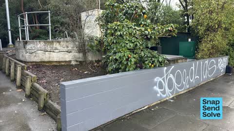
 Graffiti on a fence, building or structure —
 Graffiti on top of wall,north east end at pumpstation 22.
 General Request —
 Graffiti on fence
 Graffiti on a road, footpath or bridge —
 All over bridge
 Graffiti on a fence, building or structure —
 Christchurch pump station
 Graffiti on a fence, building or structure —
 White spray paint,non-offensive on front wall of pumpsite.
 Graffiti on a fence, building or structure —
 Graffiti under bridge
 Flooding —
 Blocked drain on Eastern Tce causing flooding
 Dumped Rubbish —
 Dumped New World shopping trolly in Heathcote river. Please have it removed
 General Request —
 Hi this camera has been on this lamppost filming the Footpath for some time, surely it can't be legal
 Hazard — vehicle —
  Dumped Rubbish —
 Dumped supermarket trolley in river but I have idea whose
 Dumped Rubbish —
 Trolley chucked into the river. Cannot tell what brand of trolley.
Graffiti —
Graffiti —
Flooding —
Leaking tobby
Also reported on Eastern Terrace
- 215 Eastern Terrace — 57 reports
- 219 Eastern Terrace — 30 reports
- 225 Eastern Terrace — 10 reports
- 223 Eastern Terrace — 9 reports
- 21 Eastern Terrace — 9 reports
- 95 Eastern Terrace — 7 reports
- 89 Eastern Terrace — 7 reports
- 59 Eastern Terrace — 7 reports
The street’s crash record
NZTA’s record names Eastern Terrace in 6 crashes that hurt somebody since 2006 — 1 seriously hurt, nobody killed.
The green nearby
- Heathcote Riverbank True Left — 7 m to the edge · 4 ha
- Enticott Reserve — 168 m to the edge
- Major Aitken Reserve — 195 m to the edge
- Centaurus Reserve No. 1 — 217 m to the edge
- Sunvale Reserve — 261 m to the edge
Parks within half a kilometre, measured to the boundary — the council’s open data.
On the doorstep
- Plunket Clinic — 319 m away · Doctors & clinics
- The Brickworks — 390 m away · Bars & pubs
Businesses within four hundred metres, measured at the pin — OpenStreetMap and the council directories.
The bus nearby
- Centaurus Rd near Bowenvale Ave — 46 m away · the Orbiter (clockwise)
- Centaurus Rd near Major Aitken Dr — 106 m away · the Orbiter (anticlockwise)
The closest Metro stops, within four hundred and fifty metres.
The tracks through here
- Walk and bike track through Beckenham — 1 m to the line · walk · bike
- Walk and bike track through Beckenham — 28 m to the line · walk · bike
- Walk and bike track through Beckenham — 34 m to the line · walk · bike
- Walk and bike track through Beckenham — 48 m to the line · walk · bike
- Walk and bike track through Beckenham — 67 m to the line · walk · bike
Tracks whose line passes within half a kilometre, measured to the line itself — the council’s open data.
The named ground
Named water within 500 m of this address, measured to the line or the edge; Named places within 1.5 km of this address; the council’s own structure register — bridges, boardwalks and steps standing nearby — the open map’s record.
Renting nearby
new bonds in Beckenham ran about $620 a week — $70 above the city median of $550 — the suburb page keeps the rent record →.
The civic layer
This ground votes in Cashmere ward — the Spreydon-Cashmere-Heathcote community board. Ward lines don’t always follow suburb lines; this one is measured at the pin, not the suburb’s centre.
What stood on this ground → · On the map → · From the air — the Crown’s aerials back to 1936; search the address on RetroLens →
Questions, answered briefly
16 council reports on record since June 2018 — most often graffiti on a fence, building or structure (4), dumped rubbish (4), graffiti (2).
Beckenham, Christchurch — on Eastern Terrace.
Nothing on the heritage register at this exact spot — the record around this ground →
Heathcote Riverbank True Left — 7 m to its edge, 4 ha.