905 Main North Road, Belfast
12 reports on record since June 2022 · 10 with photographs. The street’s heaviest record is 710 Main North Road — 105 reports on file. Indicative rating valuation and school zones, hazards, bin day and what stood here before.
What gets reported here
Photographed here 10 on record


Reported here
 Overgrown Vegetation —
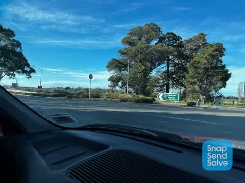
 grasses causing sightline issues. cant see cars leaving city when going straight through this intersection from kaiapoi. accident waiting t
 Roads - General —
 these grasses block vision when going straight through this intersection. from main north rd(kaiapoi direction) across to dickies rd. the ro
 Roads - General —
 cant see anything coming from town when going straight through this intersection coming from old waimak bridge direction
 Graffiti on a fence, building or structure —
  Trees - General —
 Can't see cars coming to the left when going straight across from dickies road belfast onto main north road
 General Request —
 There wasn't a type of incident to put this under, This hole is located about between 200 and 300 metres before the intersection of dickleys
 Pavement - General —
 There is a broken bottle on the pavement on main north road just before dickys road in Belfast looks like it was thrown out of a carit is ve
 Graffiti on a road, footpath or bridge —
 Under motorway on dickies road
 Water Leak —
 Water leak on Dickeys Rd opposite number 9
- Street Gutters / Storm Water —
- Street Cleaning —
 Roading/Streets —
 The flax and other plantings are too tall in this median strip for clear visibility from all directions in this incredibly busy intersection
Also reported on Main North Road
- 710 Main North Road — 105 reports
- 666 Main North Road — 14 reports
- 672A Main North Road — 13 reports
- 985 Main North Road — 12 reports
- 1311 Main North Road — 12 reports
- 453 Main North Road — 10 reports
- 720 Main North Road — 9 reports
- 680D Main North Road — 8 reports
The street’s crash record
NZTA’s record names Main North Road in 51 crashes that hurt somebody since 2006 — 4 people killed, 8 seriously hurt.
The green nearby
- Darroch Reserve — 263 m to the edge · 4 ha
Parks within half a kilometre, measured to the boundary — the council’s open data.
On the doorstep
- Thirsty Liquor Belfast — 57 m away · Bottle stores
- Black Bull Liquor The Peg — 108 m away · Bottle stores
- Belfast Tavern — 113 m away · Venues & events
- Stonehurst Sawmill — 263 m away · Sawmill
Businesses within four hundred metres, measured at the pin — OpenStreetMap and the council directories.
The bus nearby
The closest Metro stops, within four hundred and fifty metres.
The named ground
Named water within 500 m of this address, measured to the line or the edge — the open map’s record.
Renting nearby
new bonds in Belfast ran about $610 a week — $60 above the city median of $550 — the suburb page keeps the rent record →.
The civic layer
This ground votes in Harewood ward — the Fendalton-Waimairi-Harewood community board. Ward lines don’t always follow suburb lines; this one is measured at the pin, not the suburb’s centre.
What stood on this ground → · On the map → · From the air — the Crown’s aerials back to 1936; search the address on RetroLens →
Questions, answered briefly
12 council reports on record since June 2022 — most often roads - general (2), water leak (1), trees - general (1).
Belfast, Christchurch — on Main North Road.
Nothing on the heritage register at this exact spot — the record around this ground →
Darroch Reserve — 263 m to its edge, 4 ha.