10B Stretton Street, Bishopdale
19 reports on record since September 2019 · 11 with photographs. The most-reported address on Stretton Street. Indicative rating valuation and school zones, hazards, bin day and what stood here before.
What gets reported here
- Parks — 5
- Overgrown Vegetation — 5
- Graffiti — 3
- Trees - General — 1
- Rubbish/Recycling — 1
- Pavement - Damaged — 1
Photographed here 11 on record



Reported here
 Overgrown Vegetation —
 Lawns and garden over grown.
 Overgrown Vegetation —
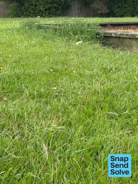
 Weeds both sides of alley from Cotswold Avenue and around edges of park and play areas
 Overgrown Vegetation —
 Grass is long and needs mowing
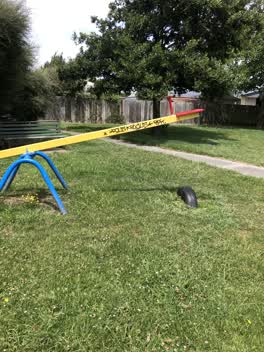 Graffiti —
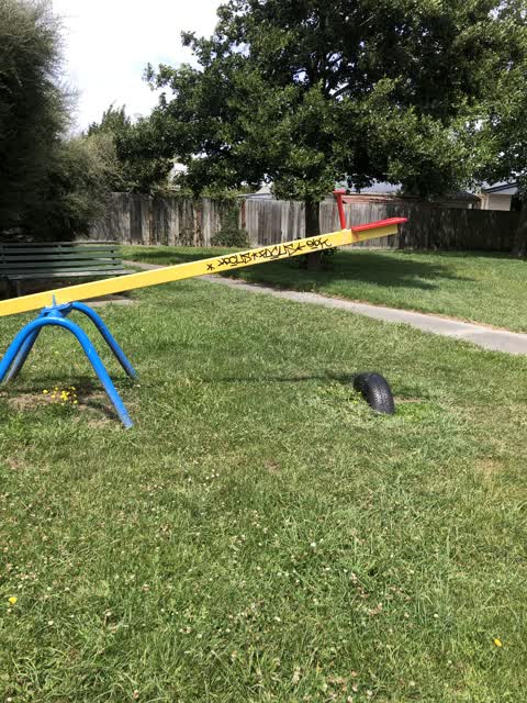
 Graffiti on see saw at park
- Hazard — vehicle —
- Pavement - Damaged —
- Fallen Tree —
- Park - General Request —
- Graffiti —
- Overgrown Vegetation —
- Overgrown Vegetation —
- Trees - General —
 Graffiti —
 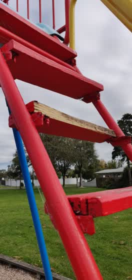 Parks —
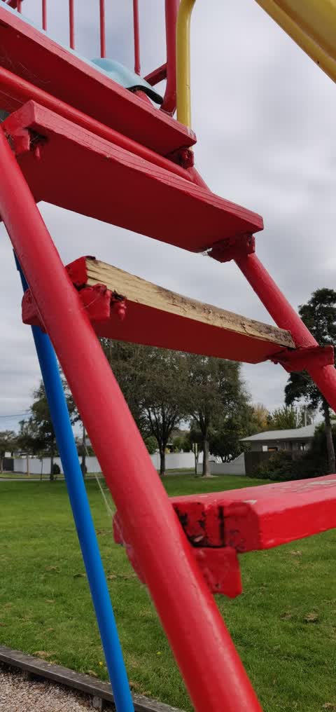
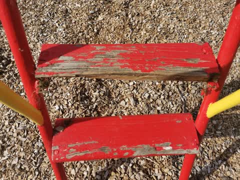
 Broken step on the big slide at Stretton Reserve playground
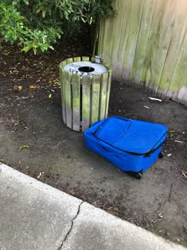 Rubbish/Recycling —
 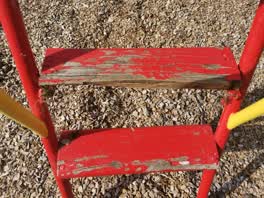 Parks —
 Broken step on slide
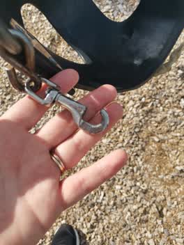 Parks —
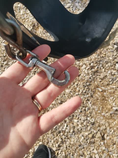
 Broken clasp on baby swing
Parks —
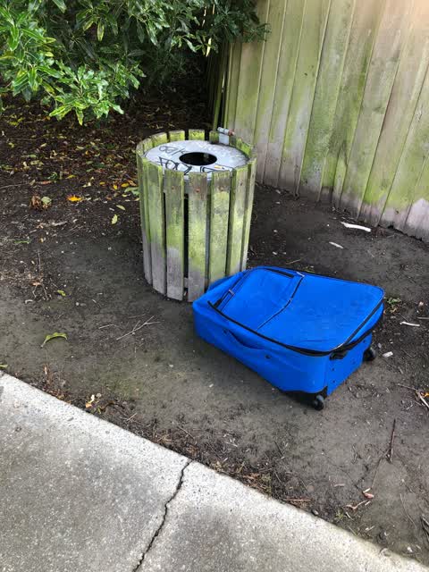
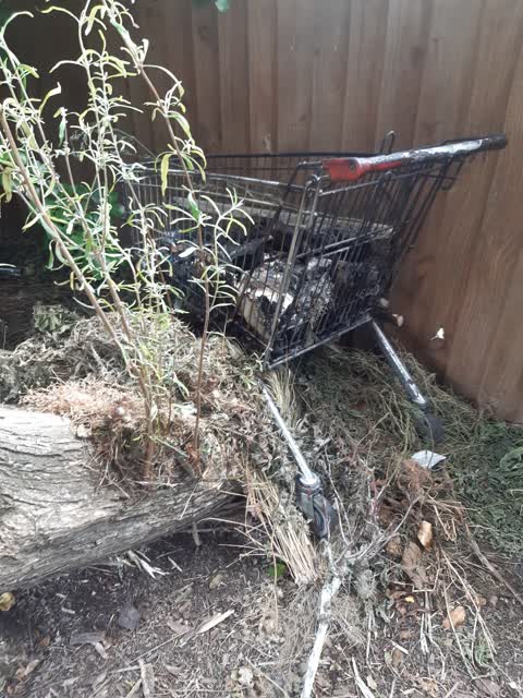
shopping cart dumped in the garden by the back fence on the left
Parks —
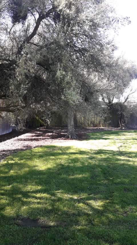
low hanging branches
Also reported on Stretton Street
- 9 Stretton Street — 4 reports
- 12 Stretton Street — 4 reports
- 10 Stretton Street — 2 reports
- 16 Stretton Street — 1 report
- 15 Stretton Street — 1 report
- 14 Stretton Street — 1 report
- 10A Stretton Street — 1 report
The green nearby
- Stretton Reserve — you are in it
- Tulett Park — 392 m to the edge · Sports ground · 8 ha
- Natalie Reserve — 409 m to the edge
- Highsted Reserve — 492 m to the edge
Parks within half a kilometre, measured to the boundary — the council’s open data.
On the doorstep
- Papanui Club — 362 m away · Clubs
- Embers Restaurant — 399 m away · Restaurants
Businesses within four hundred metres, measured at the pin — OpenStreetMap and the council directories.
The bus nearby
- Gardiners Road near Cullahill Street — 297 m away · route 27
- Sawyers Arms Rd near Cotswold Ave — 312 m away · route 27, route 107
The closest Metro stops, within four hundred and fifty metres.
Renting nearby
new bonds in Bishopdale ran about $599 a week — $49 above the city median of $550 — the suburb page keeps the rent record →.
The civic layer
This ground votes in Harewood ward — the Fendalton-Waimairi-Harewood community board. Ward lines don’t always follow suburb lines; this one is measured at the pin, not the suburb’s centre.
What stood on this ground → · On the map → · From the air — the Crown’s aerials back to 1936; search the address on RetroLens →
Questions, answered briefly
19 council reports on record since September 2019 — most often parks (5), overgrown vegetation (5), graffiti (3).
Bishopdale, Christchurch — on Stretton Street.
Nothing on the heritage register at this exact spot — the record around this ground →
Stretton Reserve — the address is inside it.