18 Guildford Street, Burnside
14 reports on record since April 2016 · 14 with photographs. The street’s heaviest record is 16 Guildford Street — 18 reports on file. Indicative rating valuation and school zones, hazards, bin day and what stood here before.
What gets reported here
- Roading/Streets — 3
- General Request — 3
- Pavement - General — 2
- Water Supply — 1
- Wastewater/Stormwater — 1
- Street Cleaning — 1
Photographed here 14 on record




Reported here
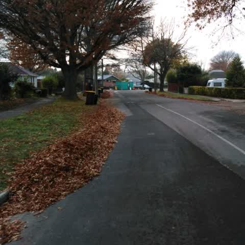
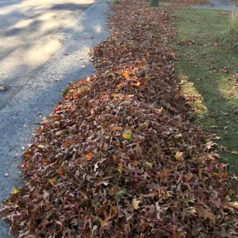
 Street Cleaning —
 Fallen leaves. Sweepers truck doesn’t allow me to pour out the leaves for him to sweep today. 11.45a.m. Sunday 3/5/26. I am confuse and unh
 Sewer General —
 Sewage not being done was others were done. Contractors didn’t come back mentioning is near the tree might affect the tree roots.. Toilet
 Pavement - General —
 Foot path yet to be concealed back after work done
 Pavement - General —
 A hole on the cover. See photo. Someone had put a stick.
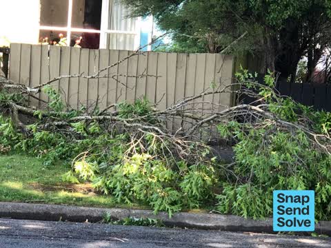
 Fallen Tree —
 Urgent attention appreciated. Fallen tree branches. Still have broken big branches up the tree. Might fall anytime onto the foot path and
 General Request —
 Students parking on the street Friday 9/5/25, our bins collection day.
 General Request —
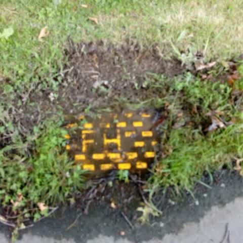
 After clearing the drain hole grating is still flooding. 9.03 a.m. Please take action. Water will be coming through the drainage pipe syst
 Flooding —
 Flooding
 General Request —
 Hi, would appreciate if you could send sweepers truck soonest to our area as it is raining and this area will be flooded.
Roading/Streets —
Thanks so much for sending out the City Care lady who raked leafs off the berms and footpath onto the road last Wednesday. Lots of neighbou
Wastewater/Stormwater —
Could you send the leaf collection truck, leafs are clogging up the drains etc in Guildford st with all the oaks
Water Supply —
Leaking fire hydrant
Roading/Streets —
Overhanging oak trees
Roading/Streets —
Leaves leaves leaves everywhere. Guildford street is lined with oaks, when are we scheduled to get the CCC leave-cleaning truck please?
Also reported on Guildford Street
- 16 Guildford Street — 18 reports
- 29 Guildford Street — 8 reports
- 9 Guildford Street — 6 reports
- 36 Guildford Street — 6 reports
- 7 Guildford Street — 4 reports
- 20 Guildford Street — 4 reports
- 15 Guildford Street — 4 reports
- 19 Guildford Street — 3 reports
The street’s crash record
NZTA’s record names Guildford Street in 14 crashes that hurt somebody since 2006 — 4 seriously hurt, nobody killed.
The green nearby
- Jellie Park — 218 m to the edge · Sports ground · 13 ha
- Flay Park — 280 m to the edge · Botanic · 1 ha
- Parkham Reserve — 413 m to the edge
- Grahams Road Berms — 427 m to the edge
- Derwent Reserve — 429 m to the edge
Parks within half a kilometre, measured to the boundary — the council’s open data.
On the doorstep
- Lower Courts — 205 m away · Sports centres
Businesses within four hundred metres, measured at the pin — OpenStreetMap and the council directories.
The bus nearby
- Guildford St near Wadhurst Pl — 82 m away · route 120
- Guildford St near Heath St — 99 m away · route 120
The closest Metro stops, within four hundred and fifty metres.
The tracks through here
- Walk and bike track through Burnside — 179 m to the line · walk · bike
- Walk and bike track through Burnside — 192 m to the line · walk · bike
- Walk and bike track through Burnside — 200 m to the line · walk · bike
- Walk and bike track through Burnside — 224 m to the line · walk · bike
- Walk and bike track through Burnside — 276 m to the line · walk · bike
Tracks whose line passes within half a kilometre, measured to the line itself — the council’s open data.
The named ground
Named water within 500 m of this address, measured to the line or the edge; the council’s own structure register — bridges, boardwalks and steps standing nearby — the open map’s record.
Renting nearby
new bonds in Burnside ran about $641 a week — $91 above the city median of $550 — the suburb page keeps the rent record →.
The civic layer
This ground votes in Fendalton ward — the Fendalton-Waimairi-Harewood community board. Ward lines don’t always follow suburb lines; this one is measured at the pin, not the suburb’s centre.
What stood on this ground → · On the map → · From the air — the Crown’s aerials back to 1936; search the address on RetroLens →
Questions, answered briefly
14 council reports on record since April 2016 — most often roading/streets (3), general request (3), pavement - general (2).
Burnside, Christchurch — on Guildford Street.
Nothing on the heritage register at this exact spot — the record around this ground →
Jellie Park — 218 m to its edge, 13 ha.