1 Bengal Drive, Cashmere
11 reports on record since September 2021 · 9 with photographs. The most-reported address on Bengal Drive. Indicative rating valuation and school zones, hazards, bin day and what stood here before.
What gets reported here
Photographed here 9 on record


Reported here
 Street Gutters / Storm Water —
 Grate fallen into drain, beside the driveway to down behind PMH. Significant hazard for cyclists and young children.
 Abandoned Vehicle —
 Honda car looks abandoned corner Bengal Drive and Cashmere Rd. Photo attached. Car has been there a month and car jam advises it is structu
 Graffiti on a fence, building or structure —
 cell phone tower grafitti
 Pothole —
 Several pit homes in driveway to hospital.
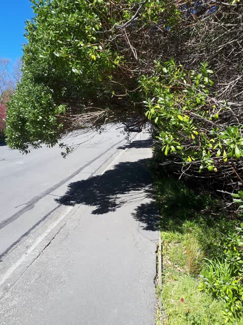
 Overgrown Vegetation —
 Overhanging tree branches blocking footpath, pushing pedestrians on to busy road
 Graffiti on a sign, mural or public art —
  General Request —
  Graffiti —
 - Fallen Tree —
- Overgrown Vegetation —
 Roading/Streets —
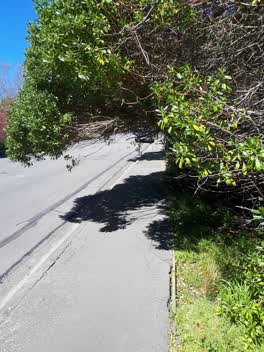
 Overhanging tree
Also reported on Bengal Drive
- 2 Bengal Drive — 8 reports
- 20 Bengal Drive — 5 reports
- 50 Bengal Drive — 3 reports
- 6 Bengal Drive — 2 reports
- 41 Bengal Drive — 2 reports
- 37 Bengal Drive — 2 reports
- 22 Bengal Drive — 2 reports
- 66 Bengal Drive — 1 report
The street’s crash record
NZTA’s record names Bengal Drive in 2 crashes that hurt somebody since 2006 — 0 seriously hurt, nobody killed.
The green nearby
- Ashgrove Reserve — 110 m to the edge
- Worsleys Reserve — 330 m to the edge
- Bengal Reserve — 379 m to the edge
- Cracroft Caverns Reserve — 413 m to the edge · Regional
- Cashmere Riverbank Reserve — 417 m to the edge · 1 ha
Parks within half a kilometre, measured to the boundary — the council’s open data.
On the doorstep
- Courtyard Cafe — 166 m away · Cafés
- Princess Margaret Hospital — 191 m away · Hospital
- Poca Poca — 372 m away · Cafés
- Shalamar Florist — 379 m away · Florists
Businesses within four hundred metres, measured at the pin — OpenStreetMap and the council directories.
The bus nearby
- Cashmere Rd near Ferniehurst St — 57 m away · the Orbiter (clockwise)
- Cashmere Rd near Ferniehurst St — 61 m away · the Orbiter (anticlockwise)
The closest Metro stops, within four hundred and fifty metres.
The tracks through here
- Walk and bike track through Cashmere — 17 m to the line · walk · bike
- Walk and bike track through Cashmere — 30 m to the line · walk · bike
- Walk and bike track through Cashmere — 73 m to the line · walk · bike
- Walk and bike track through Cashmere — 445 m to the line · walk · bike
- Walk and bike track through Cashmere — 446 m to the line · walk · bike
Tracks whose line passes within half a kilometre, measured to the line itself — the council’s open data.
The named ground
Named water within 500 m of this address, measured to the line or the edge; the council’s own structure register — bridges, boardwalks and steps standing nearby — the open map’s record.
The remembered names nearby
- Welcome to Ashgrove Reserve If You’D Have a Mind at Peace — 123 m away ·
WELCOME TO ASHGROVE RESERVE IF YOU’D HAVE A MIND AT PEACE A HEART THAT CANNOT HARDEN GO FI
· 2025
Inscribed plaques within two hundred and fifty metres — the register’s pins, not surveyed spots. The whole roll is at /plaques.
Renting nearby
new bonds in Cashmere ran about $707 a week — $157 above the city median of $550 — the suburb page keeps the rent record →.
The civic layer
This ground votes in Cashmere ward — the Spreydon-Cashmere-Heathcote community board. Ward lines don’t always follow suburb lines; this one is measured at the pin, not the suburb’s centre.
What stood on this ground → · On the map → · From the air — the Crown’s aerials back to 1936; search the address on RetroLens →
Questions, answered briefly
11 council reports on record since September 2021 — most often overgrown vegetation (2), street gutters / storm water (1), roading/streets (1).
Cashmere, Christchurch — on Bengal Drive.
Nothing on the heritage register at this exact spot — the record around this ground →
Ashgrove Reserve — 110 m to its edge.