42 Clifton Terrace, Clifton
15 reports on record since July 2020 · 13 with photographs. The street’s heaviest record is 40 Clifton Terrace — 41 reports on file. Indicative rating valuation and school zones, hazards, bin day and what stood here before.
What gets reported here
Photographed here 13 on record


Reported here
 Graffiti on a road, footpath or bridge —
  Graffiti on a road, footpath or bridge —
  Graffiti on a road, footpath or bridge —
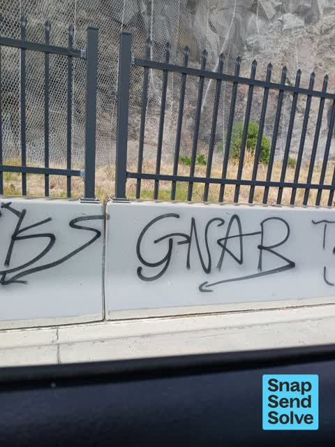
 Graffiti all along concrete roadside. This has been reported repeatedly and as nothing is being done the graffiti is spreading. Please sort
 Graffiti somewhere else —
 Horrible tags!!
 Graffiti on a road, footpath or bridge —
 Graffiti on shared walkway and cyckeway between Sumner beach and Monks Bay close to Surf club
 Graffiti on a road, footpath or bridge —
 Lots of graffiti on roadside barrier
 Graffiti on a road, footpath or bridge —
 Graffiti on roadside barrier Clifton
 Graffiti on a road, footpath or bridge —
 On roadside barrier
 Water Pollution - Sediment —
 Sediment pouring off a building site on the first sharp bend of Clifton tce at the weekend - couldn't stop to take photos as was unsafe but
 Damaged Road —
 Two slumps/dips in road on Main Rd Monks Bay, between Shag Rock and Sumner cliff side, heading towards Redcliffs from Sumner. See photo of m
 Facility - General Request —
 Fennel growing in red zone land by Main Road Clifton. This is very invasive and is starting to invade Clifton Beach across the rad. Please c
- Overgrown Vegetation —
- Damaged Street Light —
 Roading/Streets —
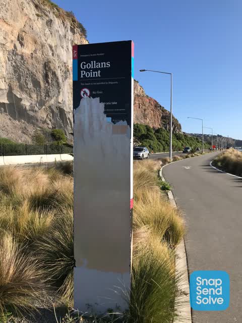
 Sign on coastal walkway appears vandalised
 Parks —
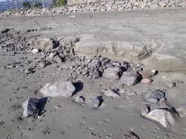
 Excessive rock debris on SumnerBeach from Coastal Pathway construction. NEVER seen it like this before in 30 years we have lived here.
Also reported on Clifton Terrace
- 40 Clifton Terrace — 41 reports
- 134 Clifton Terrace — 18 reports
- 1 Clifton Terrace — 10 reports
- 80 Clifton Terrace — 8 reports
- 79 Clifton Terrace — 8 reports
- 38 Clifton Terrace — 8 reports
- 33 Clifton Terrace — 8 reports
- 110 Clifton Terrace — 8 reports
The street’s crash record
NZTA’s record names Clifton Terrace in 6 crashes that hurt somebody since 2006 — 2 seriously hurt, nobody killed.
The green nearby
- Shag Rock Reserve — 11 m to the edge
- Sumner Beach — 14 m to the edge · Regional · 8 ha
- Sumner Coronation Garden — 163 m to the edge
- Shag Rock — 274 m to the edge · Regional
- Spit Reserve — 453 m to the edge · Regional · 27 ha
Parks within half a kilometre, measured to the boundary — the council’s open data.
On the doorstep
- Sumner Surf Life Saving Club — 159 m away · Clubs
- Sumner Coronation Garden — 204 m away · Attractions
- Casamassima Italian Fare — 349 m away · Bottle stores
Businesses within four hundred metres, measured at the pin — OpenStreetMap and the council directories.
The bus nearby
The closest Metro stops, within four hundred and fifty metres.
The tracks through here
- Walk and bike track through Clifton — 1 m to the line · walk · bike
Tracks whose line passes within half a kilometre, measured to the line itself — the council’s open data.
The named ground
Named places within 1.5 km of this address; the council’s own structure register — bridges, boardwalks and steps standing nearby — the open map’s record.
The remembered names nearby
- This Plaque Placed by the Sumner-Redcliffs Historical — 130 m away ·
This plaque placed by the Sumner-Redcliffs Historical Society in memory of Sir Terence McC
· 2009 - These Three Stone Lampstandards Were Built in 1939 — 234 m away ·
THESE THREE STONE LAMPSTANDARDS WERE BUILT IN 1939 BY THE SUMNER BOROUGH COUNCIL... RENEWE
· 2009
Inscribed plaques within two hundred and fifty metres — the register’s pins, not surveyed spots. The whole roll is at /plaques.
Renting nearby
new bonds in Clifton ran about $820 a week — $270 above the city median of $550 — the suburb page keeps the rent record →.
The civic layer
This ground votes in Heathcote ward — the Spreydon-Cashmere-Heathcote community board. Ward lines don’t always follow suburb lines; this one is measured at the pin, not the suburb’s centre.
What stood on this ground → · On the map → · From the air — the Crown’s aerials back to 1936; search the address on RetroLens →
Questions, answered briefly
15 council reports on record since July 2020 — most often graffiti on a road, footpath or bridge (7), water pollution - sediment (1), roading/streets (1).
Clifton, Christchurch — on Clifton Terrace.
Nothing on the heritage register at this exact spot — the record around this ground →
Shag Rock Reserve — 11 m to its edge.