19 Dickeys Road, Coutts Island
14 reports on record since August 2015 · 9 with photographs. The street’s heaviest record is 17 Dickeys Road — 38 reports on file. Indicative rating valuation and school zones, hazards, bin day and what stood here before.
What gets reported here
- Dumped Rubbish — 8
- Rubbish/Recycling — 2
- Road Signage — 2
- Graffiti — 2
Photographed here 9 on record


Reported here
 Road Signage —
 Just some confusion on actual road speed limit change. GPS maps etc indicate a change from 60 to 100 however if this is the case the change
 Dumped Rubbish —
 dumped concrete
 Dumped Rubbish —
 Rubbish has been dumped on the side of the road between midnight and 2:50am
 Dumped Rubbish —
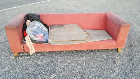
 Dumped rubbish
 Dumped Rubbish —
 Dumped rubbish, carpet and glass
 Road Signage —
 60kph sign dropped on South side of the road
- Dumped Rubbish —
- Dumped Rubbish —
- Dumped Rubbish —
- Dumped Rubbish —
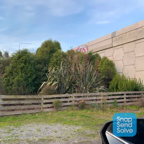
- Graffiti —
 Graffiti —
 Rubbish/Recycling —
Rubbish/Recycling —
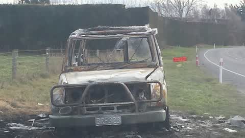
Burnt out vehicle
Also reported on Dickeys Road
- 17 Dickeys Road — 38 reports
- 19F Dickeys Road — 7 reports
- 101 Dickeys Road — 6 reports
- 95 Dickeys Road — 5 reports
- 159 Dickeys Road — 4 reports
- 91A Dickeys Road — 3 reports
- 12 Dickeys Road — 2 reports
- 97 Dickeys Road — 1 report
The street’s crash record
NZTA’s record names Dickeys Road in 2 crashes that hurt somebody since 2006 — 1 seriously hurt, nobody killed.
The green nearby
- Darroch Reserve — 357 m to the edge · 4 ha
- Dickeys Reserve — 395 m to the edge · 11 ha
Parks within half a kilometre, measured to the boundary — the council’s open data.
On the doorstep
- Stonehurst Sawmill — 298 m away · Sawmill
Businesses within four hundred metres, measured at the pin — OpenStreetMap and the council directories.
The named ground
Named water within 500 m of this address, measured to the line or the edge — the open map’s record.
The civic layer
This ground votes in Harewood ward — the Fendalton-Waimairi-Harewood community board. Ward lines don’t always follow suburb lines; this one is measured at the pin, not the suburb’s centre.
What stood on this ground → · On the map → · From the air — the Crown’s aerials back to 1936; search the address on RetroLens →
Questions, answered briefly
14 council reports on record since August 2015 — most often dumped rubbish (8), rubbish/recycling (2), road signage (2).
Coutts Island, Christchurch — on Dickeys Road.
Nothing on the heritage register at this exact spot — the record around this ground →
Darroch Reserve — 357 m to its edge, 4 ha.