210 Coutts Island Road
7 council reports since February 2024, 7 carrying a photograph. The street’s heaviest record is 295F Coutts Island Road, 10 reports on file.
From the air, then
Sourced from Canterbury Maps and partners. LINZ, CC BY 3.0 NZ. Each frame is cut from Environment Canterbury’s historic imagery MapServer for that decade, only where the Footprints layer names a CC BY survey (NZAM-covered spots stay out). RetroLens holds more Crown aerials →
The green nearby
- Waimakariri River Regional Park, 177 m to the edge · Regional · 32 ha
- Dickeys Reserve, 346 m to the edge · 11 ha
Parks within half a kilometre, measured to the boundary, the council’s open data. The whole roll is at /parks.
On the doorstep
- Waimak River Horse Treks, 176 m away · Attractions
Businesses within four hundred metres, measured at the pin, OpenStreetMap and the council directories.
The named ground
Named water within 500 m of this address, measured to the line or the edge, the open map’s record.
What gets reported here
- Damaged Road, 4
- Pothole, 1
- Flooding, 1
- Dumped Rubbish, 1
Photographed here 7 on record





What’s on record
 Damaged Road, 21 Apr 2026
Would it be possible to have some gravel put down on the verge of the road? i know this is not a long term solution but might help the curre
 Damaged Road, 3 Mar 2026
Extreme road damage due to heavy vehicles drawing shingle from. the Waimak Regional Park. Road not suitable, can't fit 2 trucks going opposi
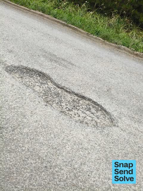
 Pothole, 24 Feb 2026
There are two large potholes which need filling.
 Damaged Road, 31 Oct 2025
Pothole in middle of the road.
 Damaged Road, 20 Aug 2025
Need a drain along the side of the road as the water is ruining the road and makes it dangerous as people drive on the wrong side of the roa
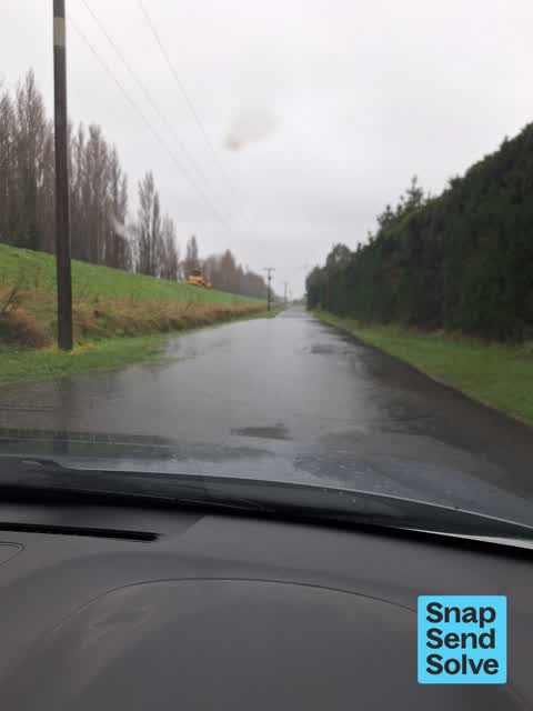
 Flooding, 1 May 2025
This part of coutts island rd floods regularly I think it need a culvert
 Dumped Rubbish, 9 Feb 2024
Elsewhere on Coutts Island Road
- 295F Coutts Island Road, 10 reports
- 219 Coutts Island Road, 9 reports
- 220 Coutts Island Road, 8 reports
- 245F Coutts Island Road, 7 reports
- 211 Coutts Island Road, 7 reports
- 207 Coutts Island Road, 7 reports
- 71 Coutts Island Road, 6 reports
- 162 Coutts Island Road, 6 reports
The street’s crash record
NZTA’s record names Coutts Island Road in 3 crashes that hurt somebody since 2006, 2 seriously hurt, nobody killed.
The civic layer
This ground votes in Harewood ward, the Fendalton-Waimairi-Harewood community board is its local layer. Ward lines don’t always follow suburb lines; this one is measured at the pin, not the suburb’s centre. The whole roll is at /wards.
Coutts Island Road, the whole record → · Everything about Coutts Island → · What stood on this ground → · On the map → · From the air, RetroLens holds the Crown’s aerials back to 1936; search the address there →
Questions, answered briefly
7 council reports on record since February 2024, most often damaged road (4), pothole (1), flooding (1).
Coutts Island, Christchurch, on Coutts Island Road.
Nothing on the heritage register at this exact spot, the record around this ground →
Waimakariri River Regional Park, 177 m to its edge, 32 ha.