6 Halberg Street, Dallington
12 reports on record since October 2020 · 10 with photographs. The street’s heaviest record is 56 Halberg Street — 16 reports on file. Indicative rating valuation and school zones, hazards, bin day and what stood here before.
What gets reported here
- Hazard — vehicle — 4
- Dumped Rubbish — 3
- General Request — 2
- Pavement - General — 1
- Facility - General Request — 1
- Abandoned Vehicle — 1
Photographed here 10 on record


Reported here
 Hazard — vehicle —
 Registration FT122 , camper parked wrong way with people living in it been there for months. Frequently let there two dogs out to roam the p
 Hazard — vehicle —
 illegally parked bus that has been there since 25th January, now are using a fire on board and illegally dumping rubbish, no registration or
 Hazard — vehicle —
 Bus is illegally freedom camping and dumping waste water into street. See image of makeshift pipe coming out from bus. This bus has been the
 Hazard — vehicle —
 Illegal freedom camping, has pipe from waste water draining from pipe from bus onto street
 Abandoned Vehicle —
 unregistered bus that people are living in, has water and power going across the footpath
 Dumped Rubbish —
 No body around dumbed white baits dumped
 Pavement - General —
 Broken glass
 Dumped Rubbish —
 Number 4 Halberg has cut trees in order to relocate the container ship on their property and dumped the cut branches on red zone next door.
 General Request —
 This fence is over the height limit set by council. Please review if permit was sought
- General Request —
- Dumped Rubbish —
Facility - General Request —
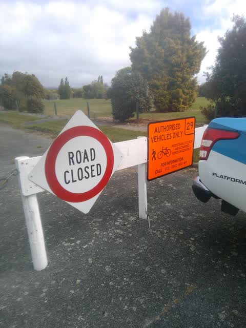
A nearby resident mentioned that vehicles have been able to sneak under the wire barrier here by lifting it up. I have removed the slack fro
Also reported on Halberg Street
- 56 Halberg Street — 16 reports
- 57 Halberg Street — 12 reports
- 4 Halberg Street — 10 reports
- 9 Halberg Street — 7 reports
- 54 Halberg Street — 6 reports
- 53 Halberg Street — 6 reports
- 3 Halberg Street — 6 reports
- 60 Halberg Street — 5 reports
The street’s crash record
NZTA’s record names Halberg Street in 2 crashes that hurt somebody since 2006 — 1 seriously hurt, nobody killed.
The green nearby
- Halberg Reserve — 16 m to the edge
- Avon Riverbank True Left — 145 m to the edge · 6 ha
- Porritt Park — 211 m to the edge · Sports ground · 11 ha
- Moyna Playground — 325 m to the edge
- Avon Park — 390 m to the edge · Sports ground · 6 ha
Parks within half a kilometre, measured to the boundary — the council’s open data.
The tracks through here
- Walk and bike track through Dallington — 140 m to the line · walk · bike
- Walk and bike track through Dallington — 199 m to the line · walk · bike
- Walk and bike track through Dallington — 271 m to the line · walk · bike
- Walk and bike track through Dallington — 383 m to the line · walk · bike
Tracks whose line passes within half a kilometre, measured to the line itself — the council’s open data.
The named ground
Named water within 500 m of this address, measured to the line or the edge; the council’s own structure register — bridges, boardwalks and steps standing nearby — the open map’s record.
Renting nearby
new bonds in Dallington ran about $520 a week — $30 below the city median of $550 — the suburb page keeps the rent record →.
The civic layer
This ground votes in Burwood ward — the Coastal-Burwood-Linwood community board. Ward lines don’t always follow suburb lines; this one is measured at the pin, not the suburb’s centre.
What stood on this ground → · On the map → · From the air — the Crown’s aerials back to 1936; search the address on RetroLens →
Questions, answered briefly
12 council reports on record since October 2020 — most often hazard — vehicle (4), dumped rubbish (3), general request (2).
Dallington, Christchurch — on Halberg Street.
Nothing on the heritage register at this exact spot — the record around this ground →
Halberg Reserve — 16 m to its edge.