1 Cedar Lane
1 council report since March 2019, 1 carrying a photograph. The most-reported address on Cedar Lane.
The green nearby
- Duvauchelle Reserve And Campground, 7 m to the edge · Sports ground · 3 ha · playground, 41 pieces
- Duvauchelle Domain Esplanade Strip, 221 m to the edge
- Duvauchelle Reserve, 380 m to the edge · playground, 41 pieces
Parks within half a kilometre, measured to the boundary, the council’s open data. The whole roll is at /parks.
On the doorstep
- Duvauchelle Holiday Park, 126 m away · Campgrounds
- Boat houses, 300 m away · Attractions
Businesses within four hundred metres, measured at the pin, OpenStreetMap and the council directories.
The named ground
Named water within 500 m of this address, measured to the line or the edge; the council’s own structure register, bridges, boardwalks and steps standing nearby, the open map’s record.
What gets reported here
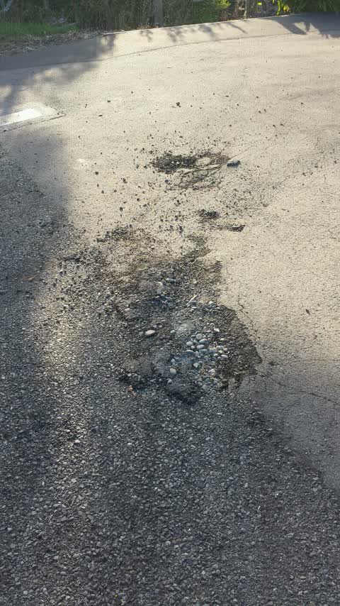
Photographed here 1 on record
What’s on record
Roading/Streets, 18 Mar 2019
Damage done to Cedar Lane when water delivered by truck to CCC run Duvauchelle Holiday Park
Elsewhere on Cedar Lane
- 7 Cedar Lane, 1 report
- 3 Cedar Lane, 1 report
The civic layer
This ground votes in Banks Peninsula ward, the Banks Peninsula community board is its local layer. Ward lines don’t always follow suburb lines; this one is measured at the pin, not the suburb’s centre. The whole roll is at /wards.
Cedar Lane, the whole record → · Everything about Duvauchelle → · What stood on this ground → · On the map → · From the air, RetroLens holds the Crown’s aerials back to 1936; search the address there →
Questions, answered briefly
1 council report on record since March 2019, most often roading/streets (1).
Duvauchelle, Christchurch, on Cedar Lane.
Nothing on the heritage register at this exact spot, the record around this ground →
Duvauchelle Reserve And Campground, 7 m to its edge, 3 ha.