5849 Christchurch-Akaroa Road
3 council reports since March 2020, 2 carrying a photograph. The street’s heaviest record is 5800 Christchurch Akaroa Road, 6 reports on file.
The green nearby
- Barrys Bay Streamside, 333 m to the edge
Parks within half a kilometre, measured to the boundary, the council’s open data. The whole roll is at /parks.
On the doorstep
- Half Moon Cottage, 53 m away · Hostels
- Barrys Bay Traditional Cheese, 359 m away · Delis
Businesses within four hundred metres, measured at the pin, OpenStreetMap and the council directories.
The named ground
Named water within 500 m of this address, measured to the line or the edge; Named places within 1.5 km of this address, the open map’s record.
What gets reported here
- Water Supply, 1
- Pavement - General, 1
- General Request, 1
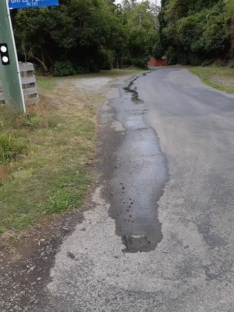
Photographed here 2 on record

What’s on record
- General Request, 15 Sept 2025
A motor cycle using this highway as race circuit. Passing 5x in short time
 Pavement - General, 22 Dec 2024
Broken glass on state highway verge. Makes it dangerous when trying to navigate with Eg a dog. Have to either walk over broken glass or on t
Water Supply, 16 Mar 2020
water toby leaking at bottom of Stoney Bay Rd
Elsewhere on Christchurch-Akaroa Road
- 5800 Christchurch Akaroa Road, 6 reports
- 6065 Christchurch Akaroa Road, 4 reports
- 6267 Christchurch Akaroa Road, 3 reports
- 5894 Christchurch Akaroa Road, 3 reports
- 6135 Christchurch Akaroa Road, 2 reports
- 6093–6143 Christchurch-Akaroa Road, 2 reports
- 6075 Christchurch Akaroa Road, 2 reports
- 6063 Christchurch Akaroa Road, 2 reports
The street’s crash record
NZTA’s record names Christchurch-Akaroa Road in 14 crashes that hurt somebody since 2006, 3 seriously hurt, nobody killed.
The civic layer
This ground votes in Banks Peninsula ward, the Banks Peninsula community board is its local layer. Ward lines don’t always follow suburb lines; this one is measured at the pin, not the suburb’s centre. The whole roll is at /wards.
Christchurch-Akaroa Road, the whole record → · Everything about Duvauchelle → · What stood on this ground → · On the map → · From the air, RetroLens holds the Crown’s aerials back to 1936; search the address there →
Questions, answered briefly
3 council reports on record since March 2020, most often water supply (1), pavement - general (1), general request (1).
Duvauchelle, Christchurch, on Christchurch-Akaroa Road.
Nothing on the heritage register at this exact spot, the record around this ground →
Barrys Bay Streamside, 333 m to its edge.