6 Kanuka Place
7 council reports since April 2022, 3 carrying a photograph.
The green nearby
- Robinsons Bay Regional Park, 158 m to the edge
- Bayview Reserve, 245 m to the edge
- Duvauchelle Reserve, 297 m to the edge · playground, 41 pieces
- Currie & Gutry Park, 405 m to the edge
Parks within half a kilometre, measured to the boundary, the council’s open data. The whole roll is at /parks.
The civic shelf nearby
- Duvauchelle Cemetery, 268 m away · Cemetery
Libraries, halls and the rest within half a kilometre, the council’s open data.
The named ground
Named places within 1.5 km of this address, the open map’s record.
What gets reported here
Photographed here 3 on record


What’s on record
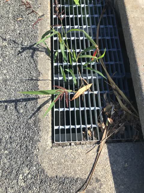
- Street Cleaning, 3 Feb 2025
2x Gutters in Monarch Drive need cleaning. Weed spraying needs to be done along footpath Monach Drive. No 11.
 Pavement - Damaged, 21 Feb 2024
 Hole in footpath Monach Drive Robinsons Bay.
 Damaged Street Light, 27 Dec 2023
 shade missing from light Monach Drive.
- Abandoned Vehicle, 7 Nov 2023
- Abandoned Vehicle, 29 Sept 2023
- Street Cleaning, 17 Jul 2023
 Roading/Streets, 3 Apr 2022
 All the footpaths in the Ngaio Point Subdivision need spraying. The garden is a mess. It was supposed to be replenished after the fibre inst
The civic layer
This ground votes in Banks Peninsula ward, the Banks Peninsula community board is its local layer. Ward lines don’t always follow suburb lines; this one is measured at the pin, not the suburb’s centre. The whole roll is at /wards.
Kanuka Place, the whole record → · Everything about Duvauchelle → · What stood on this ground → · On the map → · From the air, RetroLens holds the Crown’s aerials back to 1936; search the address there →
Questions, answered briefly
7 council reports on record since April 2022, most often street cleaning (2), abandoned vehicle (2), roading/streets (1).
Duvauchelle, Christchurch, on Kanuka Place.
Nothing on the heritage register at this exact spot, the record around this ground →
Robinsons Bay Regional Park, 158 m to its edge.