17 Daresbury Lane, Fendalton
18 reports on record since May 2021 · 11 with photographs. The most-reported address on Daresbury Lane. Indicative rating valuation and school zones, hazards, bin day and what stood here before.
What gets reported here
Photographed here 11 on record


Reported here
 Damaged Street Light —
 This lamppost was installed in the couple of months and it’s now on a significant lean. You can see that its hole is a lot bigger than it i
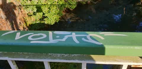
 Graffiti on a road, footpath or bridge —
 on bridge alongside railway line behind Mona Vale
 Trees - General —
 Low tree branches dangling in cycle walkway. please have tree branches trimmed back.
 Pavement - Damaged —
 large and growing bump in the road. I saw a Scooter rider crash heavily because of this bump, he said he hated this bump too. please grind d
 Rubbish and Bins - General —
  Abandoned Vehicle —
 Abandoned scooter...? Stolen, stripped. Sitting on bike lane between Mona Vale and Daresbury Lane
 Fallen Tree —
 On the 'Northern' cycle lane, large fallen branch partially blocking the lane.
- Pavement - Damaged —
- Water Leak —
- Pavement - Damaged —
- Graffiti —
- Graffiti —
- Graffiti —
- Graffiti —
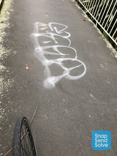
 Graffiti —
 On the Fence line between Daresbury Lane and Fendalton Rd. On the Cycleway footpath.
 Graffiti —
 Cluster of tags between Fendalton Rd and Daresbury Lane on the cycleway/ footpath
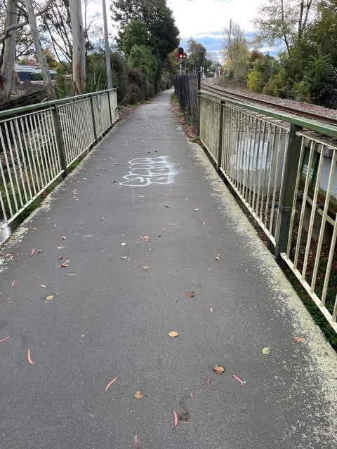
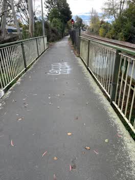 Graffiti —
 On pavement, along cycle walkway by railway line.
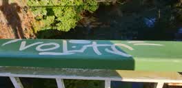 Graffiti —
 beside railway, on walkway
Also reported on Daresbury Lane
- 15 Daresbury Lane — 14 reports
- 19 Daresbury Lane — 9 reports
- 22 Daresbury Lane — 8 reports
- 18 Daresbury Lane — 7 reports
- 20 Daresbury Lane — 6 reports
- 18A Daresbury Lane — 2 reports
- 7 Daresbury Lane — 1 report
- 16A Daresbury Lane — 1 report
The street’s crash record
NZTA’s record names Daresbury Lane in 1 crash that hurt somebody since 2006 — 0 seriously hurt, nobody killed.
The green nearby
- Mona Vale — 8 m to the edge · Botanic · 5 ha
- Daresbury Park — 170 m to the edge
- Clifford Reserve — 191 m to the edge
- Avon River Esplanade Reserve — 389 m to the edge
Parks within half a kilometre, measured to the boundary — the council’s open data.
On the doorstep
- Mona Vale Homestead and Pantry — 222 m away · Cafés
- Mona Vale Homestead & Gardens Venue — 273 m away · Cafés
- Mona Vale Homestead — 318 m away · Restaurants
- Britten Stables — 383 m away · B&Bs
Businesses within four hundred metres, measured at the pin — OpenStreetMap and the council directories.
The bus nearby
- Fendalton Rd near Wairarapa Tce — 163 m away · route 29
- Fendalton Rd near Mona Vale Ave — 188 m away · route 29
The closest Metro stops, within four hundred and fifty metres.
The tracks through here
- Walk and bike track through Fendalton — 28 m to the line · walk · bike
- Walk and bike track through Fendalton — 53 m to the line · walk · bike
- Walk and bike track through Fendalton — 172 m to the line · walk · bike
- Walk and bike track through Fendalton — 195 m to the line · walk · bike
- Walk and bike track through Fendalton — 225 m to the line · walk · bike
Tracks whose line passes within half a kilometre, measured to the line itself — the council’s open data.
The named ground
Named water within 500 m of this address, measured to the line or the edge; Named places within 1.5 km of this address; the council’s own structure register — bridges, boardwalks and steps standing nearby — the open map’s record.
The remembered names nearby
- The Macleod Garden / in Memory of / Alastair John Macleod — 36 m away ·
THE MACLEOD GARDEN / IN MEMORY OF / ALASTAIR JOHN MACLEOD / M. Hort Sc (Hons) / 1959 - 198
· 2009 - The Doreen Holland / Seat for Dreaming — 36 m away ·
THE DOREEN HOLLAND / SEAT FOR DREAMING
· 2009 - Armillary Sphere — 37 m away ·
ARMILLARY SPHERE / The metal rings represent the Equator, Tropics, Arctic and Antarctic Ci
· 2009
Inscribed plaques within two hundred and fifty metres — the register’s pins, not surveyed spots. The whole roll is at /plaques.
Renting nearby
new bonds in Fendalton ran about $618 a week — $68 above the city median of $550 — the suburb page keeps the rent record →.
What was here — Mona Vale Gatehouse and Setting
145 m away · 65 Fendalton Road · located to ±12 m · the place’s own record →
On the register. Nothing researched here yet.
What was here — Mona Vale Grounds
on this spot · located to ±293 m · the place’s own record →
On the register. Nothing researched here yet.
What was here — Former Dwelling and Setting, Mona Vale
225 m away · 63 Fendalton Road · located to ±26 m · the place’s own record →
On the register. Nothing researched here yet.
What was here — Mona Vale Bath House and Setting
241 m away · located to ±10 m · the place’s own record →
On the register. Nothing researched here yet.
The civic layer
This ground votes in Fendalton ward — the Fendalton-Waimairi-Harewood community board. Ward lines don’t always follow suburb lines; this one is measured at the pin, not the suburb’s centre.
What stood on this ground → · On the map → · From the air — the Crown’s aerials back to 1936; search the address on RetroLens →
Questions, answered briefly
18 council reports on record since May 2021 — most often graffiti (8), pavement - damaged (3), water leak (1).
Fendalton, Christchurch — on Daresbury Lane.
The heritage register names 4 places at or beside it — Mona Vale Gatehouse and Setting, Mona Vale Grounds.
Mona Vale — 8 m to its edge, 5 ha.