1 Ernest Adams Drive
5 council reports since January 2018, 5 carrying a photograph. The most-reported address on Ernest Adams Drive.
On the register here
- Former Governors Bay School Master's House and Setting, 112 Main Road (124m)
- Former Governors Bay School and Setting, 112 Main Road (147m)
From the air, then
Sourced from Canterbury Maps and partners. LINZ, CC BY 3.0 NZ. Each frame is cut from Environment Canterbury’s historic imagery MapServer for that decade, only where the Footprints layer names a CC BY survey (NZAM-covered spots stay out). RetroLens holds more Crown aerials →
The green nearby
- Cholmondeley Reserve, you are in it · 1 ha
- Governors Bay Community Centre And Pool, 408 m to the edge · playground, 13 pieces
- Governors Bay Scenic Reserve, 439 m to the edge
Parks within half a kilometre, measured to the boundary, the council’s open data. The whole roll is at /parks.
The civic shelf nearby
- Governors Bay Recycling Depot, 7 m away · Transfer station
Libraries, halls and the rest within half a kilometre, the council’s open data.
On the doorstep
- Over The Hill, 377 m away · Cafés
- Harbour House, 380 m away · Cafés
- Ōtoromiro Hotel, 383 m away · Restaurants
Businesses within four hundred metres, measured at the pin, OpenStreetMap and the council directories.
The named ground
Named places within 1.5 km of this address; the council’s own structure register, bridges, boardwalks and steps standing nearby, the open map’s record.
The remembered names nearby
- International Year of the Volunteer 2001, 62 m away ·
INTERNATIONAL YEAR OF THE VOLUNTEER 2001
· 2008 - Pat Parkinson on the Occasion of Opening the Restored Old, 139 m away ·
PAT PARKINSON ON THE OCCASION OF OPENING THE RESTORED OLD SCHOOL BUILDING NOVEMBER 1998
· 2008 - The Parkinson Memorial Park Trust Assisted in This, 144 m away ·
THE PARKINSON MEMORIAL PARK TRUST ASSISTED IN THIS BUILDINGS RESTORATION
· 2008
Inscribed plaques within two hundred and fifty metres, the register’s pins, not surveyed spots. The whole roll is at /plaques.
What gets reported here
Photographed here 5 on record


What’s on record
 Public Toilet, 10 Aug 2026
 Guttering blocked toilet building Cholmondeley reserve, Governors Bay - weeds growing in it.
 Trees - General, 2 Dec 2025
 Tree branch has broken in park and one hanging in tree still to fall. Need attention as in park where kids could be playing .
 Abandoned Vehicle, 31 Aug 2024
 This abandoned car was moved from Bay Heights down the road onto Earnest Adams Dr in front of the fire station. This car has no current WOF
 Parks, 4 Dec 2021
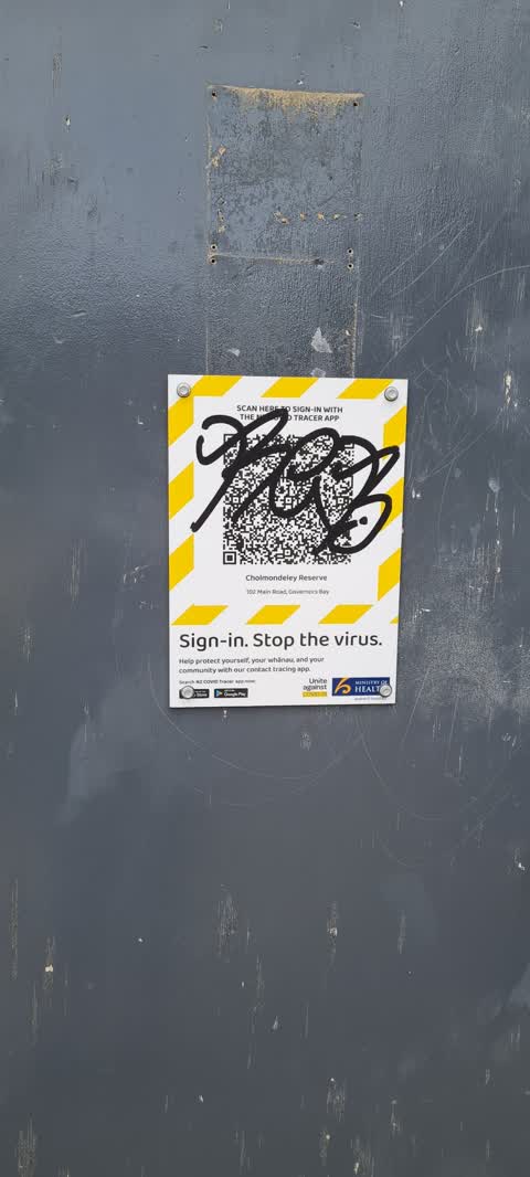
 COVID-19 scanner tagged
Parks, 5 Jan 2018
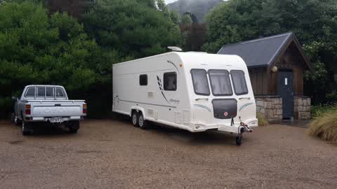
Unsure if it is a problem or not. Caravan parked up in reserve car park on Ernst Adams Dr.
Elsewhere on Ernest Adams Drive
- 8 Ernest Adams Drive, 5 reports
- 7 Ernest Adams Drive, 1 report
- 2 Ernest Adams Drive, 1 report
- 10 Ernest Adams Drive, 1 report
The street’s crash record
NZTA’s record names Ernest Adams Drive in 1 crash that hurt somebody since 2006, 1 seriously hurt, nobody killed.
The civic layer
This ground votes in Banks Peninsula ward, the Banks Peninsula community board is its local layer. Ward lines don’t always follow suburb lines; this one is measured at the pin, not the suburb’s centre. The whole roll is at /wards.
Ernest Adams Drive, the whole record → · Everything about Governors Bay → · What stood on this ground → · On the map → · From the air, RetroLens holds the Crown’s aerials back to 1936; search the address there →
Questions, answered briefly
5 council reports on record since January 2018, most often parks (2), trees - general (1), public toilet (1).
Governors Bay, Christchurch, on Ernest Adams Drive.
The heritage register names 2 places at or beside it, Former Governors Bay School Master's House and Setting, Former Governors Bay School and Setting.
Cholmondeley Reserve, the address is inside it, 1 ha.