701 Summit Road
4 council reports since January 2025, 4 carrying a photograph. The street’s heaviest record is 2129–2157 Summit Road, 10 reports on file.
From the air, then
Sourced from Canterbury Maps and partners. LINZ, CC BY 3.0 NZ. Each frame is cut from Environment Canterbury’s historic imagery MapServer for that decade, only where the Footprints layer names a CC BY survey (NZAM-covered spots stay out). RetroLens holds more Crown aerials →
What gets reported here
Photographed here 4 on record



What’s on record
 Roads - General, 24 Sept 2025
 Excess gravel everywhere on road. Very dangerous to motorcycles. All the way from sign kiwi to gebbies pass
 Street Gutters / Storm Water, 23 Jun 2025
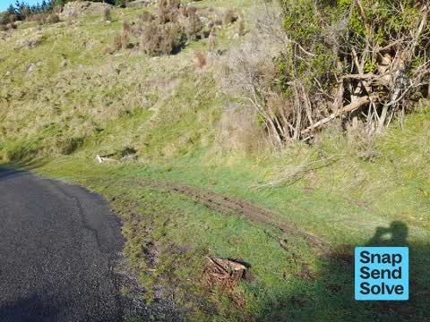
 The channel beside the road is blocked and rain flows across the road instead of into a drain that was built to take water under the road. T
 Roads - General, 28 Jan 2025
 Roadside drain overflowing after being insuffiently dug out following a slip just above the culvert. This means rain water flows over the ro
 Street Gutters / Storm Water, 9 Jan 2025
 The ditch beside the road is blocked and water is flowing across the road after rain rather than into the culvert below the road
Elsewhere on Summit Road
- 2129–2157 Summit Road, 10 reports
- 1951 Summit Road, 8 reports
- 1809 Summit Road, 7 reports
- 2069 Summit Road, 4 reports
- 2020 Summit Road, 4 reports
- 2026–2028 Summit Road, 3 reports
- 2089–2121 Summit Road, 2 reports
- 2057 Summit Road, 2 reports
The street’s crash record
NZTA’s record names Summit Road in 41 crashes that hurt somebody since 2006, 16 seriously hurt, nobody killed.
The civic layer
This ground votes in Banks Peninsula ward, the Banks Peninsula community board is its local layer. Ward lines don’t always follow suburb lines; this one is measured at the pin, not the suburb’s centre. The whole roll is at /wards.
Summit Road, the whole record → · Everything about Governors Bay → · What stood on this ground → · On the map → · From the air, RetroLens holds the Crown’s aerials back to 1936; search the address there →
Questions, answered briefly
4 council reports on record since January 2025, most often street gutters / storm water (2), roads - general (2).
Governors Bay, Christchurch, on Summit Road.
Nothing on the heritage register at this exact spot, the record around this ground →