388 Sparks Road
8 council reports since July 2019, 7 carrying a photograph. The street’s heaviest record is 270 Sparks Road, 20 reports on file.
From the air, then
Sourced from Canterbury Maps and partners. RNZAF, CC BY 3.0 NZ. Each frame is cut from Environment Canterbury’s historic imagery MapServer for that decade, only where the Footprints layer names a CC BY survey (NZAM-covered spots stay out). RetroLens holds more Crown aerials →
The green nearby
- Milns Drainage Reserve, 50 m to the edge · 1 ha
- Six Silvers Reserve, 224 m to the edge · playground, 3 pieces
- Milns Reserve, 225 m to the edge
- Sparks Road Landscape Reserve, 259 m to the edge
- John Olliver Reserve, 314 m to the edge · 2 ha
Parks within half a kilometre, measured to the boundary, the council’s open data. The whole roll is at /parks.
The tracks through here
- Walk and bike track through Halswell, 353 m to the line · walk · bike
Tracks whose line passes within half a kilometre, the council’s open data.
The named ground
Named water within 500 m of this address, measured to the line or the edge; the council’s own structure register, bridges, boardwalks and steps standing nearby, the open map’s record.
Renting nearby
new bonds in Halswell ran about $697 a week, $147 above the city median of $550, the suburb page keeps the rent record →.
What gets reported here
Photographed here 7 on record




What’s on record
 Street Cleaning, 26 Jan 2026
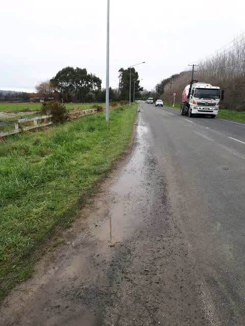
 Alongside Sparks Road between the cycleway and Sutherlands Road, the shoulder is covered in stones and dirt. It makes it really hard to bike
 Dumped Rubbish, 9 Sept 2025
 Waste from Milns Green building site has been blown and/or dumped into the drain. I was assured by the building manager for Oakridge Homes t
 Pavement - Damaged, 4 Sept 2025
 Pavement damaged
 Roads - General, 14 Jun 2025
 Hello. Just wondering why this section is still under roadworks with the cones impeding the traffic heading towards hoon hay on sparks road
 Water Leak, 26 Feb 2024
 Leaky water pipe. This water has been here in hot weather for a couple of weeks now
- Graffiti, 16 Apr 2023
 General Request, 10 Jan 2022
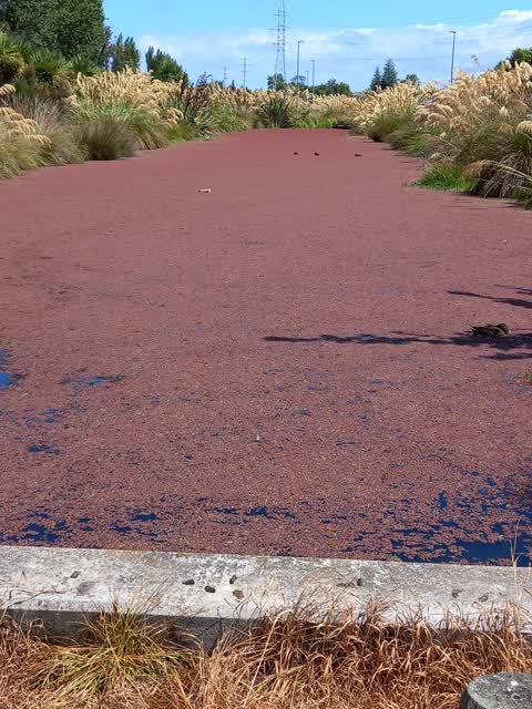
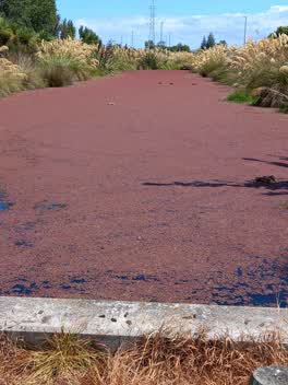
 Stormwater Basin Ponds beside cycleway between Sparks and Milns Roads have a red growth all over them (some sort of algae?)
Roading/Streets, 22 Jul 2019
grass verge needs grading off to allow road surface water to drain away. new cycle way stops short leaving cyclists on the narrow shoulder
Elsewhere on Sparks Road
- 270 Sparks Road, 20 reports
- 246 Sparks Road, 18 reports
- 381 Sparks Road, 11 reports
- 376 Sparks Road, 8 reports
- 458 Sparks Road, 6 reports
- 330A Sparks Road, 6 reports
- 469 Sparks Road, 5 reports
- 302 Sparks Road, 5 reports
The street’s crash record
NZTA’s record names Sparks Road in 29 crashes that hurt somebody since 2006, 1 person killed, 4 seriously hurt.
The civic layer
This ground votes in Halswell ward, the Halswell-Hornby-Riccarton community board is its local layer. Ward lines don’t always follow suburb lines; this one is measured at the pin, not the suburb’s centre. The whole roll is at /wards.
Sparks Road, the whole record → · Everything about Halswell → · What stood on this ground → · On the map → · From the air, RetroLens holds the Crown’s aerials back to 1936; search the address there →
Questions, answered briefly
8 council reports on record since July 2019, most often water leak (1), street cleaning (1), roads - general (1).
Halswell, Christchurch, on Sparks Road.
Nothing on the heritage register at this exact spot, the record around this ground →
Milns Drainage Reserve, 50 m to its edge, 1 ha.