43 Candys Road, Halswell
13 reports on record since January 2023 · 9 with photographs. The most-reported address on Candys Road. Indicative rating valuation and school zones, hazards, bin day and what stood here before.
What gets reported here
Photographed here 9 on record




Reported here
- Dumped Rubbish —
Dumped tyres
 Dumped Rubbish —
 1/2 a dozen dumped rubbish bags
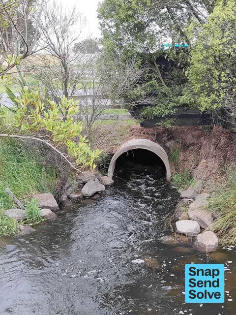
 Street Gutters / Storm Water —
 The creamery stream needs the banks trimmed with all this rain we have had is making it flood
 Dumped Rubbish —
  Dumped Rubbish —
 There is rubbish dumped here and thought I’d help out . Thanks
 Dumped Rubbish —
 3 separate dumpings
 Dumped Rubbish —
 A couple of scummy people have dumped rubbish in verious places down candy's road and there also some up sabys road also a trailer or a smal
 Damaged Street Light —
 On the corner of sabys road and Candy's road looks like someone tried painting the street light and it makes the intersection so dark at nig
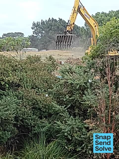
 Water Pollution - Sediment —
 Roonies creating dust storms right next to creamery ponds
 Water Pollution - Sediment —
 Moving alot of soil creating a lot of dust going everywhere including into the waterways I don't know how many times these retards need to b
- Water Pollution - Sediment —
- Sediment - Construction —
- Sediment - Construction —
Also reported on Candys Road
- 9 Candys Road — 7 reports
- 8 Candys Road — 6 reports
- 85 Candys Road — 1 report
- 6 Candys Road — 1 report
- 57 Candys Road — 1 report
- 48–70 Candys Road — 1 report
- 3 Candys Road — 1 report
- 1 Candys Road — 1 report
The street’s crash record
NZTA’s record names Candys Road in 7 crashes that hurt somebody since 2006 — 1 seriously hurt, nobody killed.
The green nearby
- Creamery Ponds — 33 m to the edge · 5 ha
- Nottingham Stream Reserve — 498 m to the edge
Parks within half a kilometre, measured to the boundary — the council’s open data.
The named ground
Named water within 500 m of this address, measured to the line or the edge; the council’s own structure register — bridges, boardwalks and steps standing nearby — the open map’s record.
Renting nearby
new bonds in Halswell ran about $697 a week — $147 above the city median of $550 — the suburb page keeps the rent record →.
The civic layer
This ground votes in Halswell ward — the Halswell-Hornby-Riccarton community board. Ward lines don’t always follow suburb lines; this one is measured at the pin, not the suburb’s centre.
What stood on this ground → · On the map → · From the air — the Crown’s aerials back to 1936; search the address on RetroLens →
Questions, answered briefly
13 council reports on record since January 2023 — most often dumped rubbish (6), water pollution - sediment (3), sediment - construction (2).
Halswell, Christchurch — on Candys Road.
Nothing on the heritage register at this exact spot — the record around this ground →
Creamery Ponds — 33 m to its edge, 5 ha.