86 Sabys Road, Halswell
20 reports on record since October 2018 · 10 with photographs. The most-reported address on Sabys Road. Indicative rating valuation and school zones, hazards, bin day and what stood here before.
What gets reported here
- Parks — 5
- Vandalism - General — 4
- Flooding — 2
- Dumped Rubbish — 2
- Water Pollution - Sediment — 1
- Water General — 1
Photographed here 10 on record


Reported here
 Water General —
 Concrete weir in river, presumably to keep level of upstream pond higher. Does this structure and its effects have a resource consent or sim
- Pavement - General —
Whopping pothole near corner of Sabys and Candy's roads on Candy road
 Flooding —
 The watercress has choked the flow of water being able to get into the halswell river from creamery ponds
 Street Gutters / Storm Water —
 Access to Creamery Ponds on Sabys road has been smashed and locked gate now open
 Overgrown Vegetation —
 Willow tree hanging in power lines on Sabys Road near Candys Road. It’s very windy and the powerlines are stuck in the tree
 Dumped Rubbish —
 Rubbish dumped on Sabys road
- Sediment - Construction —
- Water Pollution - Sediment —
- Flooding —
- Facility - General Request —
- Vandalism - General —
- Vandalism - General —
- Vandalism - General —
- Dumped Rubbish —
- Vandalism - General —
Parks —
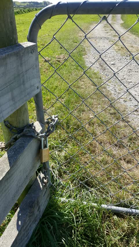
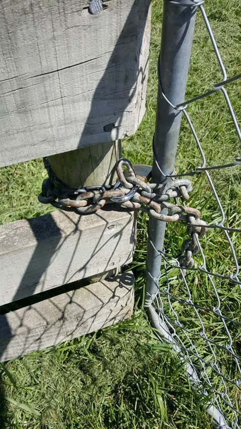
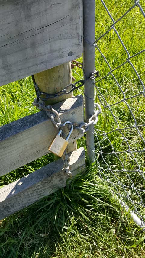
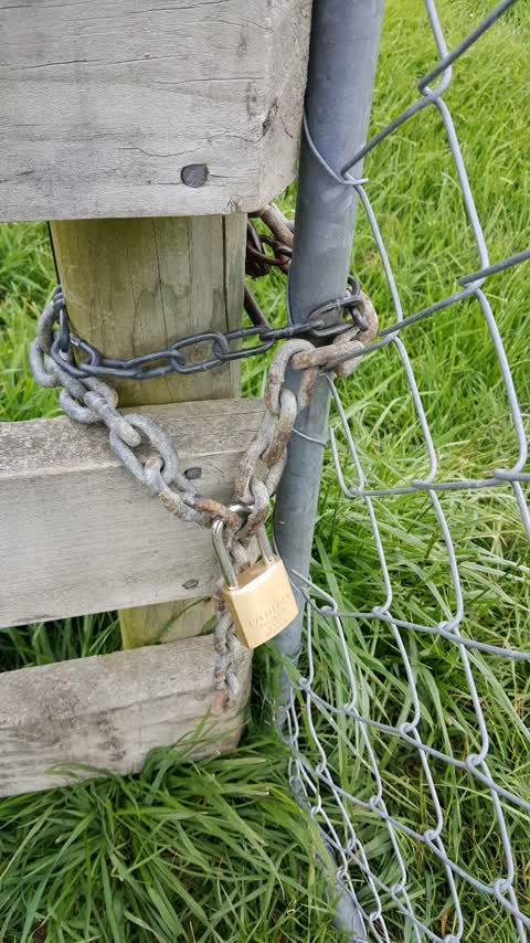
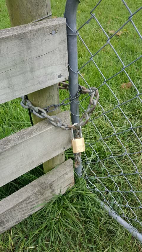
Still have a padlock on the gate. There is no obvious reason for it. I end up climbing through a wire fence like a thief. When will it be re
Parks —
Haven't heard a peep from you so I will keep complaining. I have been coming here with my dogs for years I have not seen any evidence of mis
Parks —
There is still a padlock on this gate. Any resolution happening soon?
Parks —
Hi I reported last week about the padlock to this council owned reserve that the farmer next door has put on. It is still locked. When will
Parks —
The neighbour farmer next to this reserve keeps locking the access gate when I don't think he should be. He did have cows in the paddock nex
Also reported on Sabys Road
- 101 Sabys Road — 7 reports
- 84 Sabys Road — 6 reports
- 98 Sabys Road — 5 reports
- 34A Sabys Road — 5 reports
- 90 Sabys Road — 4 reports
- 80 Sabys Road — 4 reports
- 35 Sabys Road — 4 reports
- 2A Sabys Road — 4 reports
The street’s crash record
NZTA’s record names Sabys Road in 7 crashes that hurt somebody since 2006 — 2 seriously hurt, nobody killed.
The green nearby
- Creamery Ponds — you are in it · 5 ha
Parks within half a kilometre, measured to the boundary — the council’s open data.
The named ground
Named water within 500 m of this address, measured to the line or the edge; the council’s own structure register — bridges, boardwalks and steps standing nearby — the open map’s record.
Renting nearby
new bonds in Halswell ran about $697 a week — $147 above the city median of $550 — the suburb page keeps the rent record →.
The civic layer
This ground votes in Halswell ward — the Halswell-Hornby-Riccarton community board. Ward lines don’t always follow suburb lines; this one is measured at the pin, not the suburb’s centre.
What stood on this ground → · On the map → · From the air — the Crown’s aerials back to 1936; search the address on RetroLens →
Questions, answered briefly
20 council reports on record since October 2018 — most often parks (5), vandalism - general (4), flooding (2).
Halswell, Christchurch — on Sabys Road.
Nothing on the heritage register at this exact spot — the record around this ground →
Creamery Ponds — the address is inside it, 5 ha.