16 Cam Place
2 council reports since February 2022, 2 carrying a photograph. The street’s heaviest record is 14 Cam Place, 6 reports on file.
The green nearby
- Pasadena Reserve, 98 m to the edge
- Becmead Reserve, 290 m to the edge
- Crofton Reserve, 319 m to the edge · playground, 20 pieces
- Styx River Reserve, 380 m to the edge · 2 ha
- Natalie Reserve, 469 m to the edge · playground, 18 pieces
Parks within half a kilometre, measured to the boundary, the council’s open data. The whole roll is at /parks.
On the doorstep
- Copenhagen Bakery, 187 m away · Bakeries
- Harewood Superette, 201 m away · Dairies & convenience
- Spellbound Souvlaki Caffe, 207 m away · Fast food
- @ The Mat, 211 m away · Laundromats
Businesses within four hundred metres, measured at the pin, OpenStreetMap and the council directories.
The bus nearby
- Harewood Rd near Trafford St, 151 m away · route 125
- Harewood Rd near Crofton Rd, 218 m away · route 125
The closest Metro stops, within four hundred and fifty metres.
The tracks through here
- Walk and bike track through Harewood, 259 m to the line · walk · bike
- Walk and bike track through Harewood, 450 m to the line · walk · bike
Tracks whose line passes within half a kilometre, the council’s open data.
What gets reported here
Photographed here 2 on record

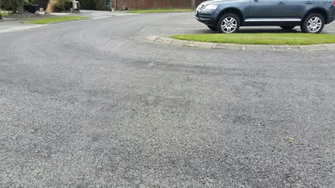
What’s on record
 Water Leak, 24 Apr 2026
 leaking water Toby near letterbox
 Roading/Streets, 24 Feb 2022
Elsewhere on Cam Place
- 14 Cam Place, 6 reports
- 9 Cam Place, 3 reports
- 11A Cam Place, 2 reports
- 1 Cam Place, 2 reports
- 4B Cam Place, 1 report
- 15 Cam Place, 1 report
- 11a Cam Place, 1 report
- 10 Cam Place, 1 report
The civic layer
This ground votes in Harewood ward, the Fendalton-Waimairi-Harewood community board is its local layer. Ward lines don’t always follow suburb lines; this one is measured at the pin, not the suburb’s centre. The whole roll is at /wards.
Cam Place, the whole record → · Everything about Harewood → · What stood on this ground → · On the map → · From the air, RetroLens holds the Crown’s aerials back to 1936; search the address there →
Questions, answered briefly
2 council reports on record since February 2022, most often water leak (1), roading/streets (1).
Harewood, Christchurch, on Cam Place.
Nothing on the heritage register at this exact spot, the record around this ground →
Pasadena Reserve, 98 m to its edge.