27 Laing Crescent
2 council reports since November 2026, 2 carrying a photograph. The street’s heaviest record is 46 Laing Crescent, 8 reports on file.
The green nearby
- Warner Reserve, 121 m to the edge · playground, 4 pieces
- Laing Reserve, 352 m to the edge
- Scruttons Reserve, 360 m to the edge
Parks within half a kilometre, measured to the boundary, the council’s open data. The whole roll is at /parks.
The bus nearby
- Port Hills Rd near Castleview Ln, 161 m away · route 8
- Port Hills Rd near Mauger Dr, 185 m away · route 8
The closest Metro stops, within four hundred and fifty metres.
Renting nearby
new bonds in Heathcote Valley ran about $750 a week, $200 above the city median of $550, the suburb page keeps the rent record →.
What gets reported here
- Water Leak, 2
Photographed here 2 on record
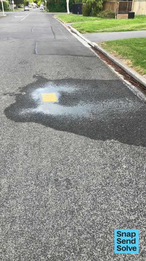
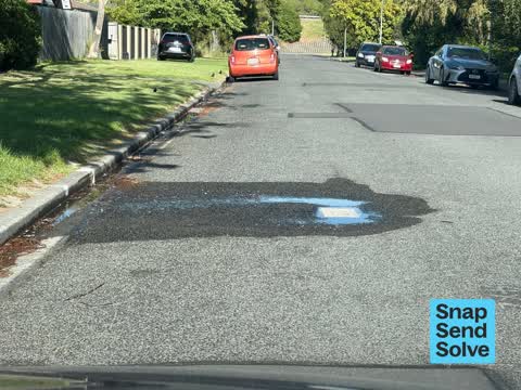
What’s on record
 Water Leak, 2 Nov 2026
Fire hydrant is leaking
 Water Leak, 1 Nov 2026
Fire hydrant water leak
Elsewhere on Laing Crescent
- 46 Laing Crescent, 8 reports
- 76 Laing Crescent, 6 reports
- 31 Laing Crescent, 6 reports
- 1/36 Laing Crescent, 5 reports
- 3 Laing Crescent, 3 reports
- 29 Laing Crescent, 3 reports
- 13 Laing Crescent, 3 reports
- 7 Laing Crescent, 2 reports
The street’s crash record
NZTA’s record names Laing Crescent in 1 crash that hurt somebody since 2006, 0 seriously hurt, nobody killed.
The civic layer
This ground votes in Heathcote ward, the Spreydon-Cashmere-Heathcote community board is its local layer. Ward lines don’t always follow suburb lines; this one is measured at the pin, not the suburb’s centre. The whole roll is at /wards.
Laing Crescent, the whole record → · Everything about Heathcote Valley → · What stood on this ground → · On the map → · Street View → · From the air, RetroLens holds the Crown’s aerials back to 1936; search the address there →
Questions, answered briefly
2 council reports on record since November 2026, most often water leak (2).
Heathcote Valley, Christchurch, on Laing Crescent.
Nothing on the heritage register at this exact spot, the record around this ground →
Warner Reserve, 121 m to its edge.