16 The Crescent, Hillsborough
13 reports on record since February 2022 · 8 with photographs. The most-reported address on The Crescent. Indicative rating valuation and school zones, hazards, bin day and what stood here before.
What gets reported here
- Dumped Rubbish — 3
- Park - General Request — 2
- Facility - General Request — 2
- Rubbish/Recycling — 1
- Pavement - General — 1
- Litter — 1
Photographed here 8 on record


Reported here
 Graffiti on a playground or in a park —
 Broken glass from car window in mt Vernon carpark
 Litter —
 Fresh Broken window glass
 Facility - General Request —
 Broken glass in car park
 Pavement - General —
 Three lots of broken glass from car break ins at mt Vernon carpark
 Facility - General Request —
 Mt Vernon carpark bike racks removed from the ground and lying on the grass
 Dumped Rubbish —
 My Vernon car park looks like rubbish bag emptied and left numerous articles
 Dumped Rubbish —
 - Park - General Request —
- Fallen Tree —
- Park - General Request —
- Dumped Rubbish —
- Graffiti —
 Rubbish/Recycling —
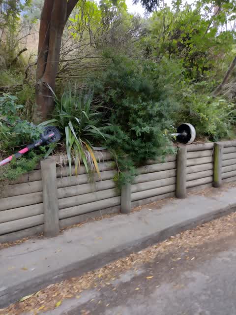
 Rubbish dumped on both sides of the driveway of the Mount Vernon Valley Track carpark, clothes horse, bar stool, lime (or similar) scooter,
Also reported on The Crescent
- 2 The Crescent — 3 reports
- 99 The Crescent — 1 report
- 9 The Crescent — 1 report
- 8–12 The Crescent — 1 report
- 4 The Crescent — 1 report
The green nearby
- Montgomery Spur Reserve — 193 m to the edge · Regional · 127 ha
- Huntsbury Reserve — 318 m to the edge · Regional · 4 ha
Parks within half a kilometre, measured to the boundary — the council’s open data.
On the doorstep
- Ruth Killoran Art Studio & Gallery — 201 m away · Galleries
Businesses within four hundred metres, measured at the pin — OpenStreetMap and the council directories.
The tracks through here
- Walk and bike track through Hillsborough — 183 m to the line · walk · bike
- Walk and bike track through Hillsborough — 247 m to the line · walk · bike
- Walk and bike track through Hillsborough — 274 m to the line · walk · bike
Tracks whose line passes within half a kilometre, measured to the line itself — the council’s open data.
The named ground
Named places within 1.5 km of this address — the open map’s record.
Renting nearby
new bonds in Hillsborough ran about $445 a week — $105 below the city median of $550 — the suburb page keeps the rent record →.
The civic layer
This ground votes in Cashmere ward — the Spreydon-Cashmere-Heathcote community board. Ward lines don’t always follow suburb lines; this one is measured at the pin, not the suburb’s centre.
What stood on this ground → · On the map → · From the air — the Crown’s aerials back to 1936; search the address on RetroLens →
Questions, answered briefly
13 council reports on record since February 2022 — most often dumped rubbish (3), park - general request (2), facility - general request (2).
Hillsborough, Christchurch — on The Crescent.
Nothing on the heritage register at this exact spot — the record around this ground →
Montgomery Spur Reserve — 193 m to its edge, 127 ha.