172 Opawa Road, Hillsborough
14 reports on record since November 2019 · 10 with photographs. The street’s heaviest record is 218 Opawa Road — 24 reports on file. Indicative rating valuation and school zones, hazards, bin day and what stood here before.
What gets reported here
Photographed here 10 on record


Reported here
 Graffiti on a fence, building or structure —
 graffiti on concrete block fence
 Graffiti on a fence, building or structure —
 multiple light lamp post poles have graffiti on them
 Graffiti on a fence, building or structure —
 graffiti on light lamp post pole
 Bus Shelter Issue —
 Bus shelter glass is shattered
 Pavement - General —
 Guys come and put a lid on this, this is not the first time I’ve sent in and I just watched an old lady almost break her ankle!
- Pothole —
Kia ora, I was driving in the motorway yesterday and unable to take a photo or note the exact location, but there is a rather aggressive pot
 Pavement - Damaged —
 Missing cover so a huge deep hole with cables in it next to the footpath. My 4 year old just ate the footpath because it was full of leaves
 Overgrown Vegetation —
 Leaves ?? everywhere needs a tidy
 Trees - General —
 Branches are too low. Need to be trimmed back
 Water Leak —
 Street toby meter
- Water Leak —
- Road Signage —
- Graffiti —
Parks —
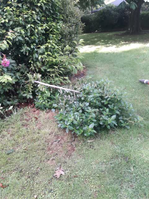
broken tree branch still attached and crumbled broken stone wall at monro playground.
Also reported on Opawa Road
- 218 Opawa Road — 24 reports
- 153A Opawa Road — 24 reports
- 288 Opawa Road — 14 reports
- 220 Opawa Road — 11 reports
- 200 Opawa Road — 10 reports
- 158 Opawa Road — 9 reports
- 255 Opawa Road — 7 reports
- 254 Opawa Road — 7 reports
The street’s crash record
NZTA’s record names Opawa Road in 14 crashes that hurt somebody since 2006 — 6 seriously hurt, nobody killed.
The green nearby
- Monro Playground — 7 m to the edge
- Heathcote Riverbank Reserve — 229 m to the edge
- Radley Playground — 353 m to the edge
- Hansen Park — 359 m to the edge · Sports ground · 12 ha
Parks within half a kilometre, measured to the boundary — the council’s open data.
On the doorstep
- Opawa Discounter — 349 m away · Dairies & convenience
- Otis — 352 m away · Company
- Radley Street Fish And Chips — 358 m away · Fast food
- J Mart — 367 m away · Dairies & convenience
Businesses within four hundred metres, measured at the pin — OpenStreetMap and the council directories.
The bus nearby
The closest Metro stops, within four hundred and fifty metres.
The tracks through here
- Walk and bike track through Hillsborough — 72 m to the line · walk · bike
- Walk and bike track through Hillsborough — 77 m to the line · walk · bike
- Walk and bike track through Hillsborough — 100 m to the line · walk · bike
- Walk and bike track through Hillsborough — 114 m to the line · walk · bike
- Walk and bike track through Hillsborough — 194 m to the line · walk · bike
Tracks whose line passes within half a kilometre, measured to the line itself — the council’s open data.
The named ground
Named water within 500 m of this address, measured to the line or the edge; the council’s own structure register — bridges, boardwalks and steps standing nearby — the open map’s record.
The remembered names nearby
- Edgar Taylor Walk in Recognition of the Life Work of Edgar — 69 m away ·
EDGAR TAYLOR WALK In recognition of the life work of Edgar Taylor, first Landscape Archite
· 2003 - Erected on the 77th Anniversary of the Opawa School — 69 m away ·
ERECTED ON THE 77TH ANNIVERSARY OF THE OPAWA SCHOOL IN MEMORY OF FORMER PUPILS, TEACHERS A
· 2009
Inscribed plaques within two hundred and fifty metres — the register’s pins, not surveyed spots. The whole roll is at /plaques.
Renting nearby
new bonds in Hillsborough ran about $445 a week — $105 below the city median of $550 — the suburb page keeps the rent record →.
The civic layer
This ground votes in Heathcote ward — the Spreydon-Cashmere-Heathcote community board. Ward lines don’t always follow suburb lines; this one is measured at the pin, not the suburb’s centre.
What stood on this ground → · On the map → · From the air — the Crown’s aerials back to 1936; search the address on RetroLens →
Questions, answered briefly
14 council reports on record since November 2019 — most often graffiti on a fence, building or structure (3), water leak (2), trees - general (1).
Hillsborough, Christchurch — on Opawa Road.
Nothing on the heritage register at this exact spot — the record around this ground →
Monro Playground — 7 m to its edge.