24 Smartlea Street, Hoon Hay
12 reports on record since November 2018 · 11 with photographs. The most-reported address on Smartlea Street. Indicative rating valuation and school zones, hazards, bin day and what stood here before.
What gets reported here
- Roading/Streets — 4
- Overgrown Vegetation — 2
- Water Pollution - Sediment — 1
- Pavement - Damaged — 1
- Litter — 1
- General Request — 1
Photographed here 11 on record


Reported here
 Dumped Rubbish —
 somebody has dumped some things in the river
 Fallen Tree —
 Tree branch snapped over on cycle pathway bridge. Significant risk of falling over again onto someone. Have cleared some of it with local re
 Overgrown Vegetation —
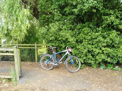
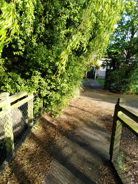
 bush on corner of 24 Smartlea st overhanging the footpath
 Overgrown Vegetation —
 Loose leaves and debris on foot bridge
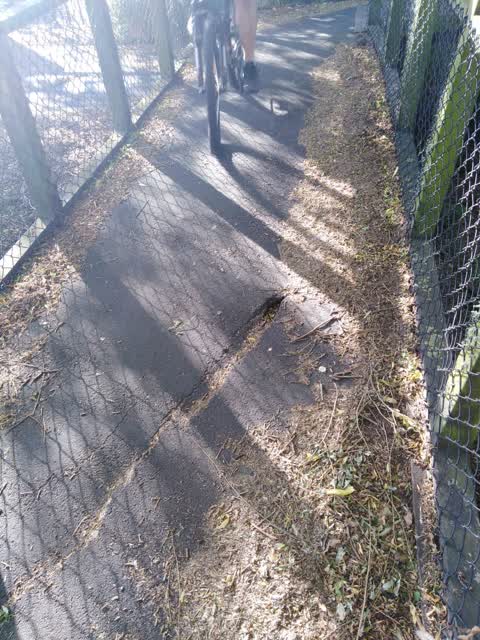
 Pavement - Damaged —
 Crack forming in footpath by bridge
 Litter —
 Abandoned road cone in the creek
 General Request —
 Dumped trolly filled with rubbish in the heathcot river (smartlea st). Dumped since yesterday afternoon
- Water Pollution - Sediment —
 Roading/Streets —
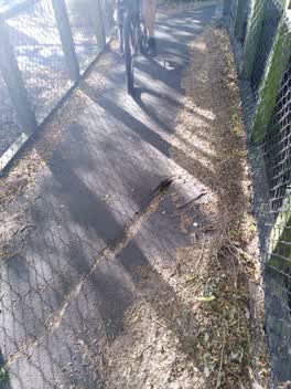
 Sink hole opening up on shared path
 Roading/Streets —
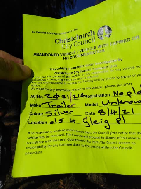
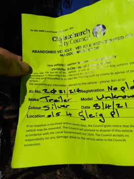
 Abandoned vehicle notice by the river
Roading/Streets —
Footpath/foot bridge blocked by overgrown Council property. This is my 2nd snap. Please get contractor moving
Roading/Streets —
Bridge ramp blocked by riverbank growth
Also reported on Smartlea Street
- 22 Smartlea Street — 11 reports
- 21 Smartlea Street — 11 reports
- 6 Smartlea Street — 6 reports
- 5 Smartlea Street — 4 reports
- 2 Smartlea Street — 4 reports
- 18 Smartlea Street — 4 reports
- 12 Smartlea Street — 4 reports
- 9 Smartlea Street — 3 reports
The street’s crash record
NZTA’s record names Smartlea Street in 2 crashes that hurt somebody since 2006 — 1 seriously hurt, nobody killed.
The green nearby
- Glynne Reserve — 142 m to the edge
- Spreydon Domain — 277 m to the edge · Sports ground · 7 ha
Parks within half a kilometre, measured to the boundary — the council’s open data.
On the doorstep
- Christchurch Irish Society — 261 m away · Clubs
- Sharkey's Bar & Cafe — 299 m away · Bars & pubs
- Lewis Street Food Bar — 305 m away · Fast food
- Sharkeys Bar & Cafe - Off — 305 m away · Bars & pubs
Businesses within four hundred metres, measured at the pin — OpenStreetMap and the council directories.
The bus nearby
- Lyttelton St near Glynne Cres — 253 m away · route 120
- Hoon Hay Rd near Smartlea St — 277 m away · route 60
The closest Metro stops, within four hundred and fifty metres.
The tracks through here
- Walk and bike track through Hoon Hay — 13 m to the line · walk · bike
- Walk and bike track through Hoon Hay — 63 m to the line · walk · bike
- Walk and bike track through Hoon Hay — 111 m to the line · walk · bike
- Walk and bike track through Hoon Hay — 248 m to the line · walk · bike
- Walk and bike track through Hoon Hay — 321 m to the line · walk · bike
Tracks whose line passes within half a kilometre, measured to the line itself — the council’s open data.
The named ground
Named water within 500 m of this address, measured to the line or the edge — the open map’s record.
Renting nearby
new bonds in Hoon Hay ran about $573 a week — $23 above the city median of $550 — the suburb page keeps the rent record →.
The civic layer
This ground votes in Spreydon ward — the Spreydon-Cashmere-Heathcote community board. Ward lines don’t always follow suburb lines; this one is measured at the pin, not the suburb’s centre.
What stood on this ground → · On the map → · From the air — the Crown’s aerials back to 1936; search the address on RetroLens →
Questions, answered briefly
12 council reports on record since November 2018 — most often roading/streets (4), overgrown vegetation (2), water pollution - sediment (1).
Hoon Hay, Christchurch — on Smartlea Street.
Nothing on the heritage register at this exact spot — the record around this ground →
Glynne Reserve — 142 m to its edge.