26 Brynley Street, Hornby
23 reports on record since January 2021 · 22 with photographs. The most-reported address on Brynley Street. Indicative rating valuation and school zones, hazards, bin day and what stood here before.
What gets reported here
Photographed here 22 on record


Reported here
 Graffiti on a fence, building or structure,
 The black graffiti in the alley way at the Brynley Street end. I'm quite sure that there is a swear word in the graffiti.
 Graffiti on a fence, building or structure,
 The white spray paint graffiti on the fences along the walkway next to no. 26 Brynley St. The white graffiti on the dark grey cinderblock wa
 Trees - General,
 could the tree please be trimmed right back as it is blocking the light on the path from Brynley St at night giving more light at night woul
 Litter,
 Tin cans , paper and general food waste containers in amongst bushes .
 Pavement - Damaged,
 The path through Helmore park is disintegrating and it is used by primary school children on scooters so it is causing accidents
 Road Signage,
 Someone flattened both of these direction signs a few months back by driving over them, looks like they've had another go at it and they're
 Litter,
 Rubbish Park
 Dumped Rubbish,
  Dumped Rubbish,
  Road Signage,
 2 X roundabout arrow signage and plants have been run over
 Road Signage,
 Roundabout arrows flattened
- Graffiti,
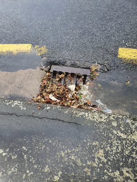
 Sewer - General,
 Corner of Brynley and Oakhampton st Hornby soon to flood as block drain thanks for your attention
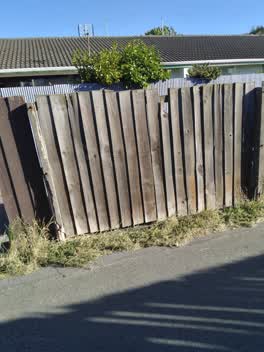 Parks,
 Fence needs to be replaced completely and higher to give neighboring residents security and privacy
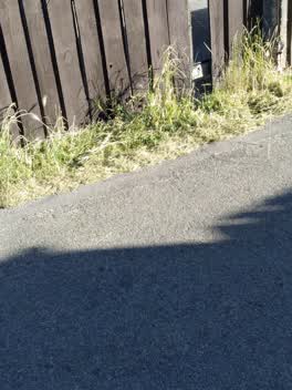 Parks,
 Only one side of the alley way has been mowed
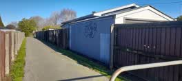 Graffiti,
 The black graffiti on the right side of the alleyway entrance.
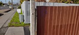 Graffiti,
 The white graffiti in the alleyway and dark blue graffiti at the enterance of the aeyway, both at the end next to 26 Brynley St.
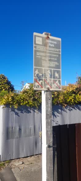 Graffiti,
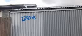
 Beige spray paint on the corrugated iron, blue scribble on the name of the park sign.
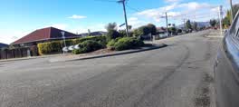 Graffiti,
 The teal graffiti on the keep left roundabout sign.
 Graffiti,
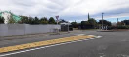
 the black graffiri on the alleyway fence
 Graffiti,
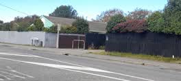
 the black graffiti on the brown fence
 Graffiti,
  Graffiti,
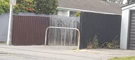
 At the beginning of the alleyway on the left.
Also reported on Brynley Street
- 28 Brynley Street, 17 reports
- 118 Brynley Street, 10 reports
- 26A Brynley Street, 9 reports
- 56 Brynley Street, 7 reports
- 48 Brynley Street, 7 reports
- 67 Brynley Street, 6 reports
- 4 Brynley Street, 6 reports
- 1 Brynley Street, 6 reports
From the air, then
Sourced from Canterbury Maps and partners. LINZ, CC BY 3.0 NZ. Each frame is cut from Environment Canterbury’s historic imagery MapServer for that decade, only where the Footprints layer names a CC BY survey (NZAM-covered spots stay out). RetroLens holds more Crown aerials →
The street’s crash record
NZTA’s record names Brynley Street in 7 crashes that hurt somebody since 2006, 1 seriously hurt, nobody killed.
The green nearby
- Helmore Park, 12 m to the edge
- Goulding Playground, 411 m to the edge
- Bermuda Reserve, 463 m to the edge
- Trevor Reserve, 490 m to the edge
- Oakhampton Reserve, 492 m to the edge
Parks within half a kilometre, measured to the boundary, the council’s open data.
On the doorstep
- Hornby Medical Centre, 111 m away · Doctors & clinics
- Hornby Veterinary Centre, 201 m away · Vets
- G&E Dental, 216 m away · Dentists
- Wigram Health, 218 m away · Doctors & clinics
Businesses within four hundred metres, measured at the pin: OpenStreetMap and the council directories.
The bus nearby
The closest Metro stops, within four hundred and fifty metres.
The tracks through here
- Walk and bike track through Hornby, 341 m to the line · walk · bike
- Walk and bike track through Hornby, 376 m to the line · walk · bike
- Walk and bike track through Hornby, 491 m to the line · walk · bike
Tracks whose line passes within half a kilometre, measured to the line itself, the council’s open data.
Renting nearby
new bonds in Hornby ran about $550 a week, about the city median, the suburb page keeps the rent record →.
The civic layer
This ground votes in Hornby ward, the Halswell-Hornby-Riccarton community board. Ward lines don’t always follow suburb lines; this one is measured at the pin, not the suburb’s centre.
What stood on this ground → · On the map → · From the air, the Crown’s aerials back to 1936; search the address on RetroLens →
Questions, answered briefly
23 council reports on record since January 2021, most often graffiti (9), road signage (3), parks (2).
Hornby, Christchurch, on Brynley Street.
Nothing on the heritage register at this exact spot, the record around this ground →
Helmore Park, 12 m to its edge.