343 Main South Road, Hornby
12 reports on record since March 2022 · 9 with photographs. The street’s heaviest record is 442 Main South Road — 80 reports on file. Indicative rating valuation and school zones, hazards, bin day and what stood here before.
What gets reported here
Photographed here 9 on record


Reported here
 Flooding —
 Surface flooding
 Pothole —
 Pothole near the give way right by the corner
 Dumped Rubbish —
 A lot of dumped rubbish by some people sleeping in a car looks awful need cleanedup in bushes off Neill Street
 Street Gutters / Storm Water —
 This place floods like this or more each time it rains. I always clear it because it makes it impossible for the public who walk or bike to
 Graffiti on a cabinet, pole or railway asset —
  Litter —
 Bins were kicked over last week according to FB community page. Rubbish has blown down the street into small grasses area at the beginning o
 Dumped Rubbish —
 Old mattress
 Dumped Rubbish —
 House hold rubbish and fence palings had been dumped in the gardens. This happens all the time and we just want it removed. Thanks
- Graffiti —
- Dumped Rubbish —
- Graffiti —
 Graffiti —
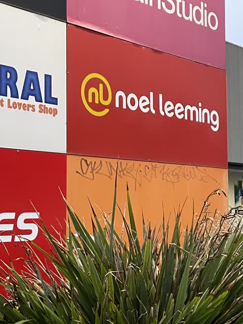
 Graffiti on commercial sign
Also reported on Main South Road
- 442 Main South Road — 80 reports
- 383 Main South Road — 26 reports
- 446 Main South Road — 21 reports
- 395 Main South Road — 20 reports
- 273 Main South Road — 19 reports
- 345 Main South Road — 13 reports
- 418 Main South Road — 12 reports
- 393A Main South Road — 11 reports
The street’s crash record
NZTA’s record names Main South Road in 112 crashes that hurt somebody since 2006 — 1 person killed, 27 seriously hurt.
The green nearby
- Bermuda Reserve — 227 m to the edge
- Helmore Park — 359 m to the edge
- Oakhampton Reserve — 500 m to the edge
Parks within half a kilometre, measured to the boundary — the council’s open data.
On the doorstep
- Repco — 70 m away · Car parts
- Carpet Court — 72 m away · Carpet
- NZ Beds — 77 m away · Bed
- Bargain Chemist — 89 m away · Pharmacies
Businesses within four hundred metres, measured at the pin — OpenStreetMap and the council directories.
The bus nearby
- Main South Rd near Canterbury St — 79 m away · route 5
- Main South Rd near Canterbury St — 96 m away · route 5
The closest Metro stops, within four hundred and fifty metres.
The tracks through here
- Walk and bike track through Hornby — 446 m to the line · walk · bike
Tracks whose line passes within half a kilometre, measured to the line itself — the council’s open data.
Renting nearby
new bonds in Hornby ran about $550 a week — about the city median — the suburb page keeps the rent record →.
The civic layer
This ground votes in Hornby ward — the Halswell-Hornby-Riccarton community board. Ward lines don’t always follow suburb lines; this one is measured at the pin, not the suburb’s centre.
What stood on this ground → · On the map → · From the air — the Crown’s aerials back to 1936; search the address on RetroLens →
Questions, answered briefly
12 council reports on record since March 2022 — most often dumped rubbish (4), graffiti (3), street gutters / storm water (1).
Hornby, Christchurch — on Main South Road.
Nothing on the heritage register at this exact spot — the record around this ground →
Bermuda Reserve — 227 m to its edge.