79 Waterloo Road, Hornby
13 reports on record since April 2017 · 13 with photographs. The street’s heaviest record is 197 Waterloo Road — 50 reports on file. Indicative rating valuation and school zones, hazards, bin day and what stood here before.
What gets reported here
- Water Leak — 8
- Overgrown Vegetation — 2
- Street Gutters / Storm Water — 1
- Parks — 1
- Graffiti — 1
Photographed here 13 on record


Reported here
 Overgrown Vegetation —
 Overgrown from neighbours garden Rosemary needs cutting back as overgrowth is damaging the fence
 Overgrown Vegetation —
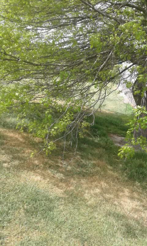
 Most trees in the entire park urgently need tree lifting I am Hornby supervisor for parks , we sent an email in November to have this work c
 Water Leak —
  Water Leak —
  Water Leak —
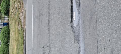
 Water bubbling up from under the road
 Water Leak —
 Persistent water leak coming from under the road seal.
 Water Leak —
 A significant leak
 Street Gutters / Storm Water —
 Looks like a burst pipe under the tar seal. Water is running from the spot on to photo down Waterloo Rd
 Water Leak —
  Water Leak —
  Water Leak —
 over three weeks now
Parks —
multiple low branches at Waterloo reserve
Graffiti —
Also reported on Waterloo Road
- 197 Waterloo Road — 50 reports
- 190a Waterloo Road — 25 reports
- 180 Waterloo Road — 24 reports
- 197-239 Waterloo Road — 15 reports
- 260 Waterloo Road — 14 reports
- 241 Waterloo Road — 14 reports
- 35 Waterloo Road — 13 reports
- 192 Waterloo Road — 13 reports
The street’s crash record
NZTA’s record names Waterloo Road in 40 crashes that hurt somebody since 2006 — 1 person killed, 4 seriously hurt.
The green nearby
- Waterloo Reserve No. 2 — 13 m to the edge · 2 ha
- Waterloo Reserve No. 1 — 344 m to the edge · Sports ground
Parks within half a kilometre, measured to the boundary — the council’s open data.
On the doorstep
- Waterloo Takeaway bar — 135 m away · Fast food
- Honorary Consul of the Federal Republic of Germany — 202 m away · Diplomatic
- Southern Institute of Technology — 354 m away · Education & tutoring
Businesses within four hundred metres, measured at the pin — OpenStreetMap and the council directories.
The tracks through here
- Walk and bike track through Hornby — 16 m to the line · walk · bike
- Walk and bike track through Hornby — 42 m to the line · walk · bike
- Walk and bike track through Hornby — 137 m to the line · walk · bike
- Walk and bike track through Hornby — 235 m to the line · walk · bike
- Walk and bike track through Hornby — 413 m to the line · walk · bike
Tracks whose line passes within half a kilometre, measured to the line itself — the council’s open data.
Renting nearby
new bonds in Hornby ran about $550 a week — about the city median — the suburb page keeps the rent record →.
The civic layer
This ground votes in Hornby ward — the Halswell-Hornby-Riccarton community board. Ward lines don’t always follow suburb lines; this one is measured at the pin, not the suburb’s centre.
What stood on this ground → · On the map → · From the air — the Crown’s aerials back to 1936; search the address on RetroLens →
Questions, answered briefly
13 council reports on record since April 2017 — most often water leak (8), overgrown vegetation (2), street gutters / storm water (1).
Hornby, Christchurch — on Waterloo Road.
Nothing on the heritage register at this exact spot — the record around this ground →
Waterloo Reserve No. 2 — 13 m to its edge, 2 ha.