105A 105A
5 council reports since October 2017, 5 carrying a photograph.
On the register here
- College House Principal's Lodge and Setting (49m)
- College House Kitchen, Dining Hall, Office, Common Room, Study Centre, Foyer, Accommodation Block and Setting, 100 Waimairi Road (71m)
- College House Chapel and Setting, 100C Waimairi Road (93m)
- College House Courtyard and setting, 100A Waimairi Road (120m)
- College House Accommodation Block (North) Rymer, Chichele, Watts Russell and Setting (128m)
From the air, then
Sourced from Canterbury Maps and partners. LINZ, CC BY 3.0 NZ. Each frame is cut from Environment Canterbury’s historic imagery MapServer for that decade, only where the Footprints layer names a CC BY survey (NZAM-covered spots stay out). RetroLens holds more Crown aerials →
The green nearby
- Peer Reserve, 134 m to the edge
- Corfe Reserve, 381 m to the edge · 1 ha
- Siska Reserve, 384 m to the edge
Parks within half a kilometre, measured to the boundary, the council’s open data. The whole roll is at /parks.
On the doorstep
- University Of Canterbury Rugby Football Club, 163 m away · Clubs
- Pizza Pi & Cafe, 254 m away · Restaurants
- Shirleys Kitchen, 261 m away · Restaurants
- Hinau Laundry, 266 m away · Laundromats
Businesses within four hundred metres, measured at the pin, OpenStreetMap and the council directories.
The bus nearby
- Waimairi Rd near Dovedale Ave, 229 m away · the Orbiter (anticlockwise)
- Waimairi Rd near Dovedale Ave, 231 m away · the Orbiter (clockwise)
The closest Metro stops, within four hundred and fifty metres.
The tracks through here
- Walk and bike track through Ilam, 13 m to the line · walk · bike
- Walk and bike track through Ilam, 173 m to the line · walk · bike
- Walk and bike track through Ilam, 220 m to the line · walk · bike
- Walk and bike track through Ilam, 225 m to the line · walk · bike
- Walk and bike track through Ilam, 234 m to the line · walk · bike
Tracks whose line passes within half a kilometre, the council’s open data.
The named ground
Named water within 500 m of this address, measured to the line or the edge; the council’s own structure register, bridges, boardwalks and steps standing nearby, the open map’s record.
Renting nearby
new bonds in Ilam ran about $548 a week, about the city median, the suburb page keeps the rent record →.
What gets reported here
Photographed here 5 on record

What’s on record
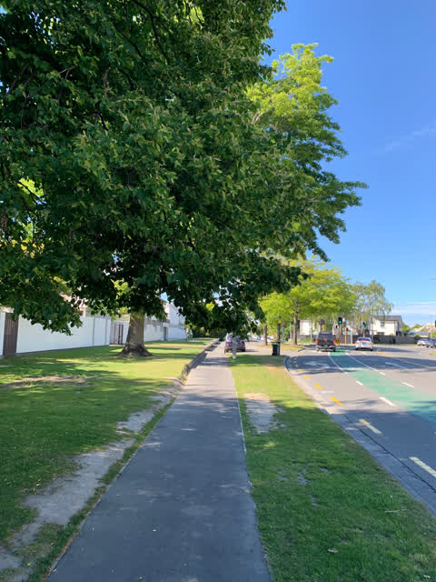
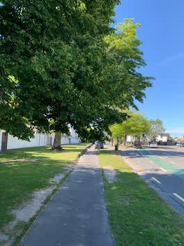 Street Light Outage, 5 Nov 2020
 Once again no option for trees hanging over pathways so chose this one. Tree needs cutting please. Thank you
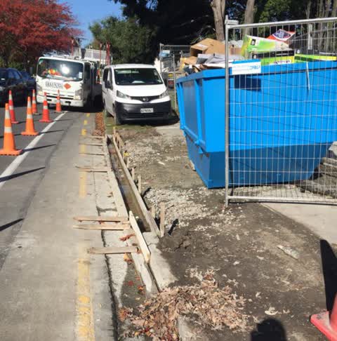
Roading/Streets, 17 Apr 2019
Footpath has been removed, no alternative route provided
Roading/Streets, 19 Dec 2018
Further to my previous message, polystyrene is all down Waimairi Rd past Athol Terrace and Peer St from the construction site at 105 Waimair
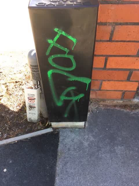
Graffiti, 9 Feb 2018
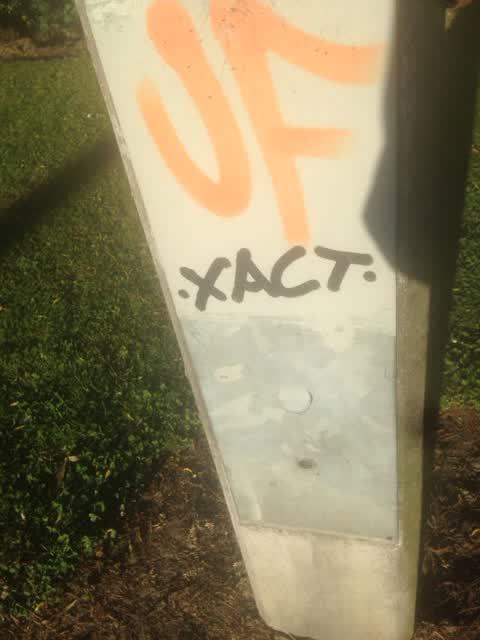
Graffiti, 24 Oct 2017
JF and XACT tags on concrete power pole opposite 107 Waimairi Road
The civic layer
This ground votes in Riccarton ward, the Halswell-Hornby-Riccarton community board is its local layer. Ward lines don’t always follow suburb lines; this one is measured at the pin, not the suburb’s centre. The whole roll is at /wards.
Everything about Ilam → · What stood on this ground → · On the map → · From the air, RetroLens holds the Crown’s aerials back to 1936; search the address there →
Questions, answered briefly
5 council reports on record since October 2017, most often roading/streets (2), graffiti (2), street light outage (1).
Ilam, Christchurch, on A.
The heritage register names 5 places at or beside it, College House Principal's Lodge and Setting, College House Kitchen, Dining Hall, Office, Common Room, Study Centre, Foyer, Accommodation Block and Setting.
Peer Reserve, 134 m to its edge.