186 Waimairi Road, Ilam
14 reports on record since January 2019 · 8 with photographs. The street’s heaviest record is 138 Waimairi Road — 16 reports on file. Indicative rating valuation and school zones, hazards, bin day and what stood here before.
What gets reported here
- Traffic Signals — 4
- Pothole — 4
- Water Leak — 2
- Overgrown Vegetation — 2
- Wastewater/Stormwater — 1
- Street Cleaning — 1
Photographed here 8 on record


Reported here
- Pothole —
A deep pothole
 Traffic Signals —
 Traffic light pole on a lean and has been slowly getting worse
 Traffic Signals —
 Traffic light is STILL on a lean. Definitely hazardous!!
 Traffic Signals —
 Traffic pole 7 on an angle
 Traffic Signals —
 the traffic light phasing on maidstone needs to be longer not 3 seconds around 8am to 9am. every day large lines waiting and waimari road no
 Pothole —
 potholes Northbound lane
 Pothole —
 Large pot hole at this intersection lane that heads south towards peer st
- Pothole —
About 180 waimari road
 Overgrown Vegetation —
 Overgrown vegetation on the corner of Waimairi Rd and Maidstone Rd traffic lights corner. It is vegetation ground over as well as the trees.
- Water Leak —
- Street Cleaning —
- Water Leak —
- Overgrown Vegetation —
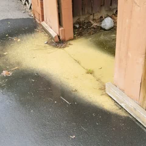
Thick grass along foot path due to major leak coming from property which is a hazard. Water evident in guttering for several weeks now fr
Wastewater/Stormwater —
Water coming up through crack between public footpath and house footpath
Also reported on Waimairi Road
- 138 Waimairi Road — 16 reports
- 201 Waimairi Road — 15 reports
- 108B Waimairi Road — 12 reports
- 130 Waimairi Road — 11 reports
- 119 Waimairi Road — 11 reports
- 97 Waimairi Road — 10 reports
- 253 Waimairi Road — 10 reports
- 134 Waimairi Road — 9 reports
The street’s crash record
NZTA’s record names Waimairi Road in 91 crashes that hurt somebody since 2006 — 12 seriously hurt, nobody killed.
The green nearby
- Ray Blank Park — 55 m to the edge · Sports ground · 5 ha
Parks within half a kilometre, measured to the boundary — the council’s open data.
On the doorstep
- Eastern Drycleaners — 38 m away · Dry cleaners
- Sushi Ya — 41 m away · Fast food
- NZ post — 42 m away · Post offices
- Hames Hairdressing — 44 m away · Hairdressers
Businesses within four hundred metres, measured at the pin — OpenStreetMap and the council directories.
The bus nearby
- Waimairi Rd near Maidstone Rd — 58 m away · route 130, the Orbiter (clockwise)
- Maidstone Rd — 61 m away · route 3
The closest Metro stops, within four hundred and fifty metres.
The tracks through here
- Walk and bike track through Ilam — 7 m to the line · walk · bike
- Walk and bike track through Ilam — 62 m to the line · walk · bike
- Walk and bike track through Ilam — 192 m to the line · walk · bike
- Walk and bike track through Ilam — 199 m to the line · walk · bike
- Walk and bike track through Ilam — 226 m to the line · walk · bike
Tracks whose line passes within half a kilometre, measured to the line itself — the council’s open data.
The named ground
Named water within 500 m of this address, measured to the line or the edge; the council’s own structure register — bridges, boardwalks and steps standing nearby — the open map’s record.
Renting nearby
new bonds in Ilam ran about $548 a week — about the city median — the suburb page keeps the rent record →.
The civic layer
This ground votes in Riccarton ward — the Halswell-Hornby-Riccarton community board. Ward lines don’t always follow suburb lines; this one is measured at the pin, not the suburb’s centre.
What stood on this ground → · On the map → · From the air — the Crown’s aerials back to 1936; search the address on RetroLens →
Questions, answered briefly
14 council reports on record since January 2019 — most often traffic signals (4), pothole (4), water leak (2).
Ilam, Christchurch — on Waimairi Road.
Nothing on the heritage register at this exact spot — the record around this ground →
Ray Blank Park — 55 m to its edge, 5 ha.