33 Dovedale Avenue, Ilam
12 reports on record since December 2021 · 9 with photographs. The most-reported address on Dovedale Avenue. Indicative rating valuation and school zones, hazards, bin day and what stood here before.
What gets reported here
- Pothole — 6
- Water Leak — 1
- Roading/Streets — 1
- Poles and Signage - General — 1
- General Request — 1
- Damaged Road — 1
Photographed here 9 on record


Reported here
 Water Leak —
 Water leak
 Pothole —
 Pothole at Dovedale Avenue & Solway Avenue Intersection
 Pothole —
 Pothole at Dovedale Avenue/Solway Avenue Road Intersection. Additional potholes present further down Dovedale Avenue near Lynfield Avenue as
 Pothole —
 Pothole with loose gravels at intersection of Dovedale Avenue and Solway Avenue
 Poles and Signage - General —
  Damaged Road —
 Pothole and a sinkhole
 Pothole —
 Pothole with water leakage at Dovedale Avenue Solway Avenue intersection.
 Animal - Deceased —
 - General Request —
- Pothole —
- Pothole —
 Roading/Streets —
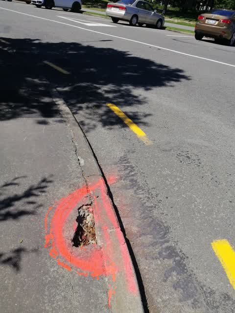
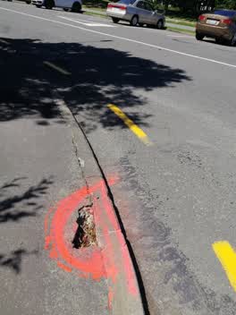
 Pavement outside 33 Divdale Ave has a dangerous hole in it. I've spray orange around it
Also reported on Dovedale Avenue
- 29 Dovedale Avenue — 8 reports
- 5 Dovedale Avenue — 6 reports
- 15 Dovedale Avenue — 5 reports
- 7 Dovedale Avenue — 4 reports
- 23 Dovedale Avenue — 3 reports
- 27B Dovedale Avenue — 2 reports
- 2 Dovedale Avenue — 2 reports
- 9–15 Dovedale Avenue — 1 report
The street’s crash record
NZTA’s record names Dovedale Avenue in 16 crashes that hurt somebody since 2006 — 3 seriously hurt, nobody killed.
The green nearby
- Montclare Reserve — 264 m to the edge
- Annandale Park — 392 m to the edge
- Corfe Reserve — 433 m to the edge · 1 ha
- Peer Reserve — 476 m to the edge
Parks within half a kilometre, measured to the boundary — the council’s open data.
On the doorstep
- Collective Cafe — 223 m away · Cafés
- Livingstone Health Medical Centre — 369 m away · Doctors & clinics
Businesses within four hundred metres, measured at the pin — OpenStreetMap and the council directories.
The bus nearby
- Solway Ave near Glenside Ave — 86 m away · route 130
- Solway Ave near Glenside Ave — 86 m away · route 130
The closest Metro stops, within four hundred and fifty metres.
The tracks through here
- Walk and bike track through Ilam — 3 m to the line · walk · bike
- Walk and bike track through Ilam — 378 m to the line · walk · bike
- Walk and bike track through Ilam — 404 m to the line · walk · bike
- Walk and bike track through Ilam — 462 m to the line · walk · bike
- Walk and bike track through Ilam — 473 m to the line · walk · bike
Tracks whose line passes within half a kilometre, measured to the line itself — the council’s open data.
The named ground
Named water within 500 m of this address, measured to the line or the edge — the open map’s record.
Renting nearby
new bonds in Ilam ran about $548 a week — about the city median — the suburb page keeps the rent record →.
What was here — Former Fendalton Open Air School Classroom and Setting
184 m away · located to ±9 m · the place’s own record →
On the register. Nothing researched here yet.
The civic layer
This ground votes in Riccarton ward — the Halswell-Hornby-Riccarton community board. Ward lines don’t always follow suburb lines; this one is measured at the pin, not the suburb’s centre.
What stood on this ground → · On the map → · From the air — the Crown’s aerials back to 1936; search the address on RetroLens →
Questions, answered briefly
12 council reports on record since December 2021 — most often pothole (6), water leak (1), roading/streets (1).
Ilam, Christchurch — on Dovedale Avenue.
The heritage register names a place at or beside it — Former Fendalton Open Air School Classroom and Setting.
Montclare Reserve — 264 m to its edge.