568 Cashmere Road, Kennedys Bush
18 reports on record since April 2022 · 10 with photographs. The most-reported address on Cashmere Road. Indicative rating valuation and school zones, hazards, bin day and what stood here before.
What gets reported here
- Abandoned Vehicle — 5
- Road Signage — 3
- Graffiti — 2
- Dumped Rubbish — 2
- Damaged Road — 2
- Rubbish/Recycling — 1
Photographed here 10 on record


Reported here
 Abandoned Vehicle —
 car that had previously crashed into the ditch around the corner to the left but has now been broken into and left looking pretty horrible.
 Abandoned Vehicle —
 a stolen car that is being cannibalism, which needs removing.
 Abandoned Vehicle —
 Abandoned car
 Damaged Street Sign —
 Street sign cut down.
 Road Signage —
  Overgrown Vegetation —
 On the corner of cashmere road you need to get rid of the grass as when we want to turn into right into hoon hay valley you can see left pro
 Damaged Road —
 Stones, mud, water over road due to to removed/lack of Maintenance.
- Dumped Rubbish —
- Road Signage —
- Abandoned Vehicle —
- Abandoned Vehicle —
- Graffiti —
- Graffiti —
- Pothole —
- Damaged Road —
 Road Signage —
 Dumped sign
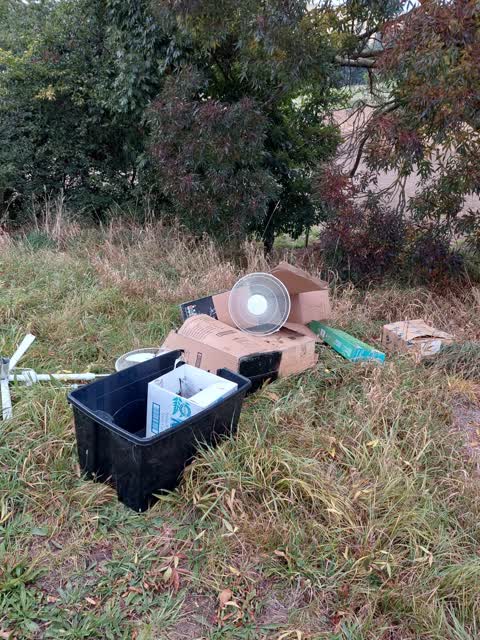
 Dumped Rubbish —
  Rubbish/Recycling —
 Dumped rubbish
Also reported on Cashmere Road
- 897 Cashmere Road — 12 reports
- 895A Cashmere Road — 4 reports
- 564 Cashmere Road — 4 reports
- 900 Cashmere Road — 2 reports
- 823 Cashmere Road — 2 reports
- 753R Cashmere Road — 2 reports
- 570R Cashmere Road — 2 reports
- 926 Cashmere Road — 1 report
The street’s crash record
NZTA’s record names Cashmere Road in 3 crashes that hurt somebody since 2006 — 1 seriously hurt, nobody killed.
On the doorstep
- Hoonhay Valley Lodge — 117 m away · B&Bs
Businesses within four hundred metres, measured at the pin — OpenStreetMap and the council directories.
The bus nearby
- Penruddock Rise near Sedbergh Place — 390 m away · route 44
- Penruddock Rise near Francis Mill Grove — 434 m away · route 44
The closest Metro stops, within four hundred and fifty metres.
The named ground
Named water within 500 m of this address, measured to the line or the edge; the council’s own structure register — bridges, boardwalks and steps standing nearby — the open map’s record.
Renting nearby
new bonds in Kennedys Bush ran about $730 a week — $180 above the city median of $550 — the suburb page keeps the rent record →.
The civic layer
This ground votes in Halswell ward — the Halswell-Hornby-Riccarton community board. Ward lines don’t always follow suburb lines; this one is measured at the pin, not the suburb’s centre.
What stood on this ground → · On the map → · From the air — the Crown’s aerials back to 1936; search the address on RetroLens →
Questions, answered briefly
18 council reports on record since April 2022 — most often abandoned vehicle (5), road signage (3), graffiti (2).
Kennedys Bush, Christchurch — on Cashmere Road.
Nothing on the heritage register at this exact spot — the record around this ground →