16 Montgomerys Road
2 council reports since May 2018, 2 carrying a photograph. The street’s heaviest record is 166 Montgomerys Road, 6 reports on file.
The named ground
Named water within 500 m of this address, measured to the line or the edge, the open map’s record.
What gets reported here
Photographed here 2 on record

What’s on record
 Road Blockage, 25 Mar 2026
 There is a large bolder in front of the culvert, it moved in the recent flooding. can it please be removed as more rain is coming.
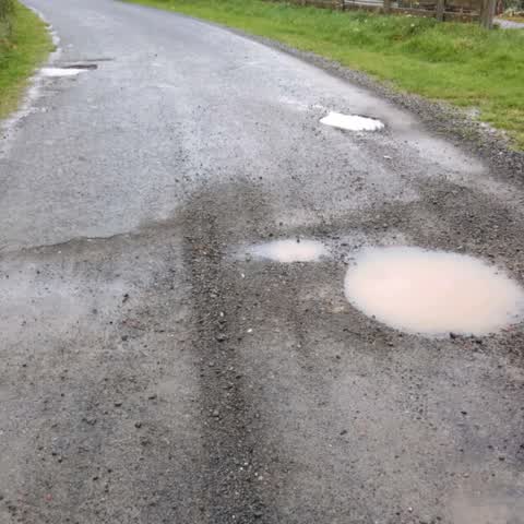
Roading/Streets, 27 May 2018
These are getting bigger and are hard to avoid. Be great to get them fixed and also continue up the road on the gravel and check out both Mo
Elsewhere on Montgomerys Road
- 166 Montgomerys Road, 6 reports
- 53 Montgomerys Road, 5 reports
- 33 Montgomerys Road, 3 reports
- 182 Montgomerys Road, 3 reports
- 23 Montgomerys Road, 1 report
- 208 Montgomerys Road, 1 report
- 189 Montgomerys Road, 1 report
The street’s crash record
NZTA’s record names Montgomerys Road in 3 crashes that hurt somebody since 2006, 1 seriously hurt, nobody killed.
The civic layer
This ground votes in Banks Peninsula ward, the Banks Peninsula community board is its local layer. Ward lines don’t always follow suburb lines; this one is measured at the pin, not the suburb’s centre. The whole roll is at /wards.
Montgomerys Road, the whole record → · Everything about Little River → · What stood on this ground → · On the map → · From the air, RetroLens holds the Crown’s aerials back to 1936; search the address there →
Questions, answered briefly
2 council reports on record since May 2018, most often roading/streets (1), road blockage (1).
Little River, Christchurch, on Montgomerys Road.
Nothing on the heritage register at this exact spot, the record around this ground →