277 Okuti Valley Road
6 council reports since July 2022, 6 carrying a photograph. The street’s heaviest record is 82 Okuti Valley Road, 8 reports on file.
On the doorstep
- Little River Campground, 140 m away · Campgrounds
Businesses within four hundred metres, measured at the pin, OpenStreetMap and the council directories.
The named ground
Named water within 500 m of this address, measured to the line or the edge, the open map’s record.
What gets reported here
Photographed here 6 on record


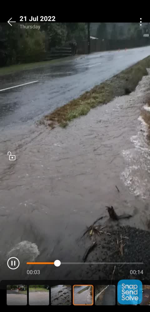
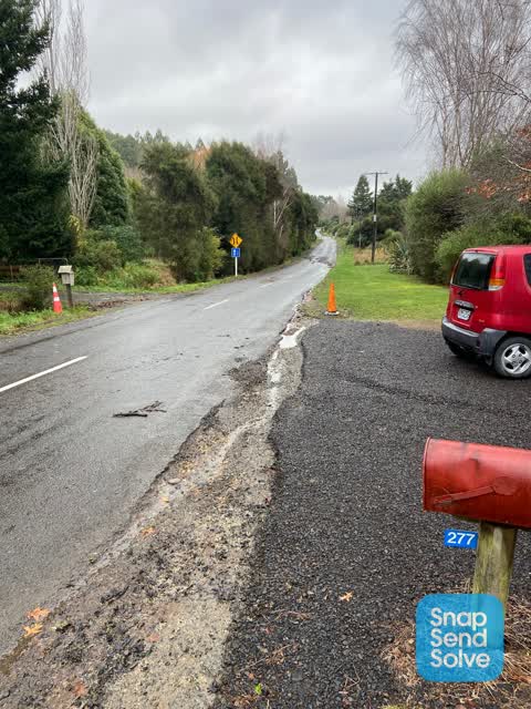
What’s on record
 Flooding, 17 Mar 2026
 Recent repairs have failed to remedy severe roadside erosion. While a basic fix has made our driveway entrance accessible, the temporary fix
 Flooding, 20 Feb 2026
 The driveway entrance is damaged from water running over the main road. Severe scouring. Water flowing over the road. Not the first time. Ne
 Flooding, 20 Feb 2026
 Huge amount of scouring outside driveway of 277 Okuti valley road preventing access. A bund or curb needs to be in place all down this side
 Street Gutters / Storm Water, 21 Jul 2022
 Same issue as all the previous times. Ccc replaced pipe/culvert this year to try to solve the issue but the size is still too small, as per
 Street Gutters / Storm Water, 21 Jul 2022
 Same issue as all the previous times. Ccc replaced pipe/culvert this year to try to solve the issue but the size is still too small, as per
 Street Gutters / Storm Water, 21 Jul 2022
 Serious scouring out at the entrance to our driveway making it difficult to enter and unsafe. The recently installed culvert above our house
Elsewhere on Okuti Valley Road
- 82 Okuti Valley Road, 8 reports
- 104 Okuti Valley Road, 7 reports
- 390 Okuti Valley Road, 4 reports
- 287 Okuti Valley Road, 4 reports
- 27 Okuti Valley Road, 3 reports
- 40 Okuti Valley Road, 2 reports
- 342–388 Okuti Valley Road, 2 reports
- 287A Okuti Valley Road, 2 reports
The street’s crash record
NZTA’s record names Okuti Valley Road in 1 crash that hurt somebody since 2006, 1 seriously hurt, nobody killed.
The civic layer
This ground votes in Banks Peninsula ward, the Banks Peninsula community board is its local layer. Ward lines don’t always follow suburb lines; this one is measured at the pin, not the suburb’s centre. The whole roll is at /wards.
Okuti Valley Road, the whole record → · Everything about Little River → · What stood on this ground → · On the map → · From the air, RetroLens holds the Crown’s aerials back to 1936; search the address there →
Questions, answered briefly
6 council reports on record since July 2022, most often street gutters / storm water (3), flooding (3).
Little River, Christchurch, on Okuti Valley Road.
Nothing on the heritage register at this exact spot, the record around this ground →