91 Western Valley Road
3 council reports since May 2021, 2 carrying a photograph. The street’s heaviest record is 48 Western Valley Road, 4 reports on file.
The green nearby
- Western Valley Streamside Esplanade, 283 m to the edge
- Awa-Iti Domain, 463 m to the edge · 5 ha
Parks within half a kilometre, measured to the boundary, the council’s open data. The whole roll is at /parks.
The civic shelf nearby
- Western Valley Road Collection Point, 381 m away · Transfer station
Libraries, halls and the rest within half a kilometre, the council’s open data.
The named ground
Named water within 500 m of this address, measured to the line or the edge; Named places within 1.5 km of this address, the open map’s record.
What gets reported here
- Flooding, 2
- Fallen Tree, 1
Photographed here 2 on record
What’s on record
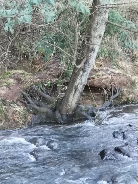
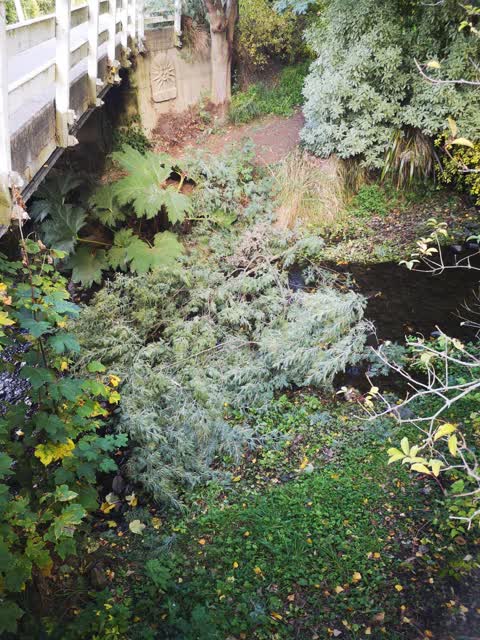
- Fallen Tree, 24 Sept 2022
 Flooding, 4 Jun 2021
 The Re ent flooding in Little River has seen a tree behind our property now have its root system exposed. It has leaned further over slightl
 Flooding, 1 May 2021
 A tree has been felled by someone and it is now blocking the river. Any major rainfall will result in flooding. The tree needs to be removed
Elsewhere on Western Valley Road
- 48 Western Valley Road, 4 reports
- 44 Western Valley Road, 4 reports
- 11 Western Valley Road, 4 reports
- 53–95 Western Valley Road, 3 reports
- 35 Western Valley Road, 3 reports
- 315 Western Valley Road, 3 reports
- 105 Western Valley Road, 3 reports
- 82 Western Valley Road, 2 reports
The street’s crash record
NZTA’s record names Western Valley Road in 6 crashes that hurt somebody since 2006, 3 seriously hurt, nobody killed.
The civic layer
This ground votes in Banks Peninsula ward, the Banks Peninsula community board is its local layer. Ward lines don’t always follow suburb lines; this one is measured at the pin, not the suburb’s centre. The whole roll is at /wards.
Western Valley Road, the whole record → · Everything about Little River → · What stood on this ground → · On the map → · From the air, RetroLens holds the Crown’s aerials back to 1936; search the address there →
Questions, answered briefly
3 council reports on record since May 2021, most often flooding (2), fallen tree (1).
Little River, Christchurch, on Western Valley Road.
Nothing on the heritage register at this exact spot, the record around this ground →
Western Valley Streamside Esplanade, 283 m to its edge.