11 Mills Road, Marshland
11 reports on record since November 2023 · 10 with photographs. The most-reported address on Mills Road. Indicative rating valuation and school zones, hazards, bin day and what stood here before.
What gets reported here
- Overgrown Vegetation, 3
- Trees - General, 2
- General Request, 2
- Dumped Rubbish, 2
- Damaged Street Sign, 1
- Accessibility, 1
Photographed here 10 on record



Reported here
 Overgrown Vegetation,
 Once again the green space beside our property is over run with weeds which are encroaching on our property. This is council land & previou
 Overgrown Vegetation,
 We are constantly battling weeds along our fence line & those of the properties bordering the reserve at Mills Rd. We believe this is the re
 Overgrown Vegetation,
 The length & untidiness of the council owned grass in the reserve area & public space in the Mills Road vicinity is an eyesore & unattractiv
 General Request,
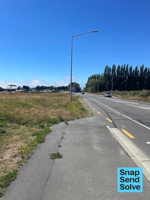
 There are a lot of weeds along the fence line of properties by the reserve in Oakbridge. These require spraying as they also infringe onto p
 Damaged Street Sign,
 A driver has knocked down the warning chevrons sign at the intersection of Mills Road and Prestons Road.
 Trees - General,
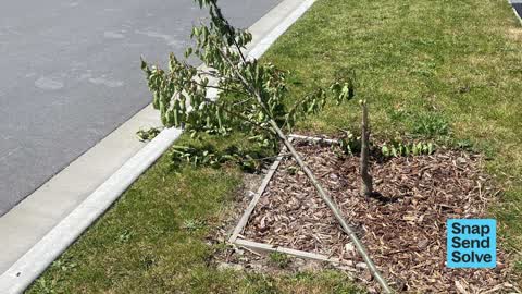
 Reported broken tree in spring. No action. Trunk has growth sprouting but only 300cm tall whereas all other trees in new subdivision suffici
 Dumped Rubbish,
 Rubbish dumped and still hasn’t been taken dispute snapping in like October
 Accessibility,
 Tree broken in wind 2 November. Was planted in spring but never staked.
 Dumped Rubbish,
 Someone has dumped a tv, bed and other rubbish
 General Request,
 Can I suggest a footpath joining Burlington and Oakbridge. This would improve safety for both Burlington residents and families in Oakbridge
- Trees - General,
Also reported on Mills Road
- 5 Mills Road, 2 reports
- 4 Mills Road, 2 reports
- 47 Mills Road, 1 report
- 31 Mills Road, 1 report
From the air, then
Sourced from Canterbury Maps and partners. LINZ, CC BY 3.0 NZ. Each frame is cut from Environment Canterbury’s historic imagery MapServer for that decade, only where the Footprints layer names a CC BY survey (NZAM-covered spots stay out). RetroLens holds more Crown aerials →
The street’s crash record
NZTA’s record names Mills Road in 2 crashes that hurt somebody since 2006, 0 seriously hurt, nobody killed.
On the doorstep
- Winehub, 237 m away · Bottle stores
Businesses within four hundred metres, measured at the pin: OpenStreetMap and the council directories.
The tracks through here
- Walk and bike track through Marshland, 463 m to the line · walk · bike
Tracks whose line passes within half a kilometre, measured to the line itself, the council’s open data.
The named ground
the council’s own structure register, bridges, boardwalks and steps standing nearby, the open map’s record.
Renting nearby
new bonds in Marshland ran about $689 a week, $139 above the city median of $550, the suburb page keeps the rent record →.
The civic layer
This ground votes in Innes ward, the Papanui-Innes-Central community board. Ward lines don’t always follow suburb lines; this one is measured at the pin, not the suburb’s centre.
What stood on this ground → · On the map → · From the air, the Crown’s aerials back to 1936; search the address on RetroLens →
Questions, answered briefly
11 council reports on record since November 2023, most often overgrown vegetation (3), trees - general (2), general request (2).
Marshland, Christchurch, on Mills Road.
Nothing on the heritage register at this exact spot, the record around this ground →