34 Cameo Grove, Marshland
16 reports on record since April 2022 · 8 with photographs. The most-reported address on Cameo Grove. Indicative rating valuation and school zones, hazards, bin day and what stood here before.
What gets reported here
- Overgrown Vegetation — 10
- Parks — 2
- Playground Equipment — 1
- Pest / Vermin — 1
- Park - General Request — 1
- Facility - General Request — 1
Photographed here 8 on record


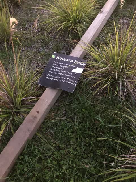
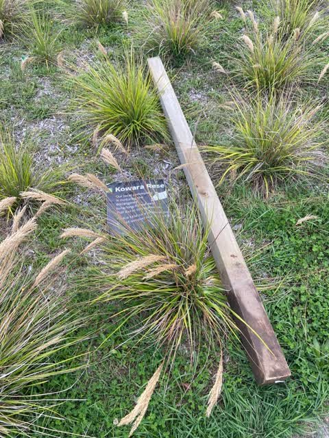
Reported here
 Pest / Vermin —
 Lake Side Playground, Prestons Park off Cameo Grove. Wasp nest next to yellow spinning merry-go-round thing
 Park - General Request —
 Broken street tree needs removing.
 Overgrown Vegetation —
 Hi there, the council park/ play area and sidewalks are all over grown and full of weeds (purple and yellow flowers). Please could this area
 Overgrown Vegetation —
 Overgrown plants caused my son to fall off his bike
 Playground Equipment —
 Overgrown path for kids bikes
 Overgrown Vegetation —
 Overgrown kids play ground and park, dangerous for the kids on scooters and bikes trying to use the scooter track
- Overgrown Vegetation —
- Overgrown Vegetation —
- Overgrown Vegetation —
- Overgrown Vegetation —
- Overgrown Vegetation —
- Overgrown Vegetation —
- Facility - General Request —
- Overgrown Vegetation —
 Parks —
 The sign that was put in advising people to not harm the tame eels in Preston’s park lake has been pulled out and damaged. Can this please b
 Parks —
 The sign that shows eels in the protected lake has been ripped out and snapped in half. Now lying in the garden on edge of lake
Also reported on Cameo Grove
- 25 Cameo Grove — 6 reports
- 26 Cameo Grove — 5 reports
- 55 Cameo Grove — 3 reports
- 28 Cameo Grove — 3 reports
- 58 Cameo Grove — 2 reports
- 45 Cameo Grove — 2 reports
- 44R Cameo Grove — 2 reports
- 38 Cameo Grove — 2 reports
The green nearby
- Snellings Waterway Reserve — 384 m to the edge · 2 ha
- Reka Reserve — 487 m to the edge
- Limes Reserve — 495 m to the edge
Parks within half a kilometre, measured to the boundary — the council’s open data.
The tracks through here
- Walk and bike track through Marshland — 428 m to the line · walk · bike
- Walk and bike track through Marshland — 440 m to the line · walk · bike
- Walk and bike track through Marshland — 465 m to the line · walk · bike
Tracks whose line passes within half a kilometre, measured to the line itself — the council’s open data.
The named ground
Named places within 1.5 km of this address; the council’s own structure register — bridges, boardwalks and steps standing nearby — the open map’s record.
The remembered names nearby
- John Lindsay Reserve — 25 m away ·
JOHN LINDSAY RESERVE / This park is dedicated to Donald "John" Lindsay, the visionary behi
· 2018
Inscribed plaques within two hundred and fifty metres — the register’s pins, not surveyed spots. The whole roll is at /plaques.
Renting nearby
new bonds in Marshland ran about $689 a week — $139 above the city median of $550 — the suburb page keeps the rent record →.
The civic layer
This ground votes in Burwood ward — the Coastal-Burwood-Linwood community board. Ward lines don’t always follow suburb lines; this one is measured at the pin, not the suburb’s centre.
What stood on this ground → · On the map → · From the air — the Crown’s aerials back to 1936; search the address on RetroLens →
Questions, answered briefly
16 council reports on record since April 2022 — most often overgrown vegetation (10), parks (2), playground equipment (1).
Marshland, Christchurch — on Cameo Grove.
Nothing on the heritage register at this exact spot — the record around this ground →
Snellings Waterway Reserve — 384 m to its edge, 2 ha.