19 Carlton Mill Road, Merivale
13 reports on record since September 2019 · 5 with photographs. The street’s heaviest record is 21 Carlton Mill Road — 27 reports on file. Indicative rating valuation and school zones, hazards, bin day and what stood here before.
What gets reported here
Photographed here 5 on record


Reported here
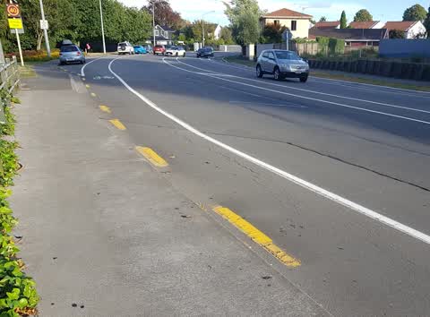
 Pavement - Damaged —
 Hello there is asphalt missing which is dangerous and a trip hazard for pedestrians. Could consideration be given to looking into repairing
 Roads - General —
 Re Temporary Traffic Management Northwest bound cycle lane on Rossall St blocked by roadworks sign associated with private concrete pour. N
 Graffiti —
 - Graffiti —
- Poles and Signage - General —
- Trees - General —
- Graffiti —
- Roads - General —
- Rubbish and Bins - General —
- Graffiti —
- Graffiti —
Roading/Streets —
a lot of broken glass on cycle lane and footpath
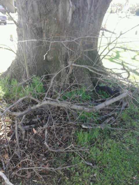
Roading/Streets —
branchs and tree suckered need removed
Also reported on Carlton Mill Road
- 21 Carlton Mill Road — 27 reports
- 48 Carlton Mill Road — 12 reports
- 89 Carlton Mill Road — 10 reports
- 27 Carlton Mill Road — 9 reports
- 2 Carlton Mill Road — 9 reports
- 66 Carlton Mill Road — 8 reports
- 65 Carlton Mill Road — 8 reports
- 101 Carlton Mill Road — 6 reports
The street’s crash record
NZTA’s record names Carlton Mill Road in 25 crashes that hurt somebody since 2006 — 5 seriously hurt, nobody killed.
The green nearby
- Little Hagley Park — 23 m to the edge · Botanic · 7 ha
- Carlton Mill Riverbank — 57 m to the edge
- Millbrook Reserve — 78 m to the edge · Botanic
- Hagley Park North — 191 m to the edge · Sports ground · 91 ha
Parks within half a kilometre, measured to the boundary — the council’s open data.
On the doorstep
- Caldera Estate — 253 m away · Bottle stores
- Hagley Golf Club — 342 m away · Golf courses
- North Hagley Community Sports & Recreation Trust — 382 m away · Clubs
- Le Panier — 395 m away · Bakeries
Businesses within four hundred metres, measured at the pin — OpenStreetMap and the council directories.
The bus nearby
- Carlton Mill Rd near Hewitts Rd — 144 m away · route 8
- Rossall St near Rhodes St — 167 m away · route 8
The closest Metro stops, within four hundred and fifty metres.
The tracks through here
- Walk and bike track through Merivale — 12 m to the line · walk · bike
- Walk and bike track through Merivale — 30 m to the line · walk · bike
- Walk and bike track through Merivale — 40 m to the line · walk · bike
- Walk and bike track through Merivale — 177 m to the line · walk · bike
- Walk and bike track through Merivale — 192 m to the line · walk · bike
Tracks whose line passes within half a kilometre, measured to the line itself — the council’s open data.
The named ground
Named water within 500 m of this address, measured to the line or the edge; Named places within 1.5 km of this address; the council’s own structure register — bridges, boardwalks and steps standing nearby — the open map’s record.
The remembered names nearby
- Little Hagley Park plaque — 54 m away · 2009
- Millbrook Reserve plaque — 129 m away · 2009
- In Fond Memory of Miss Betty Hart 30-3-1913 — 24-7-2003 — 130 m away ·
IN FOND MEMORY OF MISS BETTY HART 30-3-1913 — 24-7-2003 LONG STANDING MEMBER OF THE CHRIST
· 2009
Inscribed plaques within two hundred and fifty metres — the register’s pins, not surveyed spots. The whole roll is at /plaques.
Renting nearby
new bonds in Merivale ran about $604 a week — $54 above the city median of $550 — the suburb page keeps the rent record →.
What was here — Dwelling and Setting
207 m away · 2 Helmores Lane · located to ±15 m · the place’s own record →
On the register. Nothing researched here yet.
What was here — Bridge and Setting
225 m away · located to ±18 m · the place’s own record →
On the register. Nothing researched here yet.
What was here — Dwelling and Setting
245 m away · 16 Helmores Lane · located to ±17 m · the place’s own record →
On the register. Nothing researched here yet.
The civic layer
This ground votes in Fendalton ward — the Fendalton-Waimairi-Harewood community board. Ward lines don’t always follow suburb lines; this one is measured at the pin, not the suburb’s centre.
What stood on this ground → · On the map → · From the air — the Crown’s aerials back to 1936; search the address on RetroLens →
Questions, answered briefly
13 council reports on record since September 2019 — most often graffiti (5), roads - general (2), roading/streets (2).
Merivale, Christchurch — on Carlton Mill Road.
The heritage register names 3 places at or beside it — Dwelling and Setting, Bridge and Setting.
Little Hagley Park — 23 m to its edge, 7 ha.