23 Clifford Avenue, Merivale
11 reports on record since January 2020 · 8 with photographs. The most-reported address on Clifford Avenue. Indicative rating valuation and school zones, hazards, bin day and what stood here before.
What gets reported here
- Overgrown Vegetation — 4
- Water Supply — 1
- Roads - General — 1
- Roading/Streets — 1
- Parks — 1
- Graffiti somewhere else — 1
Photographed here 8 on record


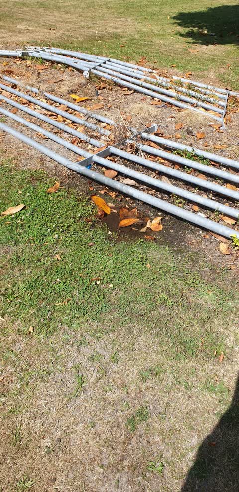
Reported here
 Graffiti on a fence, building or structure —
 tags on fence
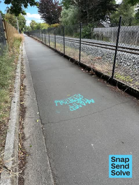
 Graffiti somewhere else —
 Graffiti on fences along railway corridor visible from walkway north of Fendalton Rd level crossing
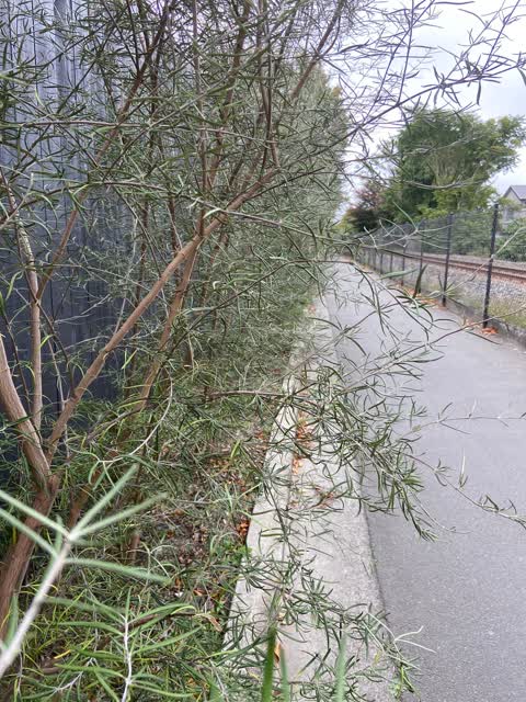
 Overgrown Vegetation —
 Down the cycle lane that follows the railway line. The section between Fendalton Road and Wroxton. The row of bushes could be trimmed back p
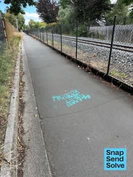 Graffiti —
 There are several examples along this pathway.
- Roads - General —
- Overgrown Vegetation —
- Overgrown Vegetation —
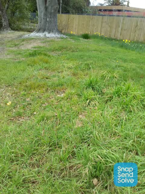
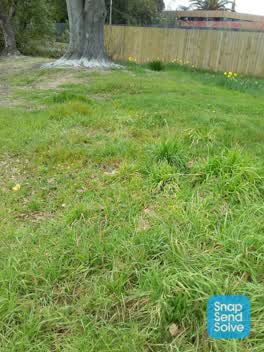 Overgrown Vegetation —
 Is this reserve ever going to get maintained and you can't use the daffodils as an excuse it's been a yr time to go to the press on this one
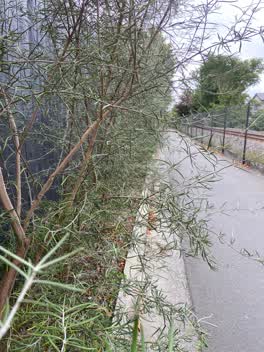 Roading/Streets —
 There are young trees that have been planted down the side of the cycleway. They are sticking out on to the cycle way and will be a real pai
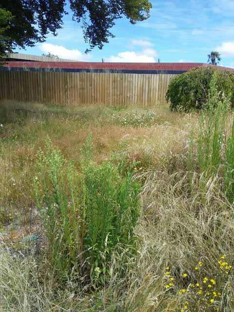
 Parks —
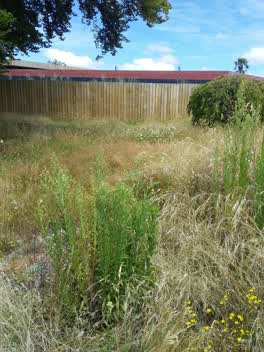
 This reserve in fendlton has not been maintained for several months and has old man's beard growing in it plus it's becoming a fire risk
Water Supply —
water leak?
Also reported on Clifford Avenue
- 2 Clifford Avenue — 6 reports
- 8 Clifford Avenue — 4 reports
- 6 Clifford Avenue — 4 reports
- 60 Clifford Avenue — 3 reports
- 32 Clifford Avenue — 3 reports
- 25 Clifford Avenue — 3 reports
- 59 Clifford Avenue — 2 reports
- 45 Clifford Avenue — 2 reports
The green nearby
- Clifford Reserve — you are in it
- Mona Vale — 113 m to the edge · Botanic · 5 ha
- Daresbury Park — 264 m to the edge
- Idris Reserve — 434 m to the edge
Parks within half a kilometre, measured to the boundary — the council’s open data.
On the doorstep
- Alexanders Digital Marketing — 351 m away · Advertising Agency
Businesses within four hundred metres, measured at the pin — OpenStreetMap and the council directories.
The bus nearby
- Fendalton Rd near Mona Vale Ave — 123 m away · route 29
- Fendalton Rd near Jacksons Rd — 173 m away · route 29
The closest Metro stops, within four hundred and fifty metres.
The tracks through here
- Walk and bike track through Merivale — 39 m to the line · walk · bike
- Walk and bike track through Merivale — 101 m to the line · walk · bike
- Walk and bike track through Merivale — 105 m to the line · walk · bike
- Walk and bike track through Merivale — 181 m to the line · walk · bike
- Walk and bike track through Merivale — 334 m to the line · walk · bike
Tracks whose line passes within half a kilometre, measured to the line itself — the council’s open data.
The named ground
Named water within 500 m of this address, measured to the line or the edge; Named places within 1.5 km of this address; the council’s own structure register — bridges, boardwalks and steps standing nearby — the open map’s record.
The remembered names nearby
- Armillary Sphere — 246 m away ·
ARMILLARY SPHERE / The metal rings represent the Equator, Tropics, Arctic and Antarctic Ci
· 2009 - The Macleod Garden / in Memory of / Alastair John Macleod — 248 m away ·
THE MACLEOD GARDEN / IN MEMORY OF / ALASTAIR JOHN MACLEOD / M. Hort Sc (Hons) / 1959 - 198
· 2009
Inscribed plaques within two hundred and fifty metres — the register’s pins, not surveyed spots. The whole roll is at /plaques.
Renting nearby
new bonds in Merivale ran about $604 a week — $54 above the city median of $550 — the suburb page keeps the rent record →.
What was here — Mona Vale Gatehouse and Setting
142 m away · 65 Fendalton Road · located to ±12 m · the place’s own record →
On the register. Nothing researched here yet.
What was here — Dwelling and Setting
153 m away · 5 Jacksons Road · located to ±15 m · the place’s own record →
On the register. Nothing researched here yet.
The civic layer
This ground votes in Fendalton ward — the Fendalton-Waimairi-Harewood community board. Ward lines don’t always follow suburb lines; this one is measured at the pin, not the suburb’s centre.
What stood on this ground → · On the map → · From the air — the Crown’s aerials back to 1936; search the address on RetroLens →
Questions, answered briefly
11 council reports on record since January 2020 — most often overgrown vegetation (4), water supply (1), roads - general (1).
Merivale, Christchurch — on Clifford Avenue.
The heritage register names 2 places at or beside it — Mona Vale Gatehouse and Setting, Dwelling and Setting.
Clifford Reserve — the address is inside it.