2 Baigent Way
6 council reports since July 2018, 5 carrying a photograph. The most-reported address on Baigent Way.
From the air, then
Sourced from Canterbury Maps and partners. LINZ, CC BY 3.0 NZ. Each frame is cut from Environment Canterbury’s historic imagery MapServer for that decade, only where the Footprints layer names a CC BY survey (NZAM-covered spots stay out). RetroLens holds more Crown aerials →
On the doorstep
- CityFitness, 259 m away · Gyms & fitness
- Brandhouse, 278 m away · Bottle stores
- Urban Escape, 290 m away · Cafés
- Sala Coffee, 293 m away · Cafés
Businesses within four hundred metres, measured at the pin, OpenStreetMap and the council directories.
The tracks through here
- Walk and bike track through Middleton, 36 m to the line · walk · bike
- Walk and bike track through Middleton, 148 m to the line · walk · bike
- Walk and bike track through Middleton, 318 m to the line · walk · bike
- Walk and bike track through Middleton, 410 m to the line · walk · bike
- Walk and bike track through Middleton, 447 m to the line · walk · bike
Tracks whose line passes within half a kilometre, the council’s open data.
The named ground
Named places within 1.5 km of this address, the open map’s record.
What gets reported here
- Pothole, 3
- Roading/Streets, 1
- Graffiti, 1
- Damaged Road, 1
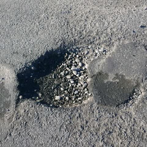
Photographed here 5 on record



What’s on record
 Pothole, 10 Nov 2025
 hole in road over area that was pipework. looks ready to collapse. quite a few trucks turn here into Owens depot
 Pothole, 15 Apr 2025
 road has lifted up approx 150mm and difficult to avoid damage to wheels or underside of cars
 Damaged Road, 17 Feb 2025
 Road surface has heaved and asphalt has pushed up, it looks like an underground pipe may be moving underneath. It looks like the surface wil
- Pothole, 17 May 2024
Small pothole about size of a bread and butter plate on left as heading on Lunn’s Rd towards Annex Rd. As road is frequented by a lot of tru
Graffiti, 30 Sept 2019
Black and blue tagging on a utility box. Green paint required to paint over. Box is situated outside Taege Engineering on Lunns Road. MDXA v
Roading/Streets, 18 Jul 2018
Pot hole
Elsewhere on Baigent Way
- 1 Baigent Way, 5 reports
- 3/25 Baigent Way, 3 reports
- 8 Baigent Way, 2 reports
- 25 Baigent Way, 2 reports
The street’s crash record
NZTA’s record names Baigent Way in 1 crash that hurt somebody since 2006, 0 seriously hurt, nobody killed.
The civic layer
This ground votes in Spreydon ward, the Spreydon-Cashmere-Heathcote community board is its local layer. Ward lines don’t always follow suburb lines; this one is measured at the pin, not the suburb’s centre. The whole roll is at /wards.
Baigent Way, the whole record → · Everything about Middleton → · What stood on this ground → · On the map → · From the air, RetroLens holds the Crown’s aerials back to 1936; search the address there →
Questions, answered briefly
6 council reports on record since July 2018, most often pothole (3), roading/streets (1), graffiti (1).
Middleton, Christchurch, on Baigent Way.
Nothing on the heritage register at this exact spot, the record around this ground →