10 Shackleton Street, New Brighton
14 reports on record since November 2016 · 13 with photographs. The most-reported address on Shackleton Street. Indicative rating valuation and school zones, hazards, bin day and what stood here before.
What gets reported here
- Trees - General — 2
- Fallen Tree — 2
- Street Light Outage — 1
- Rubbish/Recycling — 1
- Roading/Streets — 1
- Road Signage — 1
Photographed here 13 on record


Reported here
 Trees - General —
 2 different Tress remove split branches
 Trees - General —
 remove broken branch
 Road Signage —
 Road sign left in reserve
 Graffiti on a cabinet, pole or railway asset —
  Fallen Tree —
 Split branches
 Fallen Tree —
 Large branches fallen in strong winds a couple of days ago
 Pavement - Damaged —
 I rolled my ankle on this damage
 Facility - General Request —
 Post has been broken off and cars were packing in there yesterday. We have pushed it back in place so it not as obvious it is broken off
 Dumped Rubbish —
  Overgrown Vegetation —
 Not enough room for mobility scooter or pushchairs
- Street Light Outage —
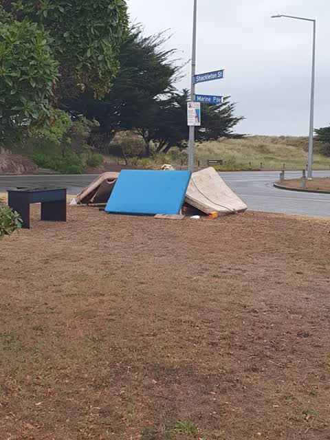
 Rubbish/Recycling —
 Rubbish has been dumped council reserve on the corner of Shackleton Street and Marine Parade.
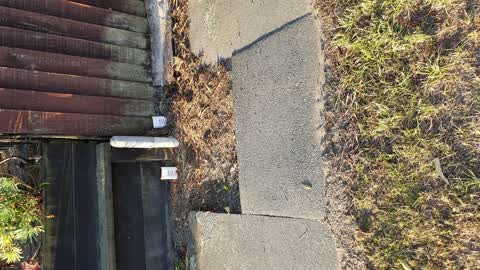
 Roading/Streets —
 seal broken, bit of a problem for my sons wheelchair
Graffiti —
Also reported on Shackleton Street
- 1 Shackleton Street — 6 reports
- 28 Shackleton Street — 5 reports
- 65 Shackleton Street — 2 reports
- 31 Shackleton Street — 2 reports
- 30 Shackleton Street — 2 reports
- 14 Shackleton Street — 2 reports
- 61 Shackleton Street — 1 report
- 58 Shackleton Street — 1 report
The street’s crash record
NZTA’s record names Shackleton Street in 1 crash that hurt somebody since 2006 — 1 person killed, 0 seriously hurt.
The green nearby
- New Brighton Beach — 34 m to the edge · Regional · 10 ha
- Withells Island Reserve — 318 m to the edge · 4 ha
- Blighs Garden — 351 m to the edge · 6 ha
Parks within half a kilometre, measured to the boundary — the council’s open data.
On the doorstep
- Ruelle Eatery — 162 m away · Cafés
- South Brighton Surf Life Saving Club — 348 m away · Clubs
Businesses within four hundred metres, measured at the pin — OpenStreetMap and the council directories.
The bus nearby
The closest Metro stops, within four hundred and fifty metres.
The named ground
Named places within 1.5 km of this address; the council’s own structure register — bridges, boardwalks and steps standing nearby — the open map’s record.
Renting nearby
new bonds in New Brighton ran about $520 a week — $30 below the city median of $550 — the suburb page keeps the rent record →.
The civic layer
This ground votes in Coastal ward — the Coastal-Burwood-Linwood community board. Ward lines don’t always follow suburb lines; this one is measured at the pin, not the suburb’s centre.
What stood on this ground → · On the map → · From the air — the Crown’s aerials back to 1936; search the address on RetroLens →
Questions, answered briefly
14 council reports on record since November 2016 — most often trees - general (2), fallen tree (2), street light outage (1).
New Brighton, Christchurch — on Shackleton Street.
Nothing on the heritage register at this exact spot — the record around this ground →
New Brighton Beach — 34 m to its edge, 10 ha.