173 Johns Road, Northwood
12 reports on record since September 2020 · 10 with photographs. The most-reported address on Johns Road. Indicative rating valuation and school zones, hazards, bin day and what stood here before.
What gets reported here
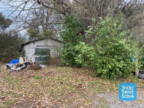
- Dumped Rubbish — 6
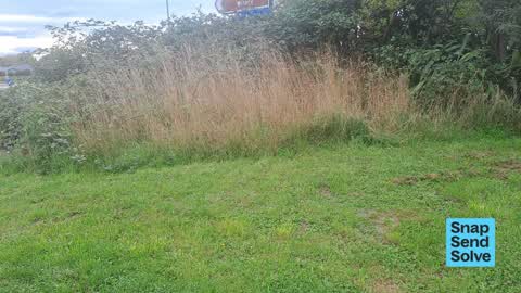
- Overgrown Vegetation — 3
- Pavement - Damaged — 1
- Litter — 1
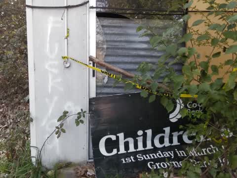
- Graffiti — 1
Photographed here 10 on record



Reported here
 Dumped Rubbish —
 So much dumped rubbish
 Overgrown Vegetation —
 overgrown veg
 Dumped Rubbish —
  Overgrown Vegetation —
  Litter —
 Rubbish dumped including plastic bottles, bedding, paint and other junk
 Dumped Rubbish —
  Dumped Rubbish —
 Dumbed bed at the best start Styx mill John’s road entrance
 Pavement - Damaged —
 Large stones over foot path
- Dumped Rubbish —
- Dumped Rubbish —
 Overgrown Vegetation —
 This area has become a health and safety issue. Rubbish everywhere no doubt harbouring vermin and the like! Please can the CCC clean up this
 Graffiti —
 best start kindergarten
Also reported on Johns Road
- 160 Johns Road — 12 reports
- 231 Johns Road — 11 reports
- 207 Johns Road — 8 reports
- 123 Johns Road — 7 reports
- 211 Johns Road — 5 reports
- 182R Johns Road — 5 reports
- 182 Johns Road — 5 reports
- 180E Johns Road — 5 reports
The street’s crash record
NZTA’s record names Johns Road in 10 crashes that hurt somebody since 2006 — 1 seriously hurt, nobody killed.
The green nearby
- Kaputone Headwaters Reserve — 48 m to the edge
- Rindle Reserve — 83 m to the edge
- Kaputone Springs Reserve — 163 m to the edge
- Brookwater Reserve — 307 m to the edge
- Rosebank Reserve — 389 m to the edge
Parks within half a kilometre, measured to the boundary — the council’s open data.
On the doorstep
- Chardonnay Motor Lodge — 119 m away · Motels
- Rosebank Estate — 166 m away · Wineries
Businesses within four hundred metres, measured at the pin — OpenStreetMap and the council directories.
The named ground
Named water within 500 m of this address, measured to the line or the edge; Named places within 1.5 km of this address; the council’s own structure register — bridges, boardwalks and steps standing nearby — the open map’s record.
Renting nearby
new bonds in Northwood ran about $530 a week — $20 below the city median of $550 — the suburb page keeps the rent record →.
The civic layer
This ground votes in Harewood ward — the Fendalton-Waimairi-Harewood community board. Ward lines don’t always follow suburb lines; this one is measured at the pin, not the suburb’s centre.
What stood on this ground → · On the map → · From the air — the Crown’s aerials back to 1936; search the address on RetroLens →
Questions, answered briefly
12 council reports on record since September 2020 — most often dumped rubbish (6), overgrown vegetation (3), pavement - damaged (1).
Northwood, Christchurch — on Johns Road.
Nothing on the heritage register at this exact spot — the record around this ground →
Kaputone Headwaters Reserve — 48 m to its edge.